


 Country:

 City:
City:


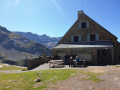
Day 1: Set off from the Gavarnie Tourist Office, finishing at the Refuge des Espuguettes, via the Grande Waterfall.
Day 2: Starts at the Refuge des Espuguettes and finishes at the Cirque d’Estaubé, including the ascent of the Piméné and a stop at the Hourquettes d’Alans.
Day 3: Set off from the Cirque d’Estaubé, finishing at the Cirque de Troumouse, via the Lac des Gloriettes.
Day 4: Departure from the Cirque de Troumouse, finishing at the Chapelle d’Héas, via La Fontaine and the Oratoire de la Sainte-Famille.
Route of the three cirques: Gavarnie, Estaubé and Troumouse


A four-day route of the three cirques of Gavarnie, Estaubé and Troumouse, including the ascent of the Piméné. A self-guided route with nights spent in bivouacs.
Details
Creation:
Last update:
Last review:
-
 Activity: Walking
 -
 Distance: 29.68 mi
 -
 Average duration: 4 days
 -
 Difficulty: Moderate
 -
-
 Back to start: No
 -
 Ascent: + 9,777 ft
 -
 Descent: - 9,186 ft
 -
-
 Highest point: 9,108 ft
 -
 Lowest point: 4,482 ft
Stages of the route
This route needs several days, find the details below:
Notes
This route passes through a protected area, which may be subject to special regulations:
Reviews and comments
4.8 / 5
Based on 4 reviews
Reliability of the description
5 / 5
5 / 5
Ease of following the route
4.8 / 5
4.8 / 5
Route interest
4.8 / 5
4.8 / 5

Eric Tex
Overall rating : 4.7 / 5
Date of your route : Aug 17, 2026
Reliability of the description : ★★★★★ Very good
Ease of following the route : ★★★★★ Very good
Route interest : ★★★★☆ Good
Very busy route : No
If you wish to return to your starting point in Gavarnie (by car, for example), a circular route on the fourth day takes you from the Cirque d’Estaubé to the Cirque de Gavarnie. The Cirque de Troumouse can be covered in a day.
Machine-translated
User 29959754
Overall rating : 5 / 5
Date of your route : Jul 13, 2026
Reliability of the description : ★★★★★ Very good
Ease of following the route : ★★★★★ Very good
Route interest : ★★★★★ Very good
Very busy route : Yes
A magnificent hike! The signposting and route markings are clear; we always managed to stick to the suggested times without rushing. It was a wonderful experience, and it’s nice to have the two most challenging days (in terms of elevation gain) at the start, followed by easier days. We came across lots of people (we did the hike in July), except on the final stretch. We also came across loads of animals – sheep and cows, of course, but also marmots!
A few points I think are worth noting:
- the off-trail section on the second day is quite steep; you need to bear this in mind and be careful which path you take, but apart from that there are no particular difficulties.
- We didn’t come across any rubbish bins before the Auberge du Maillet (the Refuge des Espuguettes doesn’t accept rubbish from people camping there; I don’t know what the situation is if you’re staying overnight).
P.S.: In response to the last post, we hitchhiked back on the final day.
Machine-translated
User 8659672
Hello.
The route looks magnificent, thank you for sharing it. I’d like to do it on my own. But how on earth, at the end of the walk (from the Héas Chapel), did you get back to the starting point (Gavarnie)?
I can’t find a way… is it quite straightforward? Because on foot… it’s not worth it!
Thank you in advance for your reply.
Machine-translated


User 23006330
Overall rating : 5 / 5
Date of your route : Aug 24, 2025
Reliability of the description : ★★★★★ Very good
Ease of following the route : ★★★★★ Very good
Route interest : ★★★★★ Very good
Very busy route : No
Very beautiful route, with lovely, uncrowded trails. Very good description.
Machine-translated

Alric
Thank you very much for your feedback.
I wish you many more wonderful adventures.
Machine-translated
User 26364050
Overall rating : 4.7 / 5
Date of your route : Aug 19, 2025
Reliability of the description : ★★★★★ Very good
Ease of following the route : ★★★★☆ Good
Route interest : ★★★★★ Very good
Very busy route : No
really fantastic, a great discovery, a well-planned route with water points and magnificent spots. Thank you very much, I'm going home delighted
Machine-translated
Other walks in the area
Gavarnie – Refuge des Espuguettes
 Visorando Member7.36 mi
+3,901 ft
-1,759 ft
6h 45
Visorando Member7.36 mi
+3,901 ft
-1,759 ft
6h 45
 Difficult
 Departure from Gavarnie (Hautes-Pyrénées)
Start from Gavarnie and climb towards the Plateau de Bellevue, then descend to the Grande Waterfall. From the Hôtellerie du Cirque, climb via the ledges to the Refuge des Espuguettes, with a campsite nearby.
The Cirque de Gavarnie via the ledges
 7.19 mi
+2,313 ft
-2,306 ft
5h 20
Moderate
Departure from Gavarnie (Hautes-Pyrénées)
7.19 mi
+2,313 ft
-2,306 ft
5h 20
Moderate
Departure from Gavarnie (Hautes-Pyrénées)
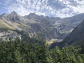
This trail is much less frequented than the main path and offers more views of the cirque along most of its length.
⚠️From 1 November to 30 April, and as soon as the quiet zone is established, using the route between 4 and 5 constitutes an offence under the National Park regulations: a 4th category offence under: R.331-65 3° — "Deliberate disturbance of the peace in the core area of the National Park" (€750 fine)."
⚠️ DOGS ARE NOT ALLOWED between 2-3-4 and 5.
Please check with the Gavarnie Tourist Office before setting off: +33 (0)5 62 92 49 10.
Refuge du Pailha circular
 5.94 mi
+1,388 ft
-1,385 ft
3h 55
Moderate
Departure from Gavarnie (Hautes-Pyrénées)
5.94 mi
+1,388 ft
-1,385 ft
3h 55
Moderate
Departure from Gavarnie (Hautes-Pyrénées)
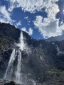
A magnificent circular hike that allows you to climb to a high altitude without too much difficulty and arrive at a refuge guarded by very friendly people. The return journey takes you along a path carved into the rock, offering splendid views.
Cirque Gavarnie par le Plateau de Bellevue et Bosquet Long
 7.53 mi
+2,228 ft
-2,231 ft
5h 25
Moderate
Departure from Gavarnie (Hautes-Pyrénées)
7.53 mi
+2,228 ft
-2,231 ft
5h 25
Moderate
Departure from Gavarnie (Hautes-Pyrénées)
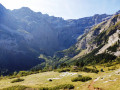
The Cirque de Gavarnie needs no introduction, it's a monument! The passage through the Plateau de Bellevue offers a wonderful viewpoint. Without snow, the path running along the side of the Bosquet Long heights adds an extra element of excitement, allowing you to appreciate it in all its splendour and tranquillity, which is not possible on the more well-known variants. The more classic return route allows you to cross the very pleasant La Prade plateau, as well as meeting other people.
⚠️ Hiking is prohibited from 1 November to 30 April. Once the quiet zone is in place, using this route between (4) and (5) constitutes a violation of National Park regulations. This is a category 4 offence under: R.331-65 3° — "Deliberate disturbance of the peace in the core area of the National Park" (€750 fine).
⚠️ DOGS PROHIBITED
See other prohibitions in the practical information section.
Please check with the Gavarnie Tourist Office before setting off: +33 (0)5 62 92 49 10.
Gavarnie waterfall with return via the Cirque du Pailla
 7.27 mi
+2,156 ft
-2,142 ft
5h 15
Moderate
Departure from Gavarnie (Hautes-Pyrénées)
7.27 mi
+2,156 ft
-2,142 ft
5h 15
Moderate
Departure from Gavarnie (Hautes-Pyrénées)
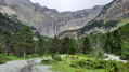
Hike in the most famous cirque in the Pyrenees. Return via the path leading to the Cirque du Pailla, which allows you to avoid the crowds and gain height to enjoy this magnificent place from a different perspective.
The Taillon
12.76 mi
+6,680 ft
-6,706 ft
6 hrs
 Very difficult
Departure from Gavarnie (Hautes-Pyrénées)
Very difficult
Departure from Gavarnie (Hautes-Pyrénées)
The summit of the Taillon as seen from Gavarnie, via the Brèche de Roland refuge.
Gavarnie to the Espuguettes Refuge
 7.16 mi
+3,868 ft
-1,677 ft
6h 40
Difficult
Departure from Gavarnie (Hautes-Pyrénées)
7.16 mi
+3,868 ft
-1,677 ft
6h 40
Difficult
Departure from Gavarnie (Hautes-Pyrénées)
Day 1The Cirque de Gavarnie needs no introduction; it is a monument, a cathedral, a colossus.The route via the Plateau de Bellevue allows you to discover it from this remarkable vantage point.The path running along the slopes of the Bosquet Long adds an element of excitement, allowing you to appreciate it in all its splendour, whilst offering a tranquillity not found on the better-known routes.The return route along the ledge on the right-hand side takes you back to the Refuge des Espuguettes, where you’ll spend the first night.
Cirque de Gavarnie via the Plateau de Bellevue
 6.95 mi
+1,450 ft
-1,470 ft
4h 25
Moderate
Departure from Gavarnie (Hautes-Pyrénées)
6.95 mi
+1,450 ft
-1,470 ft
4h 25
Moderate
Departure from Gavarnie (Hautes-Pyrénées)
Walk to the Cirque de Gavarnie, staying above the Plateau de Bellevue, aptly named.
⚠️ Hiking is prohibited from 1 November to 30 April. Once the quiet zone is in place, using this route between (4) and (7) constitutes a violation of National Park regulations. This is a category 4 offence under: R.331-65 3° — "Deliberate disturbance of the peace in the core area of the National Park" (€750 fine).
⚠️ DOGS PROHIBITED
See other prohibitions in the practical information section.
Please check with the Gavarnie Tourist Office before setting off: +33 (0)5 62 92 49 10.
For more walks, use our search engine .
The GPS track and description are the property of this route's author. Please do not copy them without permission.

