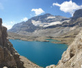
Estaubé Cirque – Troumouse Cirque

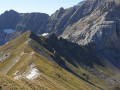
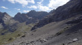
Set off from the Cirque d’Estaubé, passing by the Lac des Gloriettes, to the Cirque de Troumouse for a completely self-catering bivouac.

This walk is part of a multi-day hike: Route of the three cirques: Gavarnie, Estaubé and Troumouse

Details

68264597
Creation:
Last update:
Last review:
  • Walking
    Activity: Walking
  • ↔
    Distance: 9.52 mi
  • ◔
    Average duration: 6h 15 
  • ▲
    Difficulty: Moderate

  • ⚐
    Back to start: No
  • ↗
    Ascent: + 2,106 ft
  • ↘
    Descent: - 1,237 ft

  • ▲
    Highest point: 7,001 ft
  • ▼
    Lowest point: 5,407 ft
  • ⚐ Country: France
  • ⚐
    Areas: Pyrenees, Lavedan
  • ⚐ City: Gèdre (65120)
  • ⚑
    Start: N 42.708686° / E 0.052159°
  • ⚑
    End: N 42.725071° / E 0.110262°
  • ❏
    IGN map(s): Ref. 1748ET, 1748ETR, 1748OT, 1748OTR
  • Hour-by-hour weather

Description of the walk

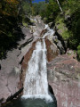
(S) Leave the campsite near the Pla d’Ailhet Waterfall and head towards Lac des Gloriettes, following the Gave d’Estaubé. Reach the hut of the same name.

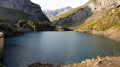
(1) Continue along the path, cross the Pont d’Estaubé and reach the footbridge upstream of Lac des Gloriettes.

(2) Carry on straight ahead, without crossing it, heading towards the Gloriettes dam. Make your way to the dam.

(3) Follow the signs to the car park.

(4) Take the nature trail until you reach a fork.

(5) Turn left towards the Cirque de Troumouse.

(6) Cross a small stream and go round the Turon de Pouey Boucou on the left, making a wide circular loop. You’ll reach a fork in the path.

(7) Turn right, leaving the path leading to the Cabane de Groutte. You’ll come within sight of the Auberge du Maillet.

(8) Walk alongside the car park situated above you, and continue in the same direction.

(9) Pass close to the Dalle H. Paget and continue along the path.

(10) Cross the Ruisseau du Mallet and enter the Cirque de Troumouse. Then begin the climb to reach the upper part of the cirque.

(11) Cut across the mountain road and continue straight ahead. The path then curves to the right, skims past the end of the road and its turning area, and reaches the footbridge over the Ruisseau du Cot.

(12) Cross the footbridge and turn immediately left to pass in front of the Cabane de la Vierge and reach the Vierge de Troumouse, right in the heart of the cirque.

(13) Retrace your steps.

(12) Leave the footbridge and turn left towards the back of the cirque to find a campsite near the Lacs des Aires (E).

Waypoints

  1. S : mi 0 - alt. 6,102 ft - Cascade du Pla d'Ailhet
  2. 1 : mi 1.62 - alt. 5,768 ft - Estaubé Hut
  3. 2 : mi 2.89 - alt. 5,509 ft - Footbridge
  4. 3 : mi 3.67 - alt. 5,417 ft - Dam - Lac des Gloriettes
  5. 4 : mi 3.79 - alt. 5,472 ft - Gloriettes car park
  6. 5 : mi 4.09 - alt. 5,679 ft - Junction, turn left
  7. 6 : mi 5.08 - alt. 6,401 ft - Stream
  8. 7 : mi 5.88 - alt. 6,204 ft - Fork in the road, turn right
  9. 8 : mi 6.88 - alt. 6,030 ft - Auberge du Maillet
  10. 9 : mi 7.13 - alt. 6,050 ft - H. Paget Slab
  11. 10 : mi 7.26 - alt. 6,073 ft - Crossing the stream
  12. 11 : mi 7.89 - alt. 6,706 ft - Mountain road
  13. 12 : mi 8.38 - alt. 6,811 ft - Footbridge
  14. 13 : mi 8.62 - alt. 6,985 ft - Vierge de Troumouse
  15. E : mi 9.52 - alt. 6,975 ft - Cirque de Troumouse (Hautes-Pyrénées)

This route passes through a protected area, which may be subject to special regulations:

Reviews and comments

4.3 / 5
Based on 1 review

Reliability of the description
5 / 5
Ease of following the route
4 / 5
Route interest
4 / 5
User 28001229

Overall rating : 4.3 / 5

Date of your route : Nov 08, 2025
Reliability of the description : ★★★★★ Very good
Ease of following the route : ★★★★☆ Good
Route interest : ★★★★☆ Good
Very busy route : No

A superb hike that we did on foot in three days in the snow. We set off from Lac des Gloriettes to explore the Cirque d'Estaubé before reaching the Cirque de Troumouse, with its chapel and the Cabane des Aires. We passed by the Tour de Lieusaube to the Cabane de l'Aguila, then returned to Lac des Gloriettes via Héas.

Machine-translated

Other walks in the area

For more walks, use our search engine .

The GPS track and description are the property of this route's author. Please do not copy them without permission.