Country:

 City:
City:


(S) Head towards the Col du Piméné and the Hourquette d’Alans via the Plateau des Cardous.
(1) Pass the path leading to the Cabane d’Alans on your left and turn right. Cross the Plateau des Cardous and continue to a crossroads.
(2) Turn left towards the Col du Piméné and head for it.
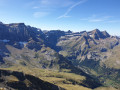
(3) Take the path on the left, follow the ridge and reach the Petit Pimené (2,667 m).
(4) Carry on straight ahead, following the ridge of the southern shoulder of the Grand Piméné, until you reach the summit (2,801 m).
(5) Turn back. When you are about a hundred metres from the Petit Piméné, veer left to follow a different route to the one taken on the ascent, following the eastern slope of the ridge. Return to the Col du Piméné.
(3) Return to the crossroads you passed on the way up.
(2) Turn left towards the Hourquette d’Alans.
(6) Once you reach the pass, continue along the path to enter the Cirque d’Estaubé.
(7) Leave the path opposite leading to the Brèche de Tuquerouye and head left. You’ll reach a viewpoint overlooking the cirque.
(8) Continue along the path, which winds through a series of tight hairpin bends.
(9) Leave the path and head right towards the Gave d’Estaubé. Navigate this off-trail section as best you can, using a small tributary to the Gave as a guide. Once at the bottom, cross the stream and rejoin the well-marked path coming from Lac des Gloriettes.
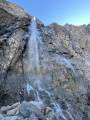
(10) Head off to the right towards the cirque and make your way to the Waterfall du Pla d’Ailhet. Then find a place to camp (E).

 Visorando Member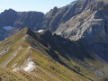
 Very difficult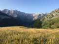
 Moderate