Gavarnie – Refuge des Espuguettes

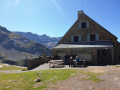
Start from Gavarnie and climb towards the Plateau de Bellevue, then descend to the Grande Waterfall. From the Hôtellerie du Cirque, climb via the ledges to the Refuge des Espuguettes, with a campsite nearby.

This walk is part of a multi-day hike: Route of the three cirques: Gavarnie, Estaubé and Troumouse

Details

68262566
Creation:
Last update:
Last review:
  • Walking
    Activity: Walking
  • ↔
    Distance: 7.36 mi
  • ◔
    Average duration: 6h 45 
  • ▲
    Difficulty: Difficult

  • ⚐
    Back to start: No
  • ↗
    Ascent: + 3,901 ft
  • ↘
    Descent: - 1,759 ft

  • ▲
    Highest point: 6,624 ft
  • ▼
    Lowest point: 4,482 ft

Description of the walk

Start from the centre of Gavarnie, near the Tourist Office.

(S) Head towards the church and the town hall.

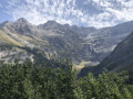
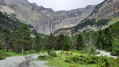
(1) Keep to the right towards the church and the cemetery, walk alongside the cemetery and take the path uphill towards the Plateau de Bellevue through the Gavarnie State Forest: continuous views of the cirque and the Grande Waterfall.

(2) Once you reach the plateau, turn left towards the cirque.

(3) Leave the nature trail on your left and continue straight on towards the Bosquet Long.

(4) Begin the descent into the cirque.

(6) Turn left towards the footbridge over the Gave de Pau.

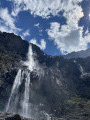
(5) Cross the footbridge and turn right. Then make your way to the foot of the Grande Waterfall.

(6) Turn round and head down to the Hôtellerie du Cirque.

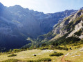
(7) Walk along the right-hand side of the buildings and head towards the Chalet de Pailla via the ledges. Continue uphill until you reach the Chalet de Pailla: magnificent views of the Pic Rouge de Pailla.

(8) Cross the stream of the same name and you’ll soon come to a junction.

(9) Turn right to reach the Refuge des Espuguettes and the designated campsite (E).

Waypoints

  1. S : mi 0 - alt. 4,482 ft - Gavarnie Tourist Office
  2. 1 : mi 0.17 - alt. 4,521 ft - Town hall, on the right
  3. 2 : mi 1.82 - alt. 5,600 ft - Bellevue Plateau.
  4. 3 : mi 2.75 - alt. 5,358 ft - Passage above the Bosquet Long
  5. 4 : mi 3.35 - alt. 5,240 ft - Junction, on the left
  6. 5 : mi 3.46 - alt. 5,161 ft - Footbridge - Gave de Pau
  7. 6 : mi 4.14 - alt. 6,093 ft - Grande Waterfall
  8. 7 : mi 4.91 - alt. 5,138 ft - Hôtellerie du Cirque.
  9. 8 : mi 6.28 - alt. 5,735 ft - Chalet-Refuge de Pailha (1750m)
  10. 9 : mi 6.38 - alt. 5,699 ft - Junction, turn right
  11. E : mi 7.36 - alt. 6,624 ft - Arrival at the designated campsite - Refuge des Espuguettes

Notes

(E) Regulated and marked-out bivouac area next to the Refuge des Espuguettes.
(E) Water point at the Refuge des Espuguettes (during the summer season).

This route passes through a protected area, which may be subject to special regulations:

Other walks in the area

For more walks, use our search engine .

The GPS track and description are the property of this route's author. Please do not copy them without permission.