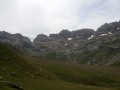
Troumouse Cirque – Héas Chapel

From the Cirque de Troumouse to the Chapel of Héas, via Fontaine and the Oratory of the Holy Family.

This walk is part of a multi-day hike: Route of the three cirques: Gavarnie, Estaubé and Troumouse

Details

68269013
Creation:
Last update:
Last review:
  • Walking
    Activity: Walking
  • ↔
    Distance: 5.19 mi
  • ◔
    Average duration: 2h 50 
  • ▲
    Difficulty: Moderate

  • ⚐
    Back to start: No
  • ↗
    Ascent: + 535 ft
  • ↘
    Descent: - 2,451 ft

  • ▲
    Highest point: 7,211 ft
  • ▼
    Lowest point: 4,980 ft

Description of the walk

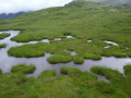
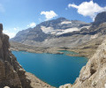
(S) After a night’s bivouac in the Cirque de Troumouse, head south across the mountain pasture to reach the path leading to the cirque. Turn left and make your way to the group of Lacs des Aires.

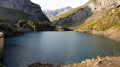
(1) Go round them by turning left and continue on to the Matacas Waterfall.

(2) Turn right to reach the Cabane des Aires.

(3) Walk round the Cabane des Aires, then follow the Ruisseau de l’Escourrède on your right until you reach the foot of the Tuc de l’Escaurède. Continue on to the Ruisseau de la Sède.

(4) Cross it and carry on to reach the Tour de Lieusaube.

(5) Continue on level ground until you reach the start of the descent.

(6) Begin the descent and reach the fountain and the Oratory of the Holy Family.

(7) Continue the descent to the left, following the left bank of the Ruisseau de l’Aquila. You’ll come to a series of hairpin bends.

(8) Leave the stream bank, turn left and complete the descent via the path’s hairpin bends. Reach the end of the walk at the Chapelle de Héas (E).

Waypoints

  1. S : mi 0 - alt. 6,923 ft - Cirque de Troumouse (Hautes-Pyrénées)
  2. 1 : mi 0.38 - alt. 6,923 ft - Lacs des Aires (Hautes-Pyrénées)
  3. 2 : mi 1.11 - alt. 6,880 ft - Junction at the Matacas Waterfall
  4. 3 : mi 1.54 - alt. 6,965 ft - Cabane des Aires (Vallée des Gaves-Cirque de Troumousse)
  5. 4 : mi 2.21 - alt. 7,070 ft - Sède Stream
  6. 5 : mi 2.64 - alt. 7,211 ft - Lieusaube Circuit
  7. 6 : mi 3.11 - alt. 7,113 ft - Start of the descent
  8. 7 : mi 3.9 - alt. 6,253 ft - Fontaine et Oratoire de la Sainte-Famille (Vallée des Gaves-Cirque de Troumousse)
  9. 8 : mi 4.51 - alt. 5,830 ft - Hairpin bends
  10. E : mi 5.19 - alt. 4,980 ft - Héas Chapel - Gave de Héas (cours d'eau)

Notes

(E) Arrange transport here to return to Gavarnie, the starting point of this route.

This route passes through a protected area, which may be subject to special regulations:

Worth a visit

Reviews and comments

4 / 5
Based on 1 review

Reliability of the description
4 / 5
Ease of following the route
4 / 5
Route interest
4 / 5
User 1251787

Overall rating : 4 / 5

Date of your route : Jun 09, 2026
Reliability of the description : ★★★★☆ Good
Ease of following the route : ★★★★☆ Good
Route interest : ★★★★☆ Good
Very busy route : Yes

A lovely walk, but on that particular day the mist prevented us from seeing the beautiful cirque – the ‘Virgin in the Mist’ – and the final stretch of the return journey is a bit of a slog after the inn; it takes a good half an hour to reach the car park near the chapel at Héas.

Machine-translated

Other walks in the area

For more walks, use our search engine .

The GPS track and description are the property of this route's author. Please do not copy them without permission.