Refine your search for walks in Büllingen
Büllingen walks


 Losheimergraben – Nidrum
 Visorando Member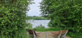
 10.42 mi
 +456 ft
 -814 ft
 5h 10
5h 10
 Moderate
 Departure from Belgium
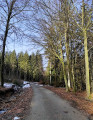
This24th stage takes us from the tranquillity of the forests of the Eastern Cantons to the livelier atmosphere of the shores of Lake Bütgenbach, before returning to the countryside in Nidrum. For your feet, it means switching from forest paths with ‘natural’ surfaces to the tarmac of small country roads, town streets and the Ravel. A complete change of scenery is guaranteed.
Bieley Rock
 7.59 mi
+633 ft
-627 ft
4h 00
Moderate
Departure from Bütgenbach (Province de Liège)
7.59 mi
+633 ft
-627 ft
4h 00
Moderate
Departure from Bütgenbach (Province de Liège)
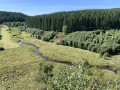
A walk through the heart of the Elsenborn and Rocherarth forests will take you to a viewpoint that is unique in Belgium: Bieley Rock. A fairy-tale view of a valley with a small stream winding through it, reflecting a thousand colours. Whatever the season or weather, the incredible view from this spot is definitely worth the detour.
Moderator's note: please read the reviews carefully: some periods are dangerous due to live fire training at the Elsenborn camp.
Tour of Lake Bütgenbach
6.25 mi
+148 ft
-144 ft
3h 00
 Easy
Departure from Bütgenbach (Province de Liège)
Easy
Departure from Bütgenbach (Province de Liège)
An easy hike with no difficulty, virtually no elevation gain and beautiful scenery... nothing but pleasure!!!
The Kolvenderbach valley from Medendorf
 6.07 mi
+650 ft
-646 ft
3h 20
Easy
Departure from Büllingen (Province de Liège)
6.07 mi
+650 ft
-646 ft
3h 20
Easy
Departure from Büllingen (Province de Liège)
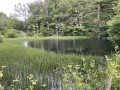
A circular walk through the quiet and peaceful Kolvenderbach valley
Nidrum – Eupen
 18.26 mi
+869 ft
-1,732 ft
9h 10
18.26 mi
+869 ft
-1,732 ft
9h 10
 Difficult
Departure from Bütgenbach (Province de Liège)
Difficult
Departure from Bütgenbach (Province de Liège)
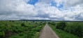
Here is another remarkable stage. It begins in the meadows of the Belgian highlands and then ‘flirts’ with Belgium’s highest elevations in the Hautes Fagnes, reaching a peak of 638 m; from there, the path descends steadily to Eupen and the Vesdre at an altitude of 263 m. It’s a route that also has a few surprises in store, particularly along the stretch beside the River Helle (Hill in German), where the path zigzags between wooden duckboards and muddy, mostly rocky ground – an environment it seeks to avoid by veering off upwards to… well, I’ll let you discover that for yourselves. A bit of suspense never hurt anyone.
Cross-border getaway to Schönberg
 11.67 mi
+1,385 ft
-1,385 ft
6h 35
Moderate
Departure from Sankt Vith (Province de Liège)
11.67 mi
+1,385 ft
-1,385 ft
6h 35
Moderate
Departure from Sankt Vith (Province de Liège)
Mostly wooded, this circular offers beautiful views on clear days over the countryside south of the German border towards Mützenich... not to be confused with the village of the same name in the municipality of Monschau, further north.
Waimes – The panoramic views of the Warche
 3.29 mi
+531 ft
-538 ft
2h 00
Moderate
Departure from Waimes (Province de Liège)
3.29 mi
+531 ft
-538 ft
2h 00
Moderate
Departure from Waimes (Province de Liège)
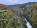
This marked walk, which appears on various walking maps, is one of the most beautiful walks in Belgium. It offers superb views of Reinhardstein Castle, which the walk passes by.
Reinhardstein Castle and Lake Roberville
 6.71 mi
+692 ft
-663 ft
3h 40
Moderate
Departure from Waimes (Province de Liège)
6.71 mi
+692 ft
-663 ft
3h 40
Moderate
Departure from Waimes (Province de Liège)
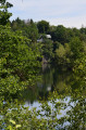
Varied route through forests, along a river and around Lake Robertville. With beautiful views of Reinhardstein Castle.
Sourbrodt (Waimes) – The Happy People’s Walk
 2.46 mi
+59 ft
-43 ft
1h 10
Easy
Departure from Waimes (Province de Liège)
2.46 mi
+59 ft
-43 ft
1h 10
Easy
Departure from Waimes (Province de Liège)
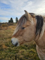
A very pleasant, signposted walk starting from the Eau Noire car park. The route is entirely flat and presents no difficulty in the Hautes Fagnes, with part of it on boardwalks.The only downside: depending on the wind direction, you can hear the Spa-Francorchamps route in the distance if it is in operation, as is the case with all walks in the region.
Between the Hautes Fagnes and secret valleys from the Noire Eau
11.50 mi
+827 ft
-833 ft
6h 00
Moderate
Departure from Waimes (Province de Liège)
This hike takes you to the heart of a demanding and authentic natural environment, where water shapes the landscape and the wind preserves the memory of places. Former military camps, Germanic-influenced place names and rugged terrain tell a story marked by borders and time.Peat bogs formed after the last ice age, acidic soils and schistose rocks make up the typical landscape of the Hautes Fagnes. Clear streams, dark rivers laden with peat and cold springs accompany the walk.Deep forests, open moors and clearings follow one another, sheltering discreet fauna and specialised flora. A hike that is both wild and soothing, ideal for celebrating a special moment in an unspoilt landscape.
Circular forest in Reichenstein
 7.27 mi
+846 ft
-850 ft
4h 05
Moderate
Departure from Belgium
7.27 mi
+846 ft
-850 ft
4h 05
Moderate
Departure from Belgium
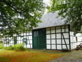
A forest walk that crosses the border (a little) into Belgium and (a lot) into Germany. Starting from the Reichenstein stop on the Vennbahn, the hike begins in the direction of Kreuz im Venn and its cave before crossing Ruitzhof, a German hamlet enclaved in Belgium, and then reaching the pretty Rur valley.Different atmospheres guaranteed depending on the season.
Circular from Reichenstein to the Schwarzbach pond via Kreuz im Venn
 8.24 mi
+774 ft
-787 ft
4h 30
Moderate
Departure from Belgium
8.24 mi
+774 ft
-787 ft
4h 30
Moderate
Departure from Belgium
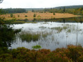
This cross-border walk on the border between the Hautes Fagnes and Germany between Montjoie (Monschau) and Sourbrodt (Waimes) starts on the RAVeL (Belgian enclave of the Vennbahn) at the former Reichenstein stop near the Reichenstein Convent (Kloster) on the road between Mützenich and Kalterherberg.Discover this pure joy away from the tourist crowds in the Hautes Fagnes.
 Ovifat, when there’s snow on the ground
 2.70 mi
+367 ft
-371 ft
2 hrs
Easy
Departure from Waimes (Province de Liège)
2.70 mi
+367 ft
-371 ft
2 hrs
Easy
Departure from Waimes (Province de Liège)
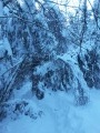
Not far from the Signal de Botrange, Belgium’s highest point, this walk will take you along the Le Ghâster stream, a tributary of the Bayehon.
Bayehon Walk - Mill and Waterfall
 5.55 mi
+653 ft
-653 ft
3h 05
Easy
Departure from Malmedy (Province de Liège)
5.55 mi
+653 ft
-653 ft
3h 05
Easy
Departure from Malmedy (Province de Liège)
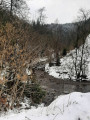
A pleasant walk that will take you to the Bayehon Waterfall, the second largest in Belgium. It is fed by the Hautes Fagnes springs, so its flow varies depending on the season. The route takes you through different types of vegetation, from deciduous trees to pines and the Fagne. Most of the route follows streams, which are crossed numerous times by small bridges.
Heading for the Signal de Botrange
3.28 mi
+171 ft
-167 ft
1h 40
Easy
Departure from Waimes (Province de Liège)
Virtual treasure hunt with the TOTEMUS app in search of the highest point in Belgium: Head for the highest point in Belgium
Easy route leading from the Park House to the Signal de Botrange and back to the Park House.
After all that effort, what could be better than enjoying a drink or treating yourself to a light meal?
Circular route in the Eifel starting from Bleialf
 12.93 mi
+1,030 ft
-1,040 ft
6h 50
Difficult
Departure from Bleialf (Eifelkreis Bitburg-Prüm)
12.93 mi
+1,030 ft
-1,040 ft
6h 50
Difficult
Departure from Bleialf (Eifelkreis Bitburg-Prüm)
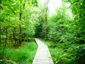
Bleialf is a small town in the Schneifel, a stone’s throw from the Belgian border.This walk begins on a nature trail that follows the Alfbach before heading towards the Birkenhof viewpoint.The region is gently undulating and mainly devoted to cereal farming.In season, you’ll therefore be walking through fields of wheat, barley, oats and so on, where the golden fields are broken up only by a few lush green copses.In the second part, the route becomes a little more wooded and crosses the Eschvenn wetland before climbing up to the Eifelblick viewpoint and its orientation table, which offers sweeping views of the northern horizon, including the Hautes-Fagnes in Belgium to the south and the Our Valley in the Grand Duchy of Luxembourg.You may also be lucky enough to spot the odd black stork landing or taking flight majestically as you approach. Common buzzards, black kites and kestrels are unlikely to be quite so rare.
From the Signal de Botrange to the Fagnes de Sourbrodt
 8.88 mi
+614 ft
-597 ft
4h 35
Moderate
Departure from Waimes (Province de Liège)
8.88 mi
+614 ft
-597 ft
4h 35
Moderate
Departure from Waimes (Province de Liège)
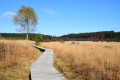
From the highest point in Belgium, set off to explore the Walloon Fagne and the Fagne de Sourbrodt, along with its Second World War memorials.
The Visorando app is highly recommended
A short walk between Brackvenn and Herzogenhügel
 7.54 mi
+505 ft
-505 ft
3h 55
Moderate
Departure from Eupen (Province de Liège)
7.54 mi
+505 ft
-505 ft
3h 55
Moderate
Departure from Eupen (Province de Liège)
This hike will delight lovers of the Hautes-Fagnes and wetlands. The highlights include the boardwalks in the southern part of Brackvenn, the trail in the Spohrbach valley, the confluence of the Spohrbach and the Helle (Hill in German) and the border marker trail (at the end of the route).
Walk in the Brackvenn fen
4.52 mi
+108 ft
-98 ft
2h 10
Easy
Departure from Eupen (Province de Liège)
Do you like moorland landscapes? Are you fond of boardwalks? Then you should enjoy this walk! This walk takes you to the Brackvenn moor, near the German border. The walk takes place in the forest, in the moors, along stretches of water... The landscapes are varied and truly delightful.
Circular at Rursee
 13.84 mi
+1,886 ft
-1,893 ft
8h 00
Difficult
Departure from Simmerath (Cologne Government Region)
13.84 mi
+1,886 ft
-1,893 ft
8h 00
Difficult
Departure from Simmerath (Cologne Government Region)
The hike takes you on a long tour of the Obersee, the central part of the Rursee complex, which consists of three stepped lakes and three dams. The Obersee is located between the Urftsee and the Rursee itself.Located in the heart of the Eifel National Park, the Rursee guarantees magnificent landscapes. In addition to lakes and forests, this hike takes you through moorland to the ghost village of Wollseifen, with its St. Roch Church and school museum.Located near the large Nazi elite training centre in Volgelsang, Wollseifen was heavily damaged by bombing during the Second World War and then completely razed by the British army to make way, just after the war, for the Vogelsang military training camp, which,since the withdrawal of British and then Belgian troops from Germany, has been converted into a memorial centre.
From Ternell to the Walloon Fagne – La Helle
 14.07 mi
+1,286 ft
-1,296 ft
7h 35
Difficult
Departure from Eupen (Province de Liège)
14.07 mi
+1,286 ft
-1,296 ft
7h 35
Difficult
Departure from Eupen (Province de Liège)
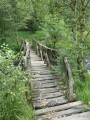
Discover one of Belgium’s wildest rivers, the Helle (Hill in German), starting from the old forest house at Ternell, and the Hautes-Fagnes where it rises. A long nature walk over varied terrain: forest paths (deciduous and spruce), dry and wet grassy paths and tracks, boardwalks (over very marshy ground), stony paths, tarmac paths.
Between forests and steppe landscapes in Ternell
 11.94 mi
+968 ft
-968 ft
6h 20
Moderate
Departure from Eupen (Province de Liège)
11.94 mi
+968 ft
-968 ft
6h 20
Moderate
Departure from Eupen (Province de Liège)
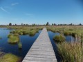
For those who like to cover a lot of ground, there are various forests (coniferous and deciduous) to explore, as well as the boardwalks and peat bogs of the Hautes Fagnes.