


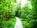
Numerous crosses mark the forest trail, including the 'Schwarzes Kreuz', which commemorates the murder in 1881 of a farmer on his way back to Bleialf to steal the money he had earned at the Sankt Vith cattle market.
Not to mention those on the magnificent Schönberg Way of the Cross at the end of the route.
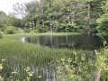
On your return to Belgium at km 15 (3), don't hesitate to take a short detour to the beautiful pond on the south side.
It is worth noting that Schönberg is well worth a visit: a friendly living space in the centre of the village, opposite the church and on the banks of the Our, the region's iconic river.
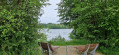
There are quite a few benches along the route, especially on the German side, as well as two picnic shelters.
Cross-border getaway to Schönberg


Mostly wooded, this circular offers beautiful views on clear days over the countryside south of the German border towards Mützenich... not to be confused with the village of the same name in the municipality of Monschau, further north.
Details
Creation:
Last update:
Last review:
–
–
-
 Activity: Walking
 -
 Distance: 11.67 mi
 -
 Average duration: 6h 35
 -
 Difficulty: Moderate
 -
-
 Back to start: Yes
 -
 Ascent: + 1,385 ft
 -
 Descent: - 1,385 ft
 -
-
 Highest point: 1,844 ft
 -
 Lowest point: 1,391 ft
-
 Country:
Belgium
Country:
Belgium
-
 City:
Sankt Vith
City:
Sankt Vith -
 Start/End: N 50.28952° / E 6.26428°
 -


 Hour-by-hour weather
Photos
Description of the walk
Waypoints
- S/E : mi 0 - alt. 1,391 ft - Schönberg centre
- 1 : mi 5.65 - alt. 1,795 ft - Picnic shelter
- 2 : mi 8.41 - alt. 1,693 ft - Picnic shelter
- 3 : mi 9.29 - alt. 1,650 ft - Pond
- S/E : mi 11.67 - alt. 1,391 ft - Schönberg centre
Other walks in the area
The Kolvenderbach valley from Medendorf
 Visorando Member
 6.07 mi
+650 ft
-646 ft
3h 20
6.07 mi
+650 ft
-646 ft
3h 20
 Easy
Easy
 Departure from Büllingen (Province de Liège)
A circular walk through the quiet and peaceful Kolvenderbach valley
Circular route in the Eifel starting from Bleialf
 12.93 mi
+1,030 ft
-1,040 ft
6h 50
12.93 mi
+1,030 ft
-1,040 ft
6h 50
 Difficult
Departure from Bleialf (Eifelkreis Bitburg-Prüm)
Difficult
Departure from Bleialf (Eifelkreis Bitburg-Prüm)
Bleialf is a small town in the Schneifel, a stone’s throw from the Belgian border.This walk begins on a nature trail that follows the Alfbach before heading towards the Birkenhof viewpoint.The region is gently undulating and mainly devoted to cereal farming.In season, you’ll therefore be walking through fields of wheat, barley, oats and so on, where the golden fields are broken up only by a few lush green copses.In the second part, the route becomes a little more wooded and crosses the Eschvenn wetland before climbing up to the Eifelblick viewpoint and its orientation table, which offers sweeping views of the northern horizon, including the Hautes-Fagnes in Belgium to the south and the Our Valley in the Grand Duchy of Luxembourg.You may also be lucky enough to spot the odd black stork landing or taking flight majestically as you approach. Common buzzards, black kites and kestrels are unlikely to be quite so rare.
Losheimergraben – Nidrum
 10.42 mi
+456 ft
-814 ft
5h 10
Moderate
Departure from Belgium
10.42 mi
+456 ft
-814 ft
5h 10
Moderate
Departure from Belgium
This24th stage takes us from the tranquillity of the forests of the Eastern Cantons to the livelier atmosphere of the shores of Lake Bütgenbach, before returning to the countryside in Nidrum. For your feet, it means switching from forest paths with ‘natural’ surfaces to the tarmac of small country roads, town streets and the Ravel. A complete change of scenery is guaranteed.
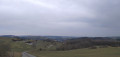
Panoramic views of the Our Valley in Burg-Reuland
 8.61 mi
+1,184 ft
-1,168 ft
5h 00
Moderate
Departure from Burg-Reuland (Province de Liège)
8.61 mi
+1,184 ft
-1,168 ft
5h 00
Moderate
Departure from Burg-Reuland (Province de Liège)
Although I’m not a big fan of tarmac roads on my walks, they are soon forgotten as magnificent landscapes unfold once you reach the ridge. We then reach the banks of the Irmisch, the river that forms the border with Germany. Finally, we return to the ridge on the other side, where a remarkable shelter for walkers and a final descent take us back to the imposing fortress of Burg-Reuland.
Rodt Sank Vith – Losheimergraben
 16.19 mi
+994 ft
-459 ft
8h 20
16.19 mi
+994 ft
-459 ft
8h 20
 Very difficult
Departure from Sankt Vith (Province de Liège)
Very difficult
Departure from Sankt Vith (Province de Liège)
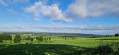
On this twenty-third stage, we’ll head to the German border – the easternmost point of my tour of Wallonia – as the village of Losheimergraben lies on the border. In reality, it isn’t really a village but rather a hamlet that’s ideal as a starting point for hikes or cross-country skiing trips. So you’ll have no trouble finding somewhere to stay there. The lowest point on the route is at an altitude of 500 m, and the highest at 682 m. We are therefore in the highest region of Belgium, to some extent. The first third of the day is spent in the countryside, and the rest in the woods.
Tour of Lake Bütgenbach
6.25 mi
+148 ft
-144 ft
3h 00
Easy
Departure from Bütgenbach (Province de Liège)
An easy hike with no difficulty, virtually no elevation gain and beautiful scenery... nothing but pleasure!!!
Nidrum – Eupen
 18.26 mi
+869 ft
-1,732 ft
9h 10
Difficult
Departure from Bütgenbach (Province de Liège)
18.26 mi
+869 ft
-1,732 ft
9h 10
Difficult
Departure from Bütgenbach (Province de Liège)
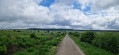
Here is another remarkable stage. It begins in the meadows of the Belgian highlands and then ‘flirts’ with Belgium’s highest elevations in the Hautes Fagnes, reaching a peak of 638 m; from there, the path descends steadily to Eupen and the Vesdre at an altitude of 263 m. It’s a route that also has a few surprises in store, particularly along the stretch beside the River Helle (Hill in German), where the path zigzags between wooden duckboards and muddy, mostly rocky ground – an environment it seeks to avoid by veering off upwards to… well, I’ll let you discover that for yourselves. A bit of suspense never hurt anyone.
Three borders circuit in Ouren
 11.48 mi
+1,486 ft
-1,460 ft
6h 35
Moderate
Departure from Burg-Reuland (Province de Liège)
11.48 mi
+1,486 ft
-1,460 ft
6h 35
Moderate
Departure from Burg-Reuland (Province de Liège)
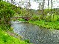
A long walk in the heart of the Eifel countryside, passing through three European countries: Belgium, Germany and the Grand Duchy of Luxembourg. You will discover the memorial dedicated to the founding of the Europe of Six.In addition to the landscapes of the Our valley and some of its tributaries, you will discover the incomparable Welchenhausen museum and its "sculpture trail".
For more walks, use our search engine .
The GPS track and description are the property of this route's author. Please do not copy them without permission.

