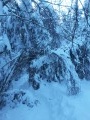
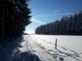
Ovifat, when there’s snow on the ground

Not far from the Signal de Botrange, Belgium’s highest point, this walk will take you along the Le Ghâster stream, a tributary of the Bayehon.

Details

461705
Creation:
Last update:
Last review:
  • Snowshoeing
    Activity: Snowshoeing
  • ↔
    Distance: 2.70 mi
  • ◔
    Duration according to the author: 2 hrs 
  • ▲
    Difficulty: Easy

  • ⚐
    Back to start: Yes
  • ↗
    Ascent: + 367 ft
  • ↘
    Descent: - 371 ft

  • ▲
    Highest point: 1,962 ft
  • ▼
    Lowest point: 1,617 ft

Photos

Description of the walk

Car park at the Domaine des Hautes Fagnes in Ovifat, Rue des Charmilles, 67.

(S/E) After the last few parking spaces, cross the lawn and turn right to reach the path running behind the hotel.

(1) Take the second path on the right to join the VITA trail (Green Cross). Continue to the picnic table. Cross the stream and turn immediately left to follow the Ghâster (Blue Rectangle). Cross it several times. Walk along the bottom of the downhill ski run; the path continues to your right just before the ski lift. Cross the bridge; the path climbs and moves slightly away from the stream.

(2) Cross the tributary and continue alongside the Ghâster, ignoring the climb on your right. Change banks several times until you reach a wide path. Continue to your left along the Bayehon.

(3) 200 metres further on, before the bridge, turn left onto the path leading uphill through the forest (unmarked) until you reach the wide track 120 metres higher up (Green Cross). Turn left and walk to the downhill run and its ski lift.

(4) Watch out for the T-bar lift; pull the barrier open, cross the ski run to reach the other side and continue through the forest.

(5) At the junction, turn right (unmarked). At the next crossroads, turn left, then left again.

(1) Cross the grassy area again to reach the car park (S/E).

Waypoints

  1. S/E : mi 0 - alt. 1,955 ft - Domaine des Hautes Fagnes car park
  2. 1 : mi 0.02 - alt. 1,942 ft - Crossroads at the end of the circular loop
  3. 2 : mi 0.92 - alt. 1,752 ft - Straight on
  4. 3 : mi 1.38 - alt. 1,617 ft - Climb up to the left
  5. 4 : mi 1.96 - alt. 1,775 ft - Ski slope barrier
  6. 5 : mi 2.32 - alt. 1,916 ft - Junction on the right
  7. S/E : mi 2.7 - alt. 1,949 ft - Domaine des Hautes Fagnes car park

Notes

The path running alongside the stream can sometimes be tricky in snowshoes.
If the trail has already been broken, crampons will suffice.

Refreshment points:
Le Moulin du Bayehon, for a snack or a hot drink: at (3) carry straight on until you reach the road and cross it.
Le Petit Creux snack bar and chip shop, near the estate, along the N676.

Worth a visit

Downhill ski run at the Ovifat Ski Club.
Signal de Botrange
Mount Rigi

Reviews and comments

3.8 / 5
Based on 4 reviews

Reliability of the description
3.5 / 5
Ease of following the route
3.3 / 5
Route interest
4.5 / 5
Aclamister
Aclamister
• Edited:

Overall rating : 3.7 / 5

Date of your route : Aug 01, 2026
Reliability of the description : ★★★☆☆ Average
Ease of following the route : ★★★☆☆ Average
Route interest : ★★★★★ Very good
Very busy route : No

The walk is very pleasant. A route with varied terrain. Wooded landscapes. Small footbridges that allow you to follow the course of the stream.

Machine-translated

lazzerini
lazzerini

Hello Mathieudeth,
It's true that with the app you can see where you are. It's much easier. The app is free, and for Belgium, as you need to use OppenStreetMap, it will remain free after the trial month. Don't hesitate to use it next time, as it gives you a better idea of the distances between each waypoint.
All the best

Machine-translated

Mathieudeth
Mathieudeth

Overall rating : 4 / 5

Date of your route : Jan 20, 2020
Reliability of the description : ★★★★☆ Good
Ease of following the route : ★★★☆☆ Average
Route interest : ★★★★★ Very good

Very beautiful route.
We did it with our children aged 3 and 5 and our baby in a sling --> the first part is technical for small children (the descent along the G'Haster) but they loved walking on the roots and in the mud.
Impossible to do with a pushchair.
Sometimes the route on the map wasn't very accurate, but I hadn't downloaded the Visarando app. The written explanations were very helpful.

Machine-translated

paul pascal
paul pascal

Overall rating : 4.3 / 5

Date of your route : Feb 01, 2019
Reliability of the description : ★★★★☆ Good
Ease of following the route : ★★★★☆ Good
Route interest : ★★★★★ Very good

We completed the loop in one direction on 29/01/2019 and then in the other direction the following day, only to find that a section between points 2 and 3 was completely impassable on snowshoes due to heavy snow, especially as the stream spreads out.
Otherwise, it's superb.

Machine-translated

marcroppe
marcroppe

Overall rating : 3 / 5

Date of your route : Sep 03, 2018
Reliability of the description : ★★★☆☆ Average
Ease of following the route : ★★★☆☆ Average
Route interest : ★★★☆☆ Average

|Description of the route for the summer is unclear.
The starting point will soon no longer be valid (according to the hotel).
Good shoes recommended.

Marc

Machine-translated

lazzerini
lazzerini
• Edited:

Hello AdelineLune,

When I say tricky, I mean that in some places the path is very narrow, just wide enough for ONE snowshoe! So you have to walk one foot in front of the other, but with snowshoes... You have to go slowly so you don't step on each other, so to speak. With just walking shoes, it's not possible if there's snow on the ground. Regular use of the trail turns it into a layer of ice, and you have to be able to "grip" the ground. Finally, fresh snow is always better for snowshoeing, even if it's more strenuous. Your thighs will remember it
Best regards

Carla

Machine-translated

gazok54
gazok54 ★

Hello Adeline.
The crampons attach to the bottom of your hiking boots. They have metal spikes that provide good grip on packed snow or ice. This is why they are not recommended for use on fresh snow, where you will sink in. In this case, snowshoes are the best option. With hiking boots alone, you risk slipping. It is important to always ensure maximum safety.

Machine-translated

AdelineLune
AdelineLune

Hello,

The description says that one section of the hike can be tricky with snowshoes, but that if the trail has already been made, crampons will suffice. What do you mean by "crampons"? (I'm not very familiar with hiking equipment). I guess mid-range hiking boots won't be suitable?

If anyone has time to enlighten me, thank you!

Adeline

Machine-translated

For more walks, use our search engine .

The GPS track and description are the property of this route's author. Please do not copy them without permission.