


Circular route in the Eifel starting from Bleialf


Bleialf is a small town in the Schneifel, a stone’s throw from the Belgian border.
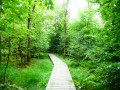
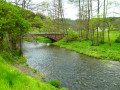
This walk begins on a nature trail that follows the Alfbach before heading towards the Birkenhof viewpoint.
The region is gently undulating and mainly devoted to cereal farming.
In season, you’ll therefore be walking through fields of wheat, barley, oats and so on, where the golden fields are broken up only by a few lush green copses.
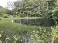
In the second part, the route becomes a little more wooded and crosses the Eschvenn wetland before climbing up to the Eifelblick viewpoint and its orientation table, which offers sweeping views of the northern horizon, including the Hautes-Fagnes in Belgium to the south and the Our Valley in the Grand Duchy of Luxembourg.
You may also be lucky enough to spot the odd black stork landing or taking flight majestically as you approach. Common buzzards, black kites and kestrels are unlikely to be quite so rare.
Details
–
-
 Activity: Walking
 -
 Distance: 12.93 mi
 -
 Average duration: 6h 50
 -
 Difficulty: Difficult
 -
-
 Back to start: Yes
 -
 Ascent: + 1,030 ft
 -
 Descent: - 1,040 ft
 -
-
 Highest point: 2,028 ft
 -
 Lowest point: 1,493 ft
 Country:
 City:
City:


Photos
Waypoints
- S/E : mi 0 - alt. 1,503 ft - Bleialf Sports Ground
- 1 : mi 0.89 - alt. 1,594 ft - Alfbach
- 2 : mi 1.82 - alt. 1,637 ft - Halenfeld
- 3 : mi 2.74 - alt. 1,690 ft - Auf der Brück
- 4 : mi 3.59 - alt. 1,831 ft - Birkenhof
- 5 : mi 7.97 - alt. 1,886 ft - Eschvenn
- 6 : mi 10.85 - alt. 2,001 ft - Eifelblick
- 7 : mi 11.72 - alt. 1,772 ft - Weidinger
- S/E : mi 12.93 - alt. 1,503 ft - Bleialf Sports Ground
Other walks in the area
Cross-border getaway to Schönberg
 Visorando Member
 11.67 mi
+1,385 ft
-1,385 ft
6h 35
11.67 mi
+1,385 ft
-1,385 ft
6h 35
 Moderate
 Departure from Sankt Vith (Province de Liège)
The Kolvenderbach valley from Medendorf
 6.07 mi
+650 ft
-646 ft
3h 20
6.07 mi
+650 ft
-646 ft
3h 20
 Easy
Departure from Büllingen (Province de Liège)
Easy
Departure from Büllingen (Province de Liège)
Panoramic views of the Our Valley in Burg-Reuland
 8.61 mi
+1,184 ft
-1,168 ft
5h 00
Moderate
Departure from Burg-Reuland (Province de Liège)
8.61 mi
+1,184 ft
-1,168 ft
5h 00
Moderate
Departure from Burg-Reuland (Province de Liège)
Losheimergraben – Nidrum
 10.42 mi
+456 ft
-814 ft
5h 10
Moderate
Departure from Belgium
10.42 mi
+456 ft
-814 ft
5h 10
Moderate
Departure from Belgium
Three borders circuit in Ouren
 11.48 mi
+1,486 ft
-1,460 ft
6h 35
Moderate
Departure from Burg-Reuland (Province de Liège)
11.48 mi
+1,486 ft
-1,460 ft
6h 35
Moderate
Departure from Burg-Reuland (Province de Liège)
Rodt Sank Vith – Losheimergraben
 16.19 mi
+994 ft
-459 ft
8h 20
16.19 mi
+994 ft
-459 ft
8h 20
 Very difficult
Departure from Sankt Vith (Province de Liège)
Very difficult
Departure from Sankt Vith (Province de Liège)
Le Grand-Bois in Vielsalm from Tinseubois
 Tourism professional
 4.75 mi
+325 ft
-331 ft
2h 30
Easy
Departure from Vielsalm (Province de Luxembourg)
4.75 mi
+325 ft
-331 ft
2h 30
Easy
Departure from Vielsalm (Province de Luxembourg)
For more walks, use our search engine .
The GPS track and description are the property of this route's author. Please do not copy them without permission.

