From the Signal de Botrange to the Fagnes de Sourbrodt

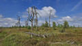
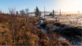
From the highest point in Belgium, set off to explore the Walloon Fagne and the Fagne de Sourbrodt, along with its Second World War memorials.
The Visorando app is highly recommended

Details

65616167
Creation:
Last update:
Last review:
  • Walking
    Activity: Walking
  • ↔
    Distance: 8.88 mi
  • ◔
    Average duration: 4h 35 
  • ▲
    Difficulty: Moderate

  • ⚐
    Back to start: Yes
  • ↗
    Ascent: + 614 ft
  • ↘
    Descent: - 597 ft

  • ▲
    Highest point: 2,287 ft
  • ▼
    Lowest point: 1,781 ft

Photos

Description of the walk

Signal de Botrange car park.

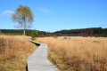
(S/E) Cross the road to reach the viewing platform overlooking the Walloon Fagne.

(1) Turn right towards the edge of the woods, keeping the Fagne on your left.

(2) Turn left to continue along the Walloon Fagne.

(3) After about 1 km, take the forest track on the right, heading south-south-east.

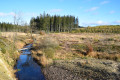
(4) Please note: 600 m further on, immediately after a forestry track, do not miss the small path on the left that runs alongside the river.
Important: in autumn, the path is closed during the period covering 2 hours before sunset and 2 hours after sunrise; you must therefore continue along the track.
Follow the river to the grassy plateau and join the path around the Fagne de Sourbrodt.

(5) Turn left and then immediately right. Immediately take a short detour to the right of the path to see the “Croix des Russes”.
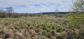
Carry on, keeping to the right at junctions, to walk alongside the fen on your right-hand side.

(6) The path curves to the right; carry on until you reach one of the site’s entry points.

(7) “The Happy People’s Walk”. A few metres further on, take the path on the right between the meadow and the marshes and continue round the Fagne. At the junctions, stay along the edge of the Fagne on your right.

(8) Take the Sentier de la Triandale. You’ll pass the “monument to the airmen”. Carry on with the Fagne on your right until you reach a car park.

(9) Take the access road to the car park (on the left) for about 80 m, then join and follow a path on the right.

(10) At the recycling centre, take the path straight ahead (between woodland and meadows).

(11) At the road, continue along the path to the right. At the next junction, turn right, then left 100 m further on.

(12) Turn left onto the track, which joins a road after 750 m. Cross this road carefully and take the path leading off to the right. You’ll reach the rear of the Peak Brewery (Belgium’s highest brewery).

(13) Carry on and, after 150 m, take the path on the left, following it for about 1 km.

(14) At the T-junction, turn left.

(15) After 500 m, turn right.

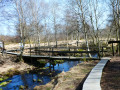
(16) After about 1 km, turn right onto the wooden walkway until you reach the Signal de Botrange car park (S/E).

Waypoints

  1. S/E : mi 0 - alt. 2,270 ft - Signal de Botrange
  2. 1 : mi 0.17 - alt. 2,267 ft - Viewing platform
  3. 2 : mi 0.89 - alt. 2,152 ft - Junction, change of direction
  4. 3 : mi 1.76 - alt. 2,024 ft - Change of direction onto a forest track
  5. 4 : mi 2.23 - alt. 1,978 ft - Change of direction onto the footpath
  6. 5 : mi 2.89 - alt. 1,860 ft - Junction, change of direction
  7. 6 : mi 3.5 - alt. 1,834 ft - Change of direction
  8. 7 : mi 4.03 - alt. 1,795 ft - The ‘Happy People’ Walk
  9. 8 : mi 4.75 - alt. 1,841 ft - The Triandale Trail
  10. 9 : mi 5.18 - alt. 1,867 ft - Car park
  11. 10 : mi 5.46 - alt. 1,936 ft - Container park
  12. 11 : mi 5.77 - alt. 1,972 ft - Change of direction
  13. 12 : mi 6.22 - alt. 2,113 ft - Change of direction
  14. 13 : mi 6.83 - alt. 2,005 ft - Brasserie Peak
  15. 14 : mi 7.56 - alt. 2,136 ft - Turn left
  16. 15 : mi 7.86 - alt. 2,156 ft - Turn right
  17. 16 : mi 8.41 - alt. 2,251 ft - Boardwalk on the right
  18. S/E : mi 8.88 - alt. 2,270 ft - Signal de Botrange

Notes

There are several possible starting points (Signal de Botrange, Brasserie Peak, Fagnes de Sourbrodt car park).
Please note: as there are many paths and trails in the area, the signposting for this route changes constantly and it sometimes takes you along unmarked paths; it is essential to use a GPS or have a very detailed map.
Depending on the weather conditions, some sections may be very muddy and the wooden walkways slippery.

Worth a visit

(13) Brasserie Peak (Belgium’s highest brasserie). Enjoy a good beer (in moderation) and a blueberry tart.
(S/E) Signal de Botrange: the highest point in Belgium (694 m). You can take the stairs at Butte Baltia to reach the extraordinary altitude of 700 m.

Reviews and comments

5 / 5
Based on 2 reviews

Reliability of the description
5 / 5
Ease of following the route
5 / 5
Route interest
5 / 5
Fastraph
Fastraph

Overall rating : 5 / 5

Date of your route : Apr 14, 2026
Reliability of the description : ★★★★★ Very good
Ease of following the route : ★★★★★ Very good
Route interest : ★★★★★ Very good
Very busy route : No

A lovely walk that allowed us to discover some magnificent scenery. The most beautiful section is between points 4 and 9. The ‘Happy People’s Walk’ is truly the highlight of this route, but the boardwalks are very narrow there (about 60 cm). Fortunately, we didn’t come across anyone on this quiet day, but it must be quite a challenge to meet people there. The rest of the walk is more unremarkable and we finish on more wooden walkways before reaching the Signal de Botrange. We had a brilliant time and thank you for this walk.

Machine-translated

bigjack74
bigjack74

Thank you for your feedback.
Indeed, in the event of heavy snow, as is currently the case, it is more complicated.
It's a shame to have cut sections 5 to 9, as for me, that's the most beautiful part of the route.
Do not hesitate to try the route again in spring or summer, it is really worth it.

Machine-translated

vtx
vtx

Overall rating : 5 / 5

Date of your route : Jan 08, 2026
Reliability of the description : Not used / Not applicable
Ease of following the route : Not used / Not applicable
Route interest : ★★★★★ Very good
Very busy route : No

Hike completed on 8 January 2026 under a beautiful blanket of snow (10–15 cm).
Alone on the trails except for the last 3 km, where the slingers were on the same route.
I took a route from 5 to 9 (i.e. 3 km less) because the weather was turning bad.
The route was easy (no snowshoes needed) and magnificent.
It might be interesting to start from the car park near 9 to avoid the crowds at the start and also to avoid finishing with an uphill climb.
Thanks to the author; it's always very pleasant to arrive at new places and explore beautiful routes.

Machine-translated

Other walks in the area

For more walks, use our search engine .

The GPS track and description are the property of this route's author. Please do not copy them without permission.