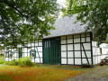
Ternell and its two valleys

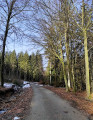
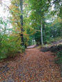
A superb forest walk through the Getzbach and Hill valleys, on either side of the Ternell house.
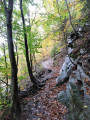
Quite challenging as it features numerous uneven paths, covered with stones and roots.

Details

2568015
Creation:
Last update:
Last review:
  • Walking
    Activity: Walking
  • ↔
    Distance: 4.98 mi
  • ◔
    Average duration: 2h 50 
  • ▲
    Difficulty: Moderate

  • ⚐
    Back to start: Yes
  • ↗
    Ascent: + 630 ft
  • ↘
    Descent: - 653 ft

  • ▲
    Highest point: 1,729 ft
  • ▼
    Lowest point: 1,230 ft

Photos

Description of the walk

The walk starts at the Ternell house, along the N67 (car park on the right-hand side of the road when coming from Eupen).

The walk follows the ‘Green Cross’ trail (in the opposite direction) but the signposting is incomplete.

(S/E) Cross the road at the pedestrian crossing and follow the small road directly opposite, heading north-north-east, perpendicular to the main road.

(1) After about 500m, when the road bends to the right, carry on straight ahead along a path that descends steeply. Further down, cross the road and continue along the steep path. Cross the stream called Getzbach.

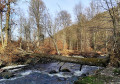
(2) Just after crossing the stream, at a T-junction, turn left. Follow the stream to the next bridge.

(3) Cross the Getzbach again. Follow the path until you reach a tarmac road.

(4) Follow the road to the right for about 1.5 km. Pass two small roads on the right and, after about 150 m, you’ll come to the start of a path on the left.

(5) Take this path on the left. At the junction (marker numbered ‘98’), take thesecond path on the left (south).

(7) Cross the N67 with care, then continue straight ahead along a path which soon turns left and descends steeply. Take in the lovely view of the Hill Valley.

(8) At a fork, take the path that descends to the right (be careful not to miss it). At the bottom, turn left. You’ll soon reach the Hill. Follow the river on your right for about 1.3 km.

(9) After passing a bench on your left and rounding a bend to the right, take thesecond path on the left. Walk uphill for nearly a kilometre, heading east, and ignore a turn-off on the left. You’ll come out onto a road (with a hut) and follow it to the left until you reach the Ternell house (S/E).

Waypoints

  1. S/E : mi 0 - alt. 1,657 ft - Ternell House
  2. 1 : mi 0.35 - alt. 1,719 ft - Start of the trail
  3. 2 : mi 0.7 - alt. 1,447 ft - Getzbach – Bridge
  4. 3 : mi 1.12 - alt. 1,404 ft - Getzbach, second bridge
  5. 4 : mi 1.31 - alt. 1,434 ft - Route
  6. 5 : mi 2.34 - alt. 1,250 ft - The trail starts on the left
  7. 6 : mi 2.56 - alt. 1,388 ft - Crossroads – Marker 98
  8. 7 : mi 2.88 - alt. 1,421 ft - N67 road
  9. 8 : mi 3.11 - alt. 1,378 ft - Junction – Path on the right
  10. 9 : mi 4.24 - alt. 1,407 ft - Junction – Path on the left
  11. S/E : mi 4.98 - alt. 1,657 ft - Ternell House

Notes

Sturdy walking shoes are essential as the paths are very uneven in places.

Access by bus is only available at weekends (route 385 Eupen–Mützenich–Monschau–Kalterherberg).

Worth a visit

This walk starts at the Ternell Nature Centre (https://www.ternell.be/), which features a café, a playground and a museum.

Reviews and comments

4.7 / 5
Based on 2 reviews

Reliability of the description
4.5 / 5
Ease of following the route
5 / 5
Route interest
4.5 / 5
Francine9858
Francine9858

Overall rating : 5 / 5

Date of your route : Feb 13, 2022
Reliability of the description : ★★★★★ Very good
Ease of following the route : ★★★★★ Very good
Route interest : ★★★★★ Very good
Very busy route : No

Luckily, we knew that the beginning wasn't easy... we're not getting any younger... That said, it's a magnificent walk, well marked with superb scenery. The crowds were arriving as we were leaving: it was Sunday at noon, so we imagine it must get busy on nice weekends.

Machine-translated

Schm
Schm

Overall rating : 4.3 / 5

Date of your route : Jul 23, 2020
Reliability of the description : ★★★★☆ Good
Ease of following the route : ★★★★★ Very good
Route interest : ★★★★☆ Good
Very busy route : Yes

Easy route to follow, often very beautiful, pleasant and not too long, ideal for children discovering hiking. Very busy when we visited.

Machine-translated

Other walks in the area

For more walks, use our search engine .

The GPS track and description are the property of this route's author. Please do not copy them without permission.