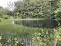
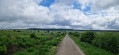
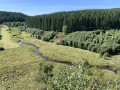
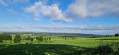
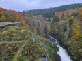
The Kolvenderbach valley from Medendorf

A circular walk through the quiet and peaceful Kolvenderbach valley

Details

11356399
Creation:
Last update:
Last review:
  • Walking
    Activity: Walking
  • ↔
    Distance: 6.07 mi
  • ◔
    Average duration: 3h 20 
  • ▲
    Difficulty: Easy

  • ⚐
    Back to start: Yes
  • ↗
    Ascent: + 650 ft
  • ↘
    Descent: - 646 ft

  • ▲
    Highest point: 1,883 ft
  • ▼
    Lowest point: 1,503 ft

Photos

Description of the walk

Park in Medendorf, at junction point no. 60.

(S/E) Follow the road westwards to reach the junction with Rue Medendorf.

(1) Turn left towards Eimerscheid, then continue on to theGR® junction.

(2) Turn right onto the GR® and head downhill to reach the Kolvenderbach stream. Cross the stream and, after a very gentle climb, you’ll reach Ins Kolvendertal Street, near a wayside cross.

(3) Turn onto the path on the right. Walk alongside a large estate and continue through the valley.
Carry on to your right along the valley. You’ll reach a tarmac road.

(4) Carry on straight ahead along this road, which climbs slightly, to reach the Wendelwasser valley.

(5) Turn right, towards the hunting lodge. You can stop there to take shelter if it rains. A little further on, there is a superb pond. Carry on to the right to reach a path junction.

(6) Take this well-marked path on the right – which resembles a forest track – and follow it to reach the Kolvenderbach valley once again.

(7) Turn slightly to the right and walk some distance alongside the river until you reach the junction with the tarmac road.

(8) Cross the road and continue straight ahead, still keeping to the river’s edge, until you reach a bend at the edge of the woods.

(9) Here, move away from the river to begin a gentle climb through the Renkensreth woods, until you reach the edge of the woods.

(10) Turn left, then take thefirst right to return to the original junction.

(1) Continue along the route in the opposite direction to the way out to reach the centre of Medendorf and arrive at the car park at junction point no. 60 (S/E).

Waypoints

  1. S/E : mi 0 - alt. 1,804 ft - Medendorf car park, junction point no. 60
  2. 1 : mi 0.21 - alt. 1,883 ft - Crossroads at the end of the circular loop
  3. 2 : mi 0.88 - alt. 1,765 ft - GR junction
  4. 3 : mi 1.49 - alt. 1,535 ft - Calvary crossroads
  5. 4 : mi 2.65 - alt. 1,617 ft - Road junction
  6. 5 : mi 3.11 - alt. 1,713 ft - Access to the Wendelwasser Valley
  7. 6 : mi 3.76 - alt. 1,818 ft - Trail junction
  8. 7 : mi 3.99 - alt. 1,690 ft - Kolvenderbach Valley
  9. 8 : mi 4.67 - alt. 1,647 ft - Road junction
  10. 9 : mi 5.07 - alt. 1,624 ft - Bend at the edge of the woods
  11. 10 : mi 5.57 - alt. 1,870 ft - Edge of the woods
  12. S/E : mi 6.07 - alt. 1,808 ft - Medendorf car park, junction point no. 60

Always be cautious and plan ahead when you're outdoors. Visorando and the author of this route cannot be held responsible for any accidents occurring on this route.

The GR® and PR® markings are the intellectual property of the Fédération Française de Randonnée Pédestre.

Reviews and comments

4.7 / 5
Based on 2 reviews

Reliability of the description
5 / 5
Ease of following the route
4.5 / 5
Route interest
4.5 / 5
adriana_manole
adriana_manole

Overall rating : 4.3 / 5

Date of your route : Apr 15, 2022
Reliability of the description : ★★★★★ Very good
Ease of following the route : ★★★★☆ Good
Route interest : ★★★★☆ Good
Very busy route : No

A beautiful route and, above all, very peaceful during the Easter holidays!

Machine-translated

Christian Simons
Christian Simons

Overall rating : 5 / 5

Date of your route : Feb 23, 2022
Reliability of the description : ★★★★★ Very good
Ease of following the route : ★★★★★ Very good
Route interest : ★★★★★ Very good
Very busy route : No

Magnificent woodland and countryside route. Very pretty views and beautiful little valleys with streams. Sightings of wildlife (roe deer). The stop at the hunting lodge was perfect for lunch. I highly recommend it.

Machine-translated

Other walks in the area

For more walks, use our search engine .

The GPS track and description are the property of this route's author. Please do not copy them without permission.