


Refine your search for walks in Brémur-et-Vaurois
Brémur-et-Vaurois walks


 Tour of the Noin at Brémur and Vaurois
 Visorando Member
 3.27 mi
 +341 ft
 -341 ft
 1h 50
1h 50
 Easy
Easy
 Departure from Brémur-et-Vaurois (Côte-d'Or)
Explore the picturesque valleys of the Seine’s first tributaries, the Brévon and the tiny Noin. Stunning waterfalls cascading over the tufa formations!
Around the Brévon valley, starting from Rochefort
6.28 mi
+581 ft
-561 ft
3h 25
 Moderate
Departure from Rochefort-sur-Brévon (Côte-d'Or)
Moderate
Departure from Rochefort-sur-Brévon (Côte-d'Or)
Far from busy roads, this is a small, hilly, shaded route full of running water, where it is not uncommon to see roe deer, does, birds of prey and herons. Discover hidden villages in northern Burgundy.
Gurgy-le-Château and the former Carthusian monastery of Lugny
13.46 mi
+1,673 ft
-1,677 ft
7h 40
 Difficult
Departure from Recey-sur-Ource (Côte-d'Or)
Difficult
Departure from Recey-sur-Ource (Côte-d'Or)
A circular route starting from Recey-sur-Ource that passes through woods and fields, via Gurgy-le-Château, the outskirts of Petit Saint-Broing, and also the former Chartreuse de Lugny. A hike requiring a good sense of direction as well as keen observation when you need to follow, for short stretches, a route not marked on the IGN map and when you need to cross six fords at the best possible spot, depending on the water level at the time of year.
Route from the Douix Cave to Darcey
 1.49 mi
+203 ft
-226 ft
0h 50
Easy
Departure from Darcey (Côte-d'Or)
1.49 mi
+203 ft
-226 ft
0h 50
Easy
Departure from Darcey (Côte-d'Or)
This route has been redeveloped and made safer. It allows you to bypass the Douix river and walk through a pleasant boxwood forest before reaching the village of Darcey and then the cave. It is not listed on IGN maps, which is why I used the Visorando app to track my route and highlight it.
From Flavigny to the Château de Bussy-Rabutin
 13.63 mi
+2,060 ft
-2,090 ft
8h 05
Difficult
Departure from Flavigny-sur-Ozerain (Côte-d'Or)
13.63 mi
+2,060 ft
-2,090 ft
8h 05
Difficult
Departure from Flavigny-sur-Ozerain (Côte-d'Or)
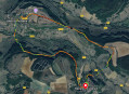
From the village of Flavigny-sur-Ozerain, a magnificent medieval village, head for a picnic at the Château de Bussy-Rabutin, which you will enjoy visiting. Then return via Alise-Sainte-Reine, a key site of the Gallic Wars, and pay a visit to Vercingétorix.
From one valley to another, starting from Flavigny-sur-Ozerain
14.96 mi
+1,526 ft
-1,526 ft
8h 15
Difficult
Departure from Flavigny-sur-Ozerain (Côte-d'Or)
A circular route starting from the medieval town of Flavigny-sur-Ozerain, allowing you to explore, in part, the valleys of the Ozerain and the Oze and discover some of the restored historic buildings there. Make sure to set aside some time to wander around Flavigny and soak up its rich and varied cultural heritage.
Salives, medieval town
 7.39 mi
+840 ft
-853 ft
4h 10
Moderate
Departure from Salives (Côte-d'Or)
7.39 mi
+840 ft
-853 ft
4h 10
Moderate
Departure from Salives (Côte-d'Or)
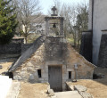
Salives, a must-see medieval village in Côte d'Or: its ramparts, its keep, the heraldic route recounting the medieval life of the village, and its wash house with the main source of the Tille river under the church. This route also takes in Barjon Castle and Saint-Frodulphe Chapel. A little further on, there is a mill with a water wheel that is still in working order. Also worth seeing in Le Meix are the wash house beneath the town hall and the château.
The terrain south of Lamargelle
 5.95 mi
+709 ft
-722 ft
3h 20
Easy
Departure from Lamargelle (Côte-d'Or)
5.95 mi
+709 ft
-722 ft
3h 20
Easy
Departure from Lamargelle (Côte-d'Or)
A circular route around Lamargelle, to discover this beautiful village on the banks of the Ignon, the Combe Saint-Seine and the sweeping landscapes of this secluded valley. This route showcases the village, set in the beautiful valley of the Ignon with its mills, wash houses and castle. It also takes you through the valleys linked to the golden legend of Saint-Seine, who founded the abbey of the same name, and whose abbots owned Lamargelle Castle.
On the edge of southern Champagne, Molesme in Burgundy
 5.74 mi
+361 ft
-390 ft
2h 55
Easy
Departure from Molesme (Côte-d'Or)
5.74 mi
+361 ft
-390 ft
2h 55
Easy
Departure from Molesme (Côte-d'Or)
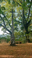
The walk starts in the small village of Molesme, situated in the north of the Côte-d’Or, in the valley of the Laigne – a tributary of the Seine – in a region straddling Burgundy and Champagne. Life in this village was strongly influenced by the monastic life of the abbey, which over the centuries experienced the consequences of the Hundred Years’ War, the Wars of Religion and the Revolution… The abbey is open to the public during the summer months by appointment. A leisurely walk allows you to explore and visit the ruins of the Oppidum of Vertillum, which was a major city in Roman times.
The sources of the Seine and their surroundings
 7.48 mi
+686 ft
-702 ft
4h 00
Moderate
Departure from Source-Seine (Côte-d'Or)
7.48 mi
+686 ft
-702 ft
4h 00
Moderate
Departure from Source-Seine (Côte-d'Or)
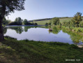
A bucolic stroll to the sources of the Seine, passing by a pond designed by a contemporary Swiss artist and the ruins of a former 12th-century hermitage.
Sources of the Seine and the Ignon
 8.51 mi
+630 ft
-653 ft
4h 30
Moderate
Departure from Poncey-sur-l'Ignon (Côte-d'Or)
8.51 mi
+630 ft
-653 ft
4h 30
Moderate
Departure from Poncey-sur-l'Ignon (Côte-d'Or)
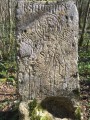
A lovely hike in the Alésia region that will take you from spring to spring.
Moderator's note , the source of the Ignon, is inaccessible; see reviews.
Through vineyards and cadoles, starting from Les Riceys
4.08 mi
+203 ft
-200 ft
2h 05
Easy
Departure from Les Riceys (Aube)
A walk through one of the most beautiful landscapes in Champagne, listed as a UNESCO World Heritage Site. Vineyards, woodland paths and cadoles.
Provisional route pending the opening of the official Cadoles de la Côte des Bar trail.
Cadoles, vineyards and forests of Les Riceys
 6.12 mi
+509 ft
-492 ft
3h 15
Moderate
Departure from Les Riceys (Aube)
6.12 mi
+509 ft
-492 ft
3h 15
Moderate
Departure from Les Riceys (Aube)
Discover some of the many Champenois cadoles, as well as the vineyards and forests of Les Riceys.
Circular route in the Moloy National Forest starting from L'Abergement.
 6.49 mi
+643 ft
-656 ft
3h 35
Moderate
Departure from Moloy (Côte-d'Or)
6.49 mi
+643 ft
-656 ft
3h 35
Moderate
Departure from Moloy (Côte-d'Or)
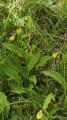
Walk in the Moloy National Forest. This walk will take you along the Bellefontaine Forest Road, past the summits and through numerous valleys. The Combe de Bellefontaine is home to a site famous for its wild orchids, the Lady’s Slipper orchids.
"Legend has it that, pursued by a satyr, Venus lost her clogs in the forest whilst running to escape him. Ever since that day, lady’s slippers have sprung up every spring."André Beuchot
Le tour des fermes au départ de Ricey Haut
 7.90 mi
+528 ft
-528 ft
4h 00
Moderate
Departure from Les Riceys (Aube)
7.90 mi
+528 ft
-528 ft
4h 00
Moderate
Departure from Les Riceys (Aube)
Une belle balade familiale à partir des Riceys, commune viticole au Sud de la Champagne dans la côte des Bars, à la croisée des chemins avec la Bourgogne toute proche. Cette commune est composée des trois villages, Ricey Bas, Haute Rive et Ricey Haut. La commune bénéficie de trois appellations et bénéficie du plus grand terroir classé champagne.
Cadoles and vineyards of Courteron along the ridge path
 6.91 mi
+495 ft
-479 ft
3h 35
Moderate
Departure from Courteron (Aube)
6.91 mi
+495 ft
-479 ft
3h 35
Moderate
Departure from Courteron (Aube)
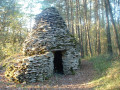
Discover the cadoles of Courteron, as well as the magnificent vineyard landscape from the ridge path.
Setting off from the church in Ricey Bas, a stroll through the vineyards
 4.64 mi
+407 ft
-404 ft
2h 30
Easy
Departure from Les Riceys (Aube)
4.64 mi
+407 ft
-404 ft
2h 30
Easy
Departure from Les Riceys (Aube)
The Riceys vineyards cover the largest area of any in the whole of Champagne. They boast three appellations d’origine contrôlée.
Located in the Côte des Bars, the vineyards are easily accessible to walkers, with access often made easier by roads maintained for vineyard operations.
Forests and vineyards above Ricey Bas and Balnot
 12.85 mi
+1,096 ft
-1,089 ft
6h 50
Difficult
Departure from Les Riceys (Aube)
12.85 mi
+1,096 ft
-1,089 ft
6h 50
Difficult
Departure from Les Riceys (Aube)
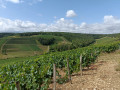
This circular walk takes us into the vineyard area of Les Riceys and Balnot-sur-Laignes. Leaving the vineyards behind, the return journey follows the course of the Laignes river and takes the route of the old "tacot" railway line which, from 1901, linked Les Riceys-Polisot to Cunfin.
Lac de Pont trail
 8.06 mi
+125 ft
-128 ft
3h 50
Moderate
Departure from Pont-et-Massène (Côte-d'Or)
8.06 mi
+125 ft
-128 ft
3h 50
Moderate
Departure from Pont-et-Massène (Côte-d'Or)
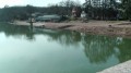
This trail leads around the Lac de Pont artificial reservoir. This dam was built in 1882 and brought up to standard at the end of 2018. Car park, camping, restaurant, beach and leisure facilities are all available. A footbridge and staircase provide access to the dam and the right bank path. Other modifications underway following the 2018 drought. This October 11, 2018: diving board and beach have been demolished and will be rebuilt. A floating footbridge is planned to serve the activity zones.
Route of birdwatching from Villeneuve-sous-Charigny
 5.34 mi
+240 ft
-256 ft
2h 40
Easy
Departure from Villeneuve-sous-Charigny (Côte-d'Or)
5.34 mi
+240 ft
-256 ft
2h 40
Easy
Departure from Villeneuve-sous-Charigny (Côte-d'Or)
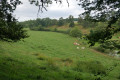
A pleasant walk offering a variety of landscapes: farmland, woodland, the lake and villages.
Along the route, there are signs showing the birds you might spot
Medieval site of Bois de Cestres
12.41 mi
+833 ft
-823 ft
6h 25
Moderate
Departure from Saint-Martin-du-Mont (Côte-d'Or) (Côte-d'Or)
This route takes in the small Côte d'Orienne commune of Saint-Martin-du-Mont, the natural site of the Ru Blanc and the remains of a medieval village dating back to the 14th century.
Around Curtil-Saint-Seine
 10.31 mi
+1,729 ft
-1,729 ft
6h 15
Moderate
Departure from Francheville (Côte-d'Or)
10.31 mi
+1,729 ft
-1,729 ft
6h 15
Moderate
Departure from Francheville (Côte-d'Or)
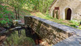
A lovely walk from the entrance to the Gouffre de la Combe aux Prêtres, passing through the small village of Curtil-Saint-Seine and overlooking the Val Suzon valley.
The tower, the valleys and the forests at Saussy
6.17 mi
+479 ft
-472 ft
3h 15
Easy
Departure from Saussy (Côte-d'Or)
A short and easy hike to discover the valleys around Saussy, including the very wild Combe Quinquendolle, a nature reserve. This hike only uses public paths and forests!
Hydraulic structures and sinkholes around Curtil-Saint-Seine
11.82 mi
+1,355 ft
-1,355 ft
6h 35
Moderate
Departure from Curtil-Saint-Seine (Côte-d'Or)
A testament to man’s ingenuity in constructing hydraulic works and his propensity to explore the depths.
More walks in Brémur-et-Vaurois
Select a point of interest below: