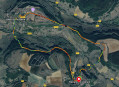
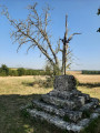
Around Fontenay Abbey

A walk around Fontenay Abbey, founded in 1118 and a UNESCO World Heritage Site. It is situated in the heart of a magnificent forest of oak and beech trees, offering a cool, peaceful setting.

Details

n°37854963
Creation:
Last update:
Last review:
  • Walking
    Activity: Walking
  • ↔
    Distance: 10.80 mi
  • ◔
    Average duration: 5h 55 
  • ▲
    Difficulty: Moderate

  • ⚐
    Back to start: Yes
  • ↗
    Ascent: + 1,050 ft
  • ↘
    Descent: - 1,033 ft

  • ▲
    Highest point: 1,227 ft
  • ▼
    Lowest point: 761 ft

Photos

Description of the walk

Park in the car park in front of or near Fontenay Abbey.

(S/E) Opposite the abbey entrance, take the path on the left marked in pink (GR®213). It runs alongside a stream under the trees. You’ll reach a fork at elevation 235.

(1) Take the path on the right, following the sign for Fontenay via Vieilles Mines, and continue to another fork.

(2) Turn right, following the pink markings along the widest path for about 400 m, until you reach a cross path.

(3) Continue left along the widest, straight path until you reach another wide path. Turn sharply right, following the pink markings, and come to a path running perpendicular to it.

(4) Turn right, following the pink markings, until you reach a junction.

(5) Turn left, heading due south, onto the path which climbs slightly for 100 m.

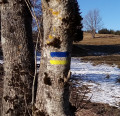
(6) Turn left again (pink markings on a tree) until you reach a fork in the path.

(7) Follow the path straight on until you reach a wider path.

(8) Take the white path on the left towards Petit Jailly. You’ll reach a fork after passing a pond on your right.

(9) Take the middle path, still heading towards Petit Jailly. Pass through Petit Jailly, leave the hamlet via the Chemin de Crevant and reach an X-junction.

(10) Continue to the right along the white track until you reach the edge of the forest.

(11) Turn left towards Touillon. Pass the sports grounds – football and tennis – and reach a road.

(12) Follow it carefully to the left towards Touillon until you reach the junction.

(13) Turn right onto the D32a towards Touillon and head for the village centre.

(14) In the square, leave the town hall on your right and take the path opposite leading to the little washhouse, between the houses. As you pass, admire the pretty, well-restored washhouse. A little further on, you’ll pass a dovecote built over the stream. You’ll arrive at a picnic area.

(15) Cross a wooden bridge, then a stone bridge. Turn right and walk alongside the stream. You’ll reach a road; follow it to the right for 100 metres, crossing the Ruisseau de Fontenay.

(16) Head uphill to the left, towards Fontenay Abbey. Follow the pink markings. You’ll reach another road; follow it to the left and return to the car park near the abbey (S/E).

Waypoints

  1. S/E : mi 0 - alt. 771 ft - Fontenay Abbey
  2. 1 : mi 0.78 - alt. 764 ft - Junction. Old mines
  3. 2 : mi 1.33 - alt. 988 ft - Junction
  4. 3 : mi 1.52 - alt. 1,014 ft - Junction
  5. 4 : mi 2.48 - alt. 1,096 ft - T-junction. Marked ‘Rose’
  6. 5 : mi 3.01 - alt. 892 ft - Junction. Path leading uphill
  7. 6 : mi 3.07 - alt. 922 ft - Junction. Pink marker on a tree
  8. 7 : mi 3.37 - alt. 915 ft - Junction. Go straight on
  9. 8 : mi 3.53 - alt. 814 ft - Junction. Head towards Le Petit Jailly
  10. 9 : mi 3.88 - alt. 843 ft - St-Bernard Pond
  11. 10 : mi 5.67 - alt. 1,138 ft - Le Petit Jailly
  12. 11 : mi 6.02 - alt. 1,152 ft - Junction. Towards Touillon
  13. 12 : mi 6.88 - alt. 1,184 ft - Junction. Road
  14. 13 : mi 7.12 - alt. 1,165 ft - Turn right towards Fontenay Abbey
  15. 14 : mi 7.62 - alt. 1,070 ft - Touillon. Chemin du petit lavoir
  16. 15 : mi 7.9 - alt. 853 ft - Stone bridge
  17. 16 : mi 9.37 - alt. 791 ft - Junction
  18. S/E : mi 10.79 - alt. 771 ft - Fontenay Abbey

Notes

Please note: this route should be avoided during the hunting season, which generally runs from mid-September to the end of February. Check with the departmental hunting federation.
Picnics are possible on the second part of the walk, after the village of Touillon.
Free toilets are available on the right-hand side, opposite the abbey.

Worth a visit

Things to do: visit the Abbey.
In Touillon: see the beautifully restored wash house.

Always be cautious and plan ahead when you're outdoors. Visorando and the author of this route cannot be held responsible for any accidents occurring on this route.

The GR® and PR® markings are the intellectual property of the Fédération Française de Randonnée Pédestre.

Reviews and comments

5 / 5
Based on 1 review

Reliability of the description
5 / 5
Ease of following the route
5 / 5
Route interest
5 / 5
Cyril Drion
Cyril Drion

Overall rating : 5 / 5

Date of your route : Apr 26, 2025
Reliability of the description : ★★★★★ Very good
Ease of following the route : ★★★★★ Very good
Route interest : ★★★★★ Very good
Very busy route : No

A very good hike around a UNESCO World Heritage Site!

Machine-translated

Netra
Netra ★

Hello Al1C21, and thank you for pointing that out!

Estimates of altitude, and therefore elevation gain, can be subject to error... On the website, we have a function for calculating altitudes using a grid of points with known (rather than estimated) altitudes. I have just activated this function and the elevation gain shown is now 309 m, which seems much more realistic for a route in that area.

Machine-translated

Al1C21
Al1C21

Hello,
This route looks very interesting, but the description mentions an elevation gain of nearly 800 metres!
I think the actual figure is more likely to be around 350 to 400 metres.
Kind regards.

Machine-translated

Other walks in the area

For more walks, use our search engine .

The GPS track and description are the property of this route's author. Please do not copy them without permission.