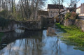
Tour of the Noin at Brémur and Vaurois

Explore the picturesque valleys of the Seine’s first tributaries, the Brévon and the tiny Noin. Stunning waterfalls cascading over the tufa formations!

Details

61843475
Creation:
Last update:
Last review:
  • Walking
    Activity: Walking
  • ↔
    Distance: 3.27 mi
  • ◔
    Average duration: 1h 50 
  • ▲
    Difficulty: Easy

  • ⚐
    Back to start: Yes
  • ↗
    Ascent: + 341 ft
  • ↘
    Descent: - 341 ft

  • ▲
    Highest point: 1,168 ft
  • ▼
    Lowest point: 856 ft

Description of the walk

Car park on the lay-by opposite the bridge over the Seine, at the bottom of Brémur and Vaurois.

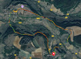
(S/E) Head down the RD 101 towards the north-east along the river and continue until just before the new small bridge marking the confluence with the Brévon.

(1) Turn right onto the yellow-marked path, “Sentiers des Châteaux”. This path initially offers a few views of the Brévon before heading into the forest. Walk on virtually level ground until you reach the first junction with the Noin, a tributary of the Brévon and a sub-tributary of the Seine.

(2) Ford the stream, which widens slightly here; make sure you’re wearing waterproof shoes or boots. Continue straight ahead along the path and note the buildings of the Chouette fish farm on your left. Shortly afterwards, begin climbing through the woods on the path branching off to the right. At the first junction, turn sharply right onto the correct path which crosses the woods. Follow it until you reach a junction with a footpath on the right, marked by standing stones.

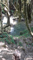
(3) Follow this path for about 100 metres to descend to the bed of the Noin. Admire the small waterfalls where the stream cascades over the tufa – these are the lower waterfalls. Retrace your steps to the starting point of the main path.

(3) Then follow it to the right. Reach the next junction, signposted ‘Fontaine Saint Martin’. Turn right onto the Sentier des Châteaux, which very quickly rejoins the Noin.

(4) Head down towards the stream to admire some more waterfalls – the upstream ones. Cross the river and turn right onto the signposted path at the next junction. Head back up onto the plateau via a dirt track, which becomes stony a little further up. You’ll reach the junction with theGR®2.

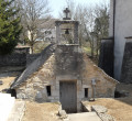
(5) Follow the red and white markings to the right, towards Brémur and Vaurois. Continue on to the village and admire the hilltop citadel; then, after the crossroads, look out for the wash house on the left, which is still in working order and built into the cliff face.

(6) Return to the crossroads and head down to the left towards Rocheprise Castle and its dovecote. Continue along Rue du Château (D101G), and return to the starting point overlooking the Seine valley (S/E).

Waypoints

  1. S/E : mi 0 - alt. 863 ft - Bridge over the Seine at Brémur - Seine [la]
  2. 1 : mi 0.2 - alt. 856 ft - Junction with the Châteaux trail - Brévon (cours d'eau) - Affluent de la Seine
  3. 2 : mi 0.73 - alt. 873 ft - The ford on the - Ruisseau du Noin (cours d'eau) - Affluent du Brévon
  4. 3 : mi 1.56 - alt. 1,030 ft - Croisemement – Waterfalls downstream on the River Noin
  5. 4 : mi 1.86 - alt. 1,037 ft - Upper waterfalls on the River Noin
  6. 5 : mi 2.31 - alt. 1,161 ft - Junction with the GR 2
  7. 6 : mi 2.87 - alt. 1,017 ft - The cliffside wash house
  8. S/E : mi 3.27 - alt. 863 ft - Bridge over the Seine at Brémur

Notes

No drinking water along the way.
Make sure you have wellington boots or waterproof shoes for crossing the Noin ford (not difficult).
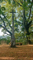
A pleasant walk in summer, as most of the route is shaded.

Worth a visit

The picturesque villages of Brémur, Vaurois and Rochefort in the Brévon valley.
The town of Châtillon-sur-Seine.
The Forêts National Park.

Always be cautious and plan ahead when you're outdoors. Visorando and the author of this route cannot be held responsible for any accidents occurring on this route.

The GR® and PR® markings are the intellectual property of the Fédération Française de Randonnée Pédestre.

Reviews and comments

3.8 / 5
Based on 3 reviews

Reliability of the description
3.7 / 5
Ease of following the route
3.3 / 5
Route interest
4.3 / 5
User 25291184

Overall rating : 3 / 5

Date of your route : Feb 09, 2026
Reliability of the description : ★★☆☆☆ Disappointing
Ease of following the route : ★★☆☆☆ Disappointing
Route interest : ★★★★★ Very good
Very busy route : No

Hello,
I'm not very good at finding my way around and couldn't find the path at the end of Number 2. (Take the right path?)
I had a GPS that helped me find my way by following the Noin.
As a result, I missed the entire second half of the walk.
It was very pretty, though.

Machine-translated

User 27105752

Overall rating : 4.3 / 5

Date of your route : Aug 11, 2025
Reliability of the description : ★★★★★ Very good
Ease of following the route : ★★★★☆ Good
Route interest : ★★★★☆ Good
Very busy route : No

Machine-translated

Liseclem
Liseclem
• Edited:

Overall rating : 4 / 5

Date of your route : May 31, 2025
Reliability of the description : ★★★★☆ Good
Ease of following the route : ★★★★☆ Good
Route interest : ★★★★☆ Good
Very busy route : No

Hello, A lovely route, just the right length, and very peaceful. Part of the route was a bit difficult to follow as earth-moving machinery had been working there. The path wasn’t very clear, but Visio Rando was a great help with its GPS tracking. The viewpoint over the tufa waterfalls (point 3) is overgrown; we couldn’t get anywhere near it. The section alongside the fish farm and the final stretch are interesting; the rest is a lovely, peaceful walk through a beautiful forest. Note: you can swim in the Seine not far from the starting point, which makes for a pleasant way to round off the walk.

Machine-translated

Other walks in the area

For more walks, use our search engine .

The GPS track and description are the property of this route's author. Please do not copy them without permission.