Around Le Puiset

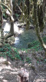
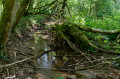
On the Langres plateau, in the far north of Burgundy, far from any major roads, lies a landscape of fields and forests where it is not uncommon to encounter does, foxes and wild boar. The final few kilometres follow a babbling brook, passing through two villages and a hamlet that seem to have been forgotten by the rest of the world; only the wind and the birds keep us company, and what a magnificent palette of colours in autumn.

Details

n°12650
Creation:
Last update:
Last review:
  • Walking
    Activity: Walking
  • ↔
    Distance: 4.94 mi
  • ◔
    Average duration: 2h 30 
  • ▲
    Difficulty: Easy

  • ⚐
    Back to start: Yes
  • ↗
    Ascent: + 312 ft
  • ↘
    Descent: - 312 ft

  • ▲
    Highest point: 1,312 ft
  • ▼
    Lowest point: 997 ft

Description of the walk

Set off from the town hall in Rochefort-sur-Brévon.

(S/E) Opposite the town hall, turn left round the building onto a very steep little road (Rue du Pigeonnier).

At the first junction, turn left and continue uphill. Once you reach the road, follow it to the left for just over 100 metres.

(1) Turn right. On the plateau, the road turns into a track; follow it without straying from the path and you’ll reach the hamlet of Le Puiset, which you pass through. Carry on straight ahead along a small tarmac road.
At the first junction, turn left and follow the track for about 100 metres.

(2) Take the track on the right which leads above the village of Beaulieu. Admire the panoramic view with the village below. Once you reach the road overlooking the village, turn right onto the D112b, then immediately left to rejoin the road.

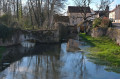
(3) Head right for a few metres, then turn left onto the D16. Follow it for just over two kilometres, skirting the Brévon, a stream running alongside the small road at the bottom of the valley. Return to the village of Rochefort-sur-Brévon (S/E).

Waypoints

  1. S/E : mi 0 - alt. 1,001 ft - Rochefort-sur-Brévon Town Hall
  2. 1 : mi 0.41 - alt. 1,250 ft - Turn right onto the path
  3. 2 : mi 1.91 - alt. 1,283 ft - To the right
  4. 3 : mi 3.18 - alt. 1,043 ft - Turn right onto the D16
  5. S/E : mi 4.94 - alt. 1,001 ft - Rochefort-sur-Brévon Town Hall

Notes

A bottle of water, good walking shoes and a raincoat just in case! It’s a short walk suitable for beginners or for the whole family.

Worth a visit

There’s a beautiful castle at the start, though it’s not open to visitors; the charm lies entirely in the magnificent landscape, which is rarely visited by tourists.

Reviews and comments

4.2 / 5
Based on 2 reviews

Reliability of the description
4.5 / 5
Ease of following the route
4.5 / 5
Route interest
3.5 / 5
Danic
Danic

Overall rating : 4 / 5

Date of your route : May 21, 2018
Reliability of the description : ★★★★☆ Good
Ease of following the route : ★★★★☆ Good
Route interest : ★★★★☆ Good

Sorry, my comment was about the “Around the Brévon Valley” walk, not “Around the Puiset”. However, this does not alter my opinion of the entire first section, which is common to both routes.

Machine-translated

jean.jacques
jean.jacques

Overall rating : 4.3 / 5

Date of your route : Mar 10, 2014
Reliability of the description : ★★★★★ Very good
Ease of following the route : ★★★★★ Very good
Route interest : ★★★☆☆ Average

A lovely, pleasant walk

Machine-translated

Other walks in the area

For more walks, use our search engine .

The GPS track and description are the property of this route's author. Please do not copy them without permission.