


 Country:
 City:
City:


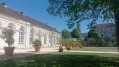
The walk starts at the Place de la Mairie or the Place de l’Église Sainte-Croix, where parking is easy.
(S/E) With your back to the church, take Rue de Villedieu, then Rue Saint Robert as far as the Croix Saint-Cyr.
(1) Turn right onto a path running alongside the woodland and head towards the village of Villedieu.
(2) Cross the D953 (Molesme – Laignes) with care, follow the D102j, pass under the church and then, further on, over the bridge across the Laigne.
(3) Leave the departmental road and turn left towards the cemetery and the church at Vertault. You’ll arrive at the crossroads opposite the town hall.
(4) Turn right and, after about 350 m, take the road on the left which climbs up to the site of the Gallo-Roman ruins of Vertillum. The site is clearly signposted (car park) and provides information on the excavations and the remains of the ancient town that are still visible.
(5) With your back to the car park, retrace your steps and then take the well-marked path through the woods on your left. This path, high above Vertault, takes you on a round trip to discover the clearly marked and well-documented remains of the ancient town.
After your visit, return to the path and continue until you reach the road leading to Béchineuil (D102).
(6) Turn left and walk carefully alongside the road, then cross the hamlet. Continue until you reach the left-hand bend.
(7) At the bend, leave the road and turn right onto a track which curves gently to the left along the edge of the woodland, then turns left, heading due north, until it meets a small road.
(8) Ignore the road leading to the Magny farm on the right, and carry on to the left, then straight ahead to join the D161.
(9) Turn right onto the road leading to Molesme. The local council has planted numerous fruit trees along the side of this road. Cross the bridge over the Laigne.
(10) Just after that, look out for a small pond with a fountain on your right. Take the path on the right that follows the banks of the pond and emerge past some vegetable gardens. Carry on to the D953, which runs through the village. Follow it to the right until you reach a Fork in the road.
(11) Turn left up Rue de l’Abbaye towards the abbey and the church, and you’ll come back to your car park (S/E).
 Visorando Member
 Moderate

 Difficult
 Tourist office
