The Furmeyer botanical trail and the Fays circular route

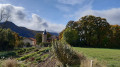
A lovely botanical route through varied habitats, starting with Mediterranean vegetation in the lower section and moving to alpine vegetation on the north-facing slopes of Le Faï. The numerous information boards highlight the area’s heritage but, above all, the plants, making the route suitable for walking in spring as well as in summer or autumn. However, May and June are the best months if you wish to see the flowers.
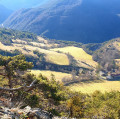
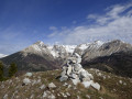
Not to mention the beautiful views over the Veynois and the Dévoluy.

Details

16855819
Creation:
Last update:
Last review:
  • Walking
    Activity: Walking
  • ↔
    Distance: 2.71 mi
  • ◔
    Average duration: 1h 50 
  • ▲
    Difficulty: Moderate

  • ⚐
    Back to start: Yes
  • ↗
    Ascent: + 696 ft
  • ↘
    Descent: - 696 ft

  • ▲
    Highest point: 3,911 ft
  • ▼
    Lowest point: 3,284 ft

Photos

Description of the walk

Park in the Furmeyer car park.

(S/E) Head towards the village centre. Walk past the village fountain and take the road on the left for a few metres, then a DFCI track on the right. Walk uphill through the cultivated fields. Continue to the end of the track.

(1) Turn left at the hairpin bend to continue along a forest track. After two hairpin bends, you’ll reach a four-way junction.

(2) Continue straight ahead along the track towards the Col du Faï.
At the water catchment point, continue uphill along a shaded path. Then leave this path and take a small track that descends along the hillside to the left. You will then reach the Col du Faï.

(3) Here, you can take a detour to the left along a lovely flat path to the Garcine mine through a beech and fir forest; on the way back, continue to the right downhill towards Furmeyer – this is the route shown on the map – to quickly reach the Châteluce crossroads.

(4) Leave this path on your right, carry on and make a wide circular route to the left to reach the junction with the D320, the Furmeyer road.

(5) Turn left onto this road and head for Furmeyer cemetery. Turn left to return to the Furmeyer car park (S/E).

Waypoints

  1. S/E : mi 0 - alt. 3,356 ft - Furmeyer car park - Chapelle de Furmeyer
  2. 1 : mi 0.43 - alt. 3,478 ft - End of the trail
  3. 2 : mi 0.87 - alt. 3,720 ft - Four-way junction
  4. 3 : mi 1.43 - alt. 3,898 ft - Round trip possible to the Garcine mine - Col du Faï (1186m)
  5. 4 : mi 1.86 - alt. 3,579 ft - Junction towards Châteluce
  6. 5 : mi 2.38 - alt. 3,287 ft - D320
  7. S/E : mi 2.71 - alt. 3,356 ft - Furmeyer car park - Chapelle de Furmeyer

Notes

Access by road: on the D 994 between Montmaur and Veynes, take the D 320 towards Furmeyer. Pass through the hamlet of Les Paroirs, turn left just after the bridge over the Buëch and continue uphill to the village centre, where you will find the car park.
There are information boards throughout the trail, all in excellent condition. The nature trail is easy and largely shaded.

Worth a visit

(S/E) If the church is open, you’ll discover some little gems inside. Don’t miss the little chapel in Furmeyer either; see here.
(3) Garcine Quarry: panoramic view over Furmeyer and the Veynois region. There is a bench on a rocky outcrop.

Reviews and comments

4.7 / 5
Based on 3 reviews

Reliability of the description
4.7 / 5
Ease of following the route
4.7 / 5
Route interest
4.7 / 5
jeannotbi
jeannotbi

Overall rating : 5 / 5

Date of your route : Nov 06, 2025
Reliability of the description : ★★★★★ Very good
Ease of following the route : ★★★★★ Very good
Route interest : ★★★★★ Very good
Very busy route : No

Hike taken at the end of October with flamboyant autumn colours. Easy path except perhaps after the pass, as you walk on a carpet of dead leaves, which is beautiful but can be slippery on the way down. I confirm that you should visit the Garcine mine site. In 10 minutes, you will discover an extraordinary view of the surrounding area and a beautifully landscaped legendary site (with a bench to admire the landscape and read information sheets about the mysterious Garcine mine).

Machine-translated

User 18404091

Overall rating : 5 / 5

Date of your route : Jul 28, 2025
Reliability of the description : ★★★★★ Very good
Ease of following the route : ★★★★★ Very good
Route interest : ★★★★★ Very good
Very busy route : No

Superb hike. About halfway along, I recommend visiting the Garcine mine, which offers incredible views.
I did this hike with my two children, aged 11 and 15, who loved it

Machine-translated

Piolit
Piolit

Overall rating : 4 / 5

Date of your route : Nov 04, 2024
Reliability of the description : ★★★★☆ Good
Ease of following the route : ★★★★☆ Good
Route interest : ★★★★☆ Good
Very busy route : No

For the descent, it’s best to wear proper footwear. I’m thinking specifically of a family walk.

Machine-translated

Other walks in the area

For more walks, use our search engine .

The GPS track and description are the property of this route's author. Please do not copy them without permission.