Circular Route of the Palus from Ordonnac

Offering a chance to explore a wetland area in the Médoc, featuring the Chenal de la Maréchale and the marshes, this route also allows you to discover some beautiful architectural heritage, such as the church at Ordonnac, the old gate to the vicarage, historic windmills, and Château Coufran.

Details

3536225
Creation:
Last update:
Last review:
  • Walking
    Activity: Walking
  • ↔
    Distance: 8.57 mi
  • ◔
    Average duration: 4h 00 
  • ▲
    Difficulty: Moderate

  • ⚐
    Back to start: Yes
  • ↗
    Ascent: + 33 ft
  • ↘
    Descent: - 33 ft

  • ▲
    Highest point: 66 ft
  • ▼
    Lowest point: 3 ft
  • ⚐ Country: France
  • ⚐
    Area: Médoc
  • ⚐ City: Ordonnac (33340)
  • ⚑
    Start/End: N 45.307262° / W 0.836921°
  • ❏
    IGN map(s): Ref. 1433SB, 1434SB
  • Hour-by-hour weather

Photos

Description of the walk

The car park is located on Place du Général de Gaulle, to the west of the town hall and Saint-Romain Church.

(S/E) Head east, passing in front of the town hall and the church. Turn right onto Rue du Centre. At the crossroads (cross), turn left onto Route de l’Abbaye. Shortly afterwards, at a Fork in the road, keep right onto Route de l’Abbaye. Stay on this tarmac road until you reach a junction at the top of a small hill (calvary).

(1) Then turn right. Go round the hill of the Abbaye de l’Ile on the right, then turn right to join a road.

(2) Turn left and follow the Chenal de la Maréchale towards the estuary. Join the Route de Cadourne (D2) and follow it as it continues. Cross the Chenal de la Maréchale.

(3) Leave the D2 immediately by turning left onto the D2E10 towards Port de la Maréchale. Just before house no. 18, take a path on the right (yellow markings).

(4) After about 300 m, turn left onto a path that leads downhill. At the T-junction, turn right. Ignore the paths branching off to the left and continue along a wide path.

(5) You’ll come out onto the D2; follow it to the left and walk past the Saint-Martin Chapel. Ignore a path branching off to the left.

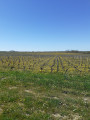
(6) Immediately afterwards, turn right onto the road leading to the Château de Coufran and Château de Soudars. At the Fork in the road that appears straight away, keep left. Ignore the turn-offs to the left and pass between two buildings. Turn left immediately and follow a path heading south. Cross a small wood, then continue south between woods and vineyards.

(7) At a place called Jeandeys, follow a road to the right. After about a hundred metres, take a path on the right. At a junction of five paths, take thesecond path on the left and follow an intermittent stream.

(8) At the T-junction, turn right. Walk between the woods and the vineyards.

(9) At the T-junction, turn left and walk alongside the grounds of Château Grand Moulin. At the triangular junction, keep right towards Troupian.

(10) Take a path on the right, passing two buildings on your right. Turn left with the path and walk between two vineyard plots. At the corner of the plot on the right, turn right. After the vineyard plot, continue straight on, passing a copse and walking alongside a vineyard on your left. At the corner of the vineyard, turn left. At the next corner, turn left again.

(11) After about a hundred metres, turn sharply right behind a hedge. Turn left immediately and walk alongside a vineyard on your left. At the T-junction, take the path on the right and walk alongside a vineyard until you reach the next junction.

(12) Then turn left. Ignore a path branching off to the left and head west-south-west. At a junction (marker 4), turn right.

(13) At the T-junction, turn right and follow the Chenal de la Maréchale. At the next T-junction, turn left. You’ll come out onto a small road; follow it straight on (due west).

(14) At the end, turn right onto the Route de Lussan. After about thirty metres, take a path on the left. Take thefirst path on the right. Ignore a path on the left and you’ll come to a T-junction. Turn right here. At the end of the path, turn right and you’ll immediately reach the Place du Général de Gaulle (S/E).


Waypoints

  1. S/E : mi 0 - alt. 36 ft - Place du Général de Gaulle - Église Saint-Romain (Ordonnac)
  2. 1 : mi 0.7 - alt. 46 ft - Crossroads – Calvaire
  3. 2 : mi 1.29 - alt. 7 ft - Chenal de la Maréchale
  4. 3 : mi 2.81 - alt. 13 ft - Junction with the Route de Cadourne (D2)
  5. 4 : mi 3.19 - alt. 36 ft - Crossroads amongst the vineyards - Estuaire de la Gironde
  6. 5 : mi 3.55 - alt. 66 ft - D2 road - Chapelle Saint-Martin (Ordonnac)
  7. 6 : mi 3.76 - alt. 59 ft - Route of the Coufran and Soudars Castles
  8. 7 : mi 4.52 - alt. 13 ft - Jeandeys
  9. 8 : mi 5.07 - alt. 10 ft - T-junction
  10. 9 : mi 5.63 - alt. 10 ft - T-junction - Château Grand Moulin
  11. 10 : mi 6.02 - alt. 30 ft - Troupian
  12. 11 : mi 6.5 - alt. 30 ft - Junction behind a hedge
  13. 12 : mi 6.7 - alt. 16 ft - Junction of paths
  14. 13 : mi 7.5 - alt. 7 ft - Chenal de la Maréchale
  15. 14 : mi 8.09 - alt. 13 ft - Route de Lussan
  16. S/E : mi 8.57 - alt. 36 ft - Place du Général de Gaulle - Église Saint-Romain (Ordonnac)

Notes

This route crosses or runs alongside private property; it is essential to stay on the paths and not to enter the vineyard plots.

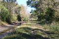
The route follows old paths or sections of road at times; it is almost always possible to walk on the flat, grassy verge for those wishing to avoid the tarmac.

This route is signposted for most of the way: in yellow and green at the start and end of the route (a wooden post with a yellow tip and a green band below), and in yellow after Cadourne (a wooden post with a yellow tip). Using a GPS device or a smartphone with the Visorando app can make it easier for walkers to find their way.

Hike completed by the author on 22 September 2022. A very quiet route.

Worth a visit

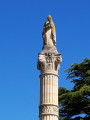
The parish church of Saint-Romain
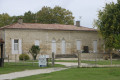
The church was built at the end of the 19th century on the site of the earlier Romanesque building by the architect Bonnore de Lesparre, who designed most of the churches built in the canton at that time. This building, dedicated to Saint-Romain, was largely financed by donations from the villagers. Near the restored bell tower and entrance porch, the village’s central square still features the porch of the former presbytery, which dates from the same period as the church and has been converted since 1950.

The Chapel of Potensac
The Chapel of Saint-Martin is situated in the heart of the hamlet of Potensac, near the fountain which was once the village’s hub. The gateway is that of a former chapel built in the 19th century by a group of wine-growing landowners. Around 1950, the badly damaged bell tower required repairs that the local council refused to pay for. Sold to Château Potensac, the building was converted into a wine cellar following the demolition of the bell tower.

Remains of the Abbey of the Canons of Saint-Pierre, situated at L’Isle
Situated on the pilgrims’ route to Santiago de Compostela, the Abbey of Saint-Pierre-de-l’Isle was described in 1079 by Pope Gregory VII. Other sources suggest that it was founded in 1128 by the Archbishop of Bordeaux, Geoffroy de Loriol. Its construction took place throughout the 12th and 13th centuries. The collegiate church was run by canons regular of the Order of Saint Augustine. It was destroyed by the armies of the Black Prince (Prince of Wales), deconsecrated at the end of the 17th century, and lay in complete ruins by 1708 after having been used as a stone quarry. Today, a section of wall from the former Abbey of l’Isle remains, along with part of the guard room and the stables. During archaeological surveys using electrical prospecting, extensive structures were uncovered. On one of the paths leading to the abbey, there is also a mill that once formed part of its holdings. It is now overgrown with vegetation. From the outside, one can still see a fortified gate, an apse wall with a pointed-arch window, the defensive moat which still marks the boundaries of the abbey grounds, and the ruins of monastic buildings.

Butte de la Lot is a remarkable natural site managed by the Conservatoire d’Espaces Naturels d’Aquitaine since 2006. It is one of the most remarkable sites in the Gironde department. Covering just over four hectares in a single block at the heart of the Médoc wine-growing region, this clay-limestone hill is home to a rich diversity of habitats and species and also offers the opportunity to observe geological strata that are distinctive compared to the surrounding formations.

''Source: Wikipedia (excerpts), the “Gironde Tourisme” website and the “C’est en France – Patrimoine de France” website''

Reviews and comments

4.7 / 5
Based on 2 reviews

Reliability of the description
4.5 / 5
Ease of following the route
4.5 / 5
Route interest
5 / 5
JP Arnaud
JP Arnaud

Overall rating : 5 / 5

Date of your route : Apr 04, 2023
Reliability of the description : ★★★★★ Very good
Ease of following the route : ★★★★★ Very good
Route interest : ★★★★★ Very good
Very busy route : No

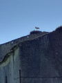
What a lovely walk! A variety of scenery, well-maintained paths, a few muddy sections (but nothing too difficult) and storks!!! They really deserve a mention in the description. We highly recommend this walk.

Machine-translated

pgetrochon
pgetrochon

Hello,

Thank you for your very informative message. I’ll take the time to go through it when I return in about five weeks.
Enjoy your walks. Best regards

Machine-translated

bx86
bx86

Overall rating : 4.3 / 5

Date of your route : Oct 09, 2022
Reliability of the description : ★★★★☆ Good
Ease of following the route : ★★★★☆ Good
Route interest : ★★★★★ Very good
Very busy route : No

Hello
A walk in fine weather, taking the clockwise route (which, in my opinion, is best as it means you get the long straight stretch along the Maréchale canal – which is a bit of a slog – out of the way first).
Starting from the town hall (car park in front). Then a pretty house with pigeons, hens, guinea fowl and golden pheasants… The ruins of the abbey on the Butte de l’Isle.
The straight stretch running alongside the Maréchale canal does, however, offer a view of a ‘tonne’ (a camouflaged duck-hunting hide) and allows you to see the extensive work carried out to drain the marshes (canals, sub-canals, various sluice gates). Cows grazing in the marshes.
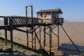
The pretty little port of La Maréchale (ideal for a picnic) with tables and views over the Gironde and the opposite bank (we’re heading south of Talmont).
In fact, there’s little monotony (the Médoc isn’t actually that flat!! as even the slightest 10-metre rise counts as a hill), and between the marshes, the harbour, the wine châteaux, the vineyards and the hamlets, there’s little or no monotony.
A few details on the route markers
At point 4: There’s no point going down into the vineyard… just carry on straight ahead until you reach a wall where you’ll find a post marked in yellow, then take the carved path to the right (the one described in the route description as the ‘wide path’). The markings help you find your way at certain points, so don’t ignore them systematically.
At point 7, if there is an intermittent stream on your left, the path actually follows a canal on your right that always has water in it. So it’s impossible to go wrong.
Between points 7 and 8, I’d personally add a ‘7a’ to make sure you turn right towards point 8. There’s a post marked in green… so it’s easy to spot, because there are plenty of T-junctions (one just before leads to a vast field for horses, though you wouldn’t realise it straight away)
Between 10 and 12, I left the zigzagging paths through the vineyards to one side! We took the very narrow road (not open to traffic) up to the gravel track that runs alongside ‘Pabeau’. This brings you to point 12.
Finally, to reach point 13, the path goes via the 4-metre mark (why indicate an elevation if you don’t have an altimeter?) and even with an altimeter – as I have one – the area fluctuates between 3, 4 and 5 metres… Let’s just say that by cross-referencing the altimeter, the compass, the route description and the map, you can find this little section. But it’s true that there aren’t enough landmarks… I’m not really sure how to be any more precise, to be honest.

Thanks for this lovely route.

Machine-translated

Other walks in the area

For more walks, use our search engine .

The GPS track and description are the property of this route's author. Please do not copy them without permission.