Begadan circular walk through vineyards and woodland

Bégadan, a small village in the heart of the Médoc. Walks amongst the vineyards, pastures and woods. Wildlife spotting (a wide variety of birds) whilst passing by the Étang de Bagneau.

Details

n°2911863
Creation:
Last update:
Last review:
  • Walking
    Activity: Walking
  • ↔
    Distance: 6.45 mi
  • ◔
    Average duration: 3h 00 
  • ▲
    Difficulty: Easy

  • ⚐
    Back to start: Yes
  • ↗
    Ascent: + 20 ft
  • ↘
    Descent: - 23 ft

  • ▲
    Highest point: 39 ft
  • ▼
    Lowest point: 10 ft
  • ⚐ Country: France
  • ⚐
    Area: Médoc
  • ⚐ City: Bégadan (33340)
  • ⚑
    Start/End: N 45.357119° / W 0.893871°
  • ❏
    IGN map(s): Ref. 1433OT, 1433SB
  • Hour-by-hour weather

Description of the walk

(S/E) From the car park at Saint-Saturnin Church in Bégadan, take the road towards the cemetery.

(1) Turn right after walking alongside the cemetery wall and continue straight on at the crossroads. Further on, first turn right then left and continue until you reach the Route de Cante Cocut.

(2) Turn left onto this road, then right, and pass through the hamlet of Le Reyssinet. Pass the first junction and follow the path alongside the Bois de Laygat.

(3) At the junction of three roads, turn left onto the Route des Picots until you reach the hamlet of La Branne.

(4) Turn left between the houses onto the path that crosses the vineyards and a woodland to join the D103E4 road, which you follow to the right..

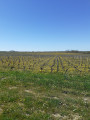
(5) Turn left onto the grassy track behind the vineyards. Join the road and then pass through the hamlet of La Caussade. Cross the D201 with care and continue straight ahead. Pass near the hamlet of Le Peyrat (cross), take the track opposite and then turn left towards the D103.

(6) Cross the D103 with care, take the grassy path opposite at the corner of the fence, then take the path on the left and continue straight on to join the Route de Houreste. Turn left, then right onto the D103.

(7) Take the path that runs alongside the fence, with the woods on your left and the pond on your right.

(8) One section is sometimes flooded. If this is the case, turn right and follow the fence.
Beautiful view of the pond and its wildlife: there are always plenty of birds on this (private) stretch of water. Please observe the regulations in force. Join the Route de Laujac and turn left, then right onto the white track.

(9) Turn left onto Route de la Lande and, at the junction, turn right onto Route de la Franquaise, then immediately take the path on the left. Turn right, then left to reach Route de Trembleaux.

(10) Take this road to the right and, after about 100 m, turn left onto the track through the vineyards to join the D103.

(11) Cross the Route de Saint-Saturnin with care and follow it to the right (walk along the wide grassy verge). Keep the church in sight; please be careful as this road has a fair amount of traffic.

(1) Walk past the cemetery and you’ll reach the car park at Saint-Saturnin Church (S/E).

Waypoints

  1. S/E : mi 0 - alt. 33 ft - Car park at Saint-Saturnin Church
  2. 1 : mi 0.16 - alt. 39 ft - Corner of the cemetery
  3. 2 : mi 0.45 - alt. 36 ft - Turn left onto the road to Cante Cocut
  4. 3 : mi 1.06 - alt. 13 ft - Turn left at the junction with Route de Picot
  5. 4 : mi 1.27 - alt. 33 ft - Path on the left between the houses
  6. 5 : mi 1.99 - alt. 36 ft - A path through the vineyards
  7. 6 : mi 3.3 - alt. 13 ft - Path opposite, at the corner by the fence
  8. 7 : mi 4.16 - alt. 20 ft - On the D103 road, turn right onto the lane
  9. 8 : mi 4.36 - alt. 20 ft - Take the bypass along the fence if necessary
  10. 9 : mi 4.81 - alt. 16 ft - Turn left onto Route de la Lande
  11. 10 : mi 5.37 - alt. 30 ft - Turn right onto Route de Trembleaux
  12. 11 : mi 5.98 - alt. 30 ft - On the right, the road to Saint-Saturnin
  13. S/E : mi 6.45 - alt. 30 ft - Car park at Saint-Saturnin Church

Notes

A few shops in the village centre,
Tours and wine tastings at the local vineyards.

Worth a visit

- Visits to, amongst others, the châteaux of Plagnac, Grand Bertin, Moulin de Cassy, Le Pey and the Saint-Jean winery… for lovers of fine wines, to be enjoyed in moderation.

- Views over the Étang de Bagneau and its wildlife
There are always plenty of birds on this (private) lake
__ Please observe the regulations in force __.

- Nearby: ‘La Grange des Marais’ nature park and ‘Parc du Château de Beaulon’

- The Port de Goulée on the banks of the Gironde at Valeyrac (restaurants, crêperie)
- BY harbour
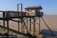
- Richard Lighthouse (museum and picnic area)
- The port of Saint-Vivien (restaurants, crêperie, prawn farm and canoe trips down the Gua)

Reviews and comments

3.8 / 5
Based on 2 reviews

Reliability of the description
4 / 5
Ease of following the route
3.5 / 5
Route interest
4 / 5
User 23044514

Overall rating : 4 / 5

Date of your route : Feb 05, 2026
Reliability of the description : ★★★★☆ Good
Ease of following the route : ★★★★☆ Good
Route interest : ★★★★☆ Good
Very busy route : No

Very pleasant trail but cut off towards the gravel pit by a flooded path, to be redone in
another season.

Machine-translated

loran78
loran78

At this time of year, the paths through the vineyards and the woods are often impassable after heavy rain. However, the water clears away quickly after a few days of fine weather.

Machine-translated

notthebest33
notthebest33

Overall rating : 3.7 / 5

Date of your route : Mar 02, 2020
Reliability of the description : ★★★★☆ Good
Ease of following the route : ★★★☆☆ Average
Route interest : ★★★★☆ Good

Difficult to assess given the weather conditions and the impassable sections of the forest tracks.
A route best enjoyed in fine weather

Machine-translated

Other walks in the area

For more walks, use our search engine .

The GPS track and description are the property of this route's author. Please do not copy them without permission.