Around the Gallo-Roman Theatre in Brion

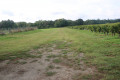
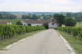
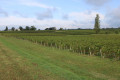
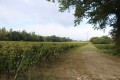
An unusual route along dykes in a floodplain marshland area, taking in the archaeological site of the Gallo-Roman Theatre at Brion, before returning through vineyards and small woodlands. This area, with its settlements on the hills and knolls, offers beautiful scenery.

Details

3536369
Creation:
Last update:
Last review:
  • Walking
    Activity: Walking
  • ↔
    Distance: 5.40 mi
  • ◔
    Average duration: 2h 30 
  • ▲
    Difficulty: Easy

  • ⚐
    Back to start: Yes
  • ↗
    Ascent: + 49 ft
  • ↘
    Descent: - 49 ft

  • ▲
    Highest point: 79 ft
  • ▼
    Lowest point: 3 ft

Photos

Description of the walk

(S/E) Leave the railway line behind and carefully follow the small road to Gouat. Ignore a road on the left, then a path on the right. At the T-junction, turn right.

(1) At the Fork in the road, take the path on the right. Join the Chenal de la Calupeyre and walk along its right-hand side. Further on, the path veers away to the left.

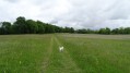
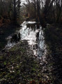
(2) Take thefirst track on the right and go round the hamlet of La Motte Blanque on the left. Cross the Chenal de la Calupeyre and follow it on your left. Cross a floodplain with numerous secondary drainage channels on the right.

(3) Turn left and cross the bridge over the channel. Walk through a small wood with a pond on your right, then turn left along the path. Go round a small promontory on your left, which is home to the archaeological site of the Gallo-Roman theatre at Brion (see the ‘During the walk’ section).

(4) Take a path on the right to quickly reach the site of the Gallo-Roman theatre. Retrace your steps.

(4) Continue to the right along the main path. The path winds several times before reaching a small road.

(5) Carefully follow the road to the left. Pass a vineyard and then a small copse.

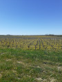
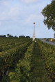
(6) At the edge of the copse, turn right and pass between the copse (on your right) and a vineyard (on your left). Pass under a high-voltage power line and walk alongside the vineyards on your right.

(7) Turn onto thefirst path on the left. Head south with the vineyards on your right. At the first junction, carry straight on along the path, which is now uphill.

(8) At the next junction, turn left onto a track that skirts the top of the hill. At the end of the track, turn right. At the next junction (marker 24), turn left and head down the hill.

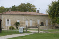
(9) When you reach Château Hauterive, turn right and pass a water reservoir on your left. You’ll come out onto a road; follow it to the right.

(1) Continue along the road and turn into thefirst road on the left. Follow this road to the car park (S/E).

Waypoints

  1. S/E : mi 0 - alt. 30 ft - Roadside from Gouat to Moulin de Batan
  2. 1 : mi 0.42 - alt. 20 ft - Junction on the circular loop
  3. 2 : mi 1.24 - alt. 7 ft - La Motte Blanque – Start of the path on the right
  4. 3 : mi 2 - alt. 3 ft - Bridge over the Chenal de la Calupeyre
  5. 4 : mi 2.64 - alt. 10 ft - Access to the - Théâtre Gallo-Romain de Brion
  6. 5 : mi 3.38 - alt. 10 ft - Small road
  7. 6 : mi 3.58 - alt. 10 ft - Road–path junction
  8. 7 : mi 4.15 - alt. 52 ft - T-junction with a path branching off to the left
  9. 8 : mi 4.44 - alt. 79 ft - Junction
  10. 9 : mi 4.77 - alt. 30 ft - Château Hauterive
  11. S/E : mi 5.4 - alt. 30 ft - Roadside from Gouat to Moulin de Batan

Notes

The car park is situated along the road leading from Gouat to Moulin de Batan, after the railway level crossing, preferably on the left-hand side where there is slightly more space (limited number of spaces).

This walk across varied terrain requires sturdy footwear.

This route is partially signposted. Consequently, it is advisable to follow the directions in this description and on the map, whilst also taking note of the landscapes you pass through. Distance markers from the starting point, or even the GPS coordinates of waypoints (including the start), can also help hikers find their way.
Using a GPS device or a smartphone with the Visorando app can make the walk easier.

Worth a visit

The archaeological site at Brion
Gironde’s Heritage
The visible remains of the Brion archaeological site are those of a Gallo-Roman villa built around the middle of the first century AD.
Visits: open all year round. Free guided tours – from 1 July to 31 August and by appointment the rest of the year; book tours at the heritage centre, opposite the church.

Access: The site is situated at the far end of the Reysson marsh, on a slight rise of land, partly wooded, about 600 metres west of the hamlet of Brion. The site can be reached from the village of Saint-Germain d’Esteuil, either via Barbannes or via Boyentran.

The Brion site
It now appears that, in all likelihood, this was the town that the Greek scholar Ptolemy referred to in his *Geography*, around the year 130, under the name Noviomagus. Noviogalus was then, along with Burdigala (ancient Bordeaux), one of some twenty towns in Roman Aquitaine that stretched from the Loire to the Pyrenees.
The remains, some of which are badly damaged, bear witness to the architectural quality of the buildings.
A bronze ram’s head found on the site suggests the worship of the god Mercury. Examination of the painted plasterwork has revealed a very rich décor: at least half a dozen paintings featuring figures, a ship’s stern… The numerous objects discovered on the site, including 140 amphorae, are on display in the exhibition hall at the Maison du Patrimoine for the public to view.
Maison du Patrimoine
1, rue du stade
33340 St Germain d’Esteuil
Telephone: 05 56 09 03 42 / 05 56 09 02 07
Mobile: 06 84 78 33 32

Archaeological excavations have revealed:
- a Gallo-Roman theatre dating from the Early Empire (built between 60 and 80),
- a fortified house built on the site of the theatre during the Middle Ages,
- dwellings and public buildings,
- a temple of Celtic tradition or fanum.

Documentary sources: Saint-Germain d’Esteuil Archaeological and Historical Society.
For further information:
Source: website

The Theatre
This monument, which has never been fully excavated, has been the subject of a detailed architectural study.
Situated on flat ground, it was built entirely of regular masonry (small limestone blocks jointed with iron, alternating with courses of brick).
The embankment surrounding it was built after the theatre fell into disuse and helped to protect it from complete ruin.
The only monument of its kind in Gironde, it dates from the 1st century AD.
The theatre comprises three parts:
- The hemicycle (cavea), formed here of four concentric levels on which the tiers of seats were set, of which no trace remains.
- At the centre and at the base of this cavea, a semi-circular area (the orchestra), the floor of which is formed by the exposed limestone outcrop.
- At the front, the stage and the proscenium wall, the width of which is equal to the diameter of the cavea (approximately 57 m).
Access to the tiers was via nine entrances (vomitoria). These entrances, flanked by two pilasters on either side, led onto a stone staircase taking spectators up into the theatre’s cavea.
The regularity of its layout and the perfection of the structural system adopted for the façade make it more akin to certain urban buildings than to those found in secondary towns, which are often rather crude.
Source: information panel on site

Medieval settlement
In 1340, having been ostracised by society for his misdeeds, Arnaud de Bourg was settled by his family on these lands, in the midst of the marshes. The castle complex, built partly using stones from the theatre, comprises a tower, a main building, a bailey and a rampart.
Situated in the centre, the tower is a square building with sides measuring 10 metres. Today, 2 to 3 metres of it remain, but it originally had at least one storey.
A few metres away stands the main residence, the residential part of the fortified complex. Rectangular in shape, it comprises four rooms and is flanked on the west by a sort of adjoining gallery.
The northern end of this limestone promontory appears to have formed the farmyard. An enclosure comprising earthworks and reused ancient walls surrounded the entire complex.
Source: information panel on site

Reviews and comments

4.8 / 5
Based on 2 reviews

Reliability of the description
5 / 5
Ease of following the route
5 / 5
Route interest
4.5 / 5
balladonnous
balladonnous
• Edited:

Overall rating : 5 / 5

Date of your route : Aug 19, 2024
Reliability of the description : ★★★★★ Very good
Ease of following the route : ★★★★★ Very good
Route interest : ★★★★★ Very good
Very busy route : No

A lovely walk through vineyards and marshes, with a fantastic site featuring Gallo-Roman ruins (a theatre, village and temple). Just remember to wear long socks in summer, as the grass can be a bit tall in places. We spotted a fallow deer, some swans, a goose and some crayfish...

Machine-translated

Yule
Yule

Overall rating : 4.7 / 5

Date of your route : May 17, 2021
Reliability of the description : ★★★★★ Very good
Ease of following the route : ★★★★★ Very good
Route interest : ★★★★☆ Good
Very busy route : No

Hello, and thank you for the route.
It was a bit of a drive, but we didn’t see a single car.
It was quite varied.
We came across pheasants three times

Machine-translated

Other walks in the area

For more walks, use our search engine .

The GPS track and description are the property of this route's author. Please do not copy them without permission.