Circular walk around Château d’Escot

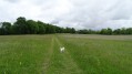
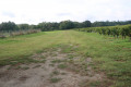
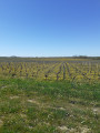
From Château d’Escot, a route through vineyards, pastures and woods, and alongside streams.

Details

2983126
Creation:
Last update:
Last review:
  • Walking
    Activity: Walking
  • ↔
    Distance: 6.02 mi
  • ◔
    Average duration: 2h 45 
  • ▲
    Difficulty: Easy

  • ⚐
    Back to start: Yes
  • ↗
    Ascent: + 16 ft
  • ↘
    Descent: - 16 ft

  • ▲
    Highest point: 59 ft
  • ▼
    Lowest point: 30 ft

Description of the walk

Parking is available next to the large oak tree opposite Château d'Escot.

(S/E) With your back to the château, follow the road for a few metres and turn left at the corner by the vineyard onto the grassy track. A green sign indicates ‘hiking trail’ – be careful! Do not follow this sign if you come across other signs.

(1) When you reach the first houses in Sainte-Marie, carry straight on along the small road, then leave it at the left-hand bend to take a grassy path opposite.

(2) Cross the small road and continue straight ahead onto the track called “Le Basque”. Carry on straight ahead until you reach the junction with the D3E1 in the hamlet of Grand Gartieu.

(3) Cross carefully and carry on straight ahead to the track junction on the left.

(4) Turn left onto this track, cross another track a little further on and continue for a few hundred metres.

(5) Just after the small stream (Ruisseau de la Bermède), take the track on the left; then, once at the end, turn right and join the Route de Plassan.

(6) Turn left, carry on to the next junction and continue to the right along the side of the road called Chemin de la Forêt.

(7) At the edge of the woodland, take the first dirt track on the left and carry straight on to pass through
the hamlet of Ginestra.

(8) Take the first track on the right, then turn left, and further on you’ll come out onto Chemin du Cabanon, near a cluster of houses on your left.

(9) Turn right onto the track, then take the first dirt track on your left, which leads to the rear of the Château d’Escot.

(10) Keep to the right on the track, which curves to the left, and you’ll come out onto the road (Chemin de Treman). Cross the road and carry on straight ahead along the remains of the old road. At the next junction, turn left to return to your starting point (S/E).


Waypoints

  1. S/E : mi 0 - alt. 43 ft - Large oak tree opposite the château
  2. 1 : mi 0.37 - alt. 33 ft - Sainte-Marie
  3. 2 : mi 1.44 - alt. 30 ft - The ‘Basque’ track is opposite
  4. 3 : mi 2.14 - alt. 46 ft - Grand Gartieu
  5. 4 : mi 2.45 - alt. 49 ft - Turn left onto the lane
  6. 5 : mi 3.11 - alt. 43 ft - The Bermède stream, on the left
  7. 6 : mi 3.93 - alt. 39 ft - Route de Plassan
  8. 7 : mi 4.31 - alt. 46 ft - Path along the edge of the woodland on the left
  9. 8 : mi 4.94 - alt. 52 ft - At the crossroads, turn right
  10. 9 : mi 5.34 - alt. 56 ft - Chemin du Cabanon, on the right
  11. 10 : mi 5.79 - alt. 46 ft - Continue along the road to the right
  12. S/E : mi 6.02 - alt. 43 ft - Large oak tree opposite the château

Notes

Château D'Escot: vineyard.
Parking available near the large oak tree.
The large Terre Rouge shopping centre is approximately 1 km away, along the D1215.
In this shopping area, there are restaurants on Rue des Forgerons.
1 km away, Lesparre-Médoc on either side of the D1215.

Worth a visit

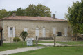
Château d’Escot: a renowned vineyard in the Bas Médoc, well worth a visit.
The vineyards, farms and pastures of the Médoc, its small streams, the primeval forest, the hamlets and the
flora and fauna.
Lesparre-Médoc is the main town in the Bas Médoc and vies for the title of ‘capital’ of the Médoc.
The keep, a 14th-century remnant of the Château des Sires Lesparre.
Guided tour of the tower, its museum and the panoramic view across the entire region from its upper terrace,
30 metres high.
To the west, woodland, beaches and the ocean; to the left, the vast vineyards and the banks of the Gironde; and to the
north, the headland with its marshes and lagoons.

Reviews and comments

4.5 / 5
Based on 2 reviews

Reliability of the description
4.5 / 5
Ease of following the route
4.5 / 5
Route interest
4.5 / 5
loran78
loran78

Thank you for your kind comments
👍
Loran

Machine-translated

Denisevelyne
Denisevelyne

Overall rating : 4.7 / 5

Date of your route : Mar 15, 2022
Reliability of the description : ★★★★★ Very good
Ease of following the route : ★★★★★ Very good
Route interest : ★★★★☆ Good
Very busy route : No

A lovely person on the route, very good with dogs

Machine-translated

loran78
loran78

Good evening
Maps don’t always reflect reality, or some paths may not be shown on them.
When mapping the route, I use the GPS track.
I’m glad you enjoyed this walk.
Kind regards
Loran

Machine-translated

DOUCAT
DOUCAT

Overall rating : 4.3 / 5

Date of your route : May 25, 2020
Reliability of the description : ★★★★☆ Good
Ease of following the route : ★★★★☆ Good
Route interest : ★★★★★ Very good
Very busy route : No

A pleasant walk. Very little road walking. Lots of shaded paths. However, there were a few inaccuracies in the printed route description. The Visorando app on my mobile proved very useful.

Machine-translated

Other walks in the area

For more walks, use our search engine .

The GPS track and description are the property of this route's author. Please do not copy them without permission.