From Saint-Germain d’Esteuil to Miqueu

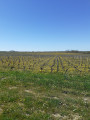
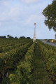
A pleasant walk through varied terrain, alternating between areas of vineyards, pastures, some farmland and small woods. There are numerous points of interest along the route: the archaeological site at Brion, beautiful mansions reflecting a rich architectural heritage, and wine estates such as Château Hauterive, Brie, Château Livran, Château Castéra and Château Peylaby. This area also boasts a rich biodiversity: flora, fauna, butterflies, birds, etc.

Details

3542766
Creation:
Last update:
Last review:
  • Walking
    Activity: Walking
  • ↔
    Distance: 8.06 mi
  • ◔
    Average duration: 3h 45 
  • ▲
    Difficulty: Moderate

  • ⚐
    Back to start: Yes
  • ↗
    Ascent: + 79 ft
  • ↘
    Descent: - 75 ft

  • ▲
    Highest point: 95 ft
  • ▼
    Lowest point: 0 ft

Photos

Description of the walk

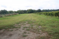
(S/E) Leave the car park heading north-east along Rue du Huit Mai. After passing Rue du Stade on the left, the road gives way to a farm track that winds its way between vineyard plots and fields. Further on, cross Route de Boyentran with care and continue straight ahead until you reach Route de Barbehère.

(1) Turn right and follow this quiet little road. Just at the edge of a small wood on the left-hand side, you can visit the megalithic monument known as the Barbehère dolmen, about 150 metres from the road. Alternatively, carry on along the road, passing Barbehère, then continue towards Boyentran. At the junction with the Route de Boyentran, you’ll see the wayside cross on your right. Carry on to the left and pass through the hamlet.

(2) Turn right onto a path that starts opposite the small road coming from the north-east. The path heads south and soon curves in a wide ‘S’ shape before entering a more wooded area. Further on, it branches off to the left, and again to the left less than a hundred metres further on, heading north for a short while. The track finally turns right after about a hundred metres, emerging from the woods on a gentle incline and running alongside vineyards until it reaches a small road leading from Boyentran to the hamlet of Brion. Turn right and follow the small road for about five hundred metres.

(3) As you approach a left-hand bend in the road, take the farm track on the right, heading downhill towards a stream: at the junction, a signpost indicates the Brion archaeological site. Cross the stream and continue straight ahead along the track, which leaves the wooded area bordering the stream and opens out onto a large clearing.

As you reach the top of the small hill, you will see a sign on the right indicating the central settlement of the Brion site. At this point, leave the forest track to go and see the remains of this central settlement right in the middle of the plot. Then head off to the right to rejoin the forest track just before the trees, and a few metres further on, you’ll find three information signs about the quarry and silos, the medieval settlement and the Roman theatre. Head towards the amphitheatre and go down the steps to reach the stony forest track.

(4) Turn left to follow this track heading south-east. Continue straight on until you reach the Chenal de la Calupeyre, which you’ll come to after passing through a wooded area.

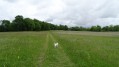
(5) Cross the channel and immediately turn right onto the grassy path running alongside it. As you go, take in the various water management structures in the Palus de Reysson (marsh). After passing the hamlet of La Motte Blanque, turn right and take the track heading north-west, which goes round a property. Follow it until you reach a good, motorable farm track.

(6) Head to the right and follow this track, which passes a wine-growing farm on your left, the Château Peylaby estate (producing organic wine). Shortly afterwards, cross the Route de Gouat and continue straight ahead along a track. As you emerge from a wooded area, you can see Château Hauterive in the distance to the left. The track then climbs slightly towards the hamlet of Brie.

(7) Just before reaching it, turn right onto a path between two vineyard plots. At the next T-junction, turn left onto the path heading west towards the north of Miqueu, until you reach the D4.

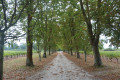
(8) At this point, you’ll see a small chapel on your left. Cross the D4 with care and take the path opposite, which veers diagonally to the right towards the north-west. When you reach a modern house, turn left onto the path heading south-west, which passes the semi-buried water tower at Miqueu. Shortly afterwards, turn right onto a path running alongside a hedge on your left and a plot of land without vines on your right. You’ll come to a lovely tree-lined avenue.

(9) Turn right to follow this avenue leading to Château de Livran. This avenue is lined with American black walnut trees as far as the small road leading to the château.
When you reach the road, turn right and follow it to the small road leading to the Château Livran wine storehouse (delivery access).

(10) When you reach the courtyard of the winery, turn right onto the path which runs alongside a vineyard plot on your left and a farm track on your right. Continue to the path on the left between two vineyard plots. Turn left and, at the bottom of these plots, turn left again to join the path known as La Mouline, which you follow to the right towards the hamlet of Garramey.

At the crossroads just before the hamlet, turn right onto the path which soon joins the farm track leading from Garramey towards Château Castéra. Follow this track between the vineyard plots until you reach the Route des Marceaux in front of the entrance to Château Castéra.

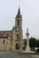
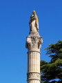
(11) Turn right and walk carefully along the Route des Marceaux. When you reach the junction with the D4, turn left and, shortly afterwards, take the Passage de l’Église. Next to the church, admire the mission cross dating from 1860 with a statue of the Virgin Mary.

Turn right to rejoin the D4, then turn right again and immediately turn left onto Rue du Stade.
At the end of the street, turn right onto Rue du 8 Mai 1945 to return to the car park (S/E).

Waypoints

  1. S/E : mi 0 - alt. 33 ft - Car park at the Salle des Fêtes
  2. 1 : mi 0.66 - alt. 36 ft - Crossroads (path and road)
  3. 2 : mi 1.66 - alt. 20 ft - Boyentran crossroads
  4. 3 : mi 2.57 - alt. 26 ft - Junction of Route de Brion and the path on the right
  5. 4 : mi 3.07 - alt. 10 ft - Crossroads
  6. 5 : mi 3.7 - alt. 3 ft - Chenal de Calupeyre, junction
  7. 6 : mi 4.46 - alt. 7 ft - Motte Blanque, crossroads
  8. 7 : mi 5.38 - alt. 79 ft - Brie, junction of paths and road
  9. 8 : mi 5.89 - alt. 89 ft - Junction of footpath and road at Miqueu
  10. 9 : mi 6.36 - alt. 89 ft - T-junction
  11. 10 : mi 6.86 - alt. 89 ft - Château Livran wine cellar
  12. 11 : mi 7.56 - alt. 75 ft - Junction of footpath and the D204E1 road
  13. S/E : mi 8.06 - alt. 33 ft - Car park at the Salle des Fêtes

Notes

The car park is located at the Salle des fêtes in Saint-Germain d’Esteuil.

This walk across varied terrain requires sturdy footwear. The route follows mainly well-maintained farm tracks and grassy verges alongside tarmac roads bordering vineyard plots.

This route is based on a walk published by www.tourisme-coeurmedoc.com. It is signposted in yellow and green (wooden posts with tips painted yellow and green). In addition, it is advisable to follow the instructions in this description and on the map, whilst also observing the landscapes you pass through. Distance markers from the starting point, or even the GPS coordinates of key points along the route (including the start), can also help walkers find their way.
Using a GPS device or a smartphone with the Visorando app can make it easier for walkers to find their way.

Important: access to vineyard plots is restricted and requires the landowner’s permission. Consequently, please stay strictly on the paths and, where necessary, keep your dog on a lead.
Passing near Château Livran is permitted by the owner provided you stay on the paths, including between the vineyard plots (telephone contact on 29 September 2023).

Walk undertaken by the author on 29 September 2023

Worth a visit

Saint Germain d’Esteuil
The area has been inhabited since Neolithic times, as evidenced by the Barbehère megalithic monument.

Places and monuments
- The megalithic monument known as the Barbehère dolmen++, listed as a historic monument since 1989. It was the subject of systematic excavations between 1987 and 1992 and yielded a wealth of archaeological material. It is situated 500 metres west of the Barbehère farm, at a place known as Bois des Haures.
Religious heritage
A mission cross dating from 1860 featuring a statue of the Virgin Mary. It has been listed as a historic monument since 1992.
The neo-Romanesqueparish church ofSaint-Germain with its bell-tower porch. It is listed in the General Inventory of Cultural Heritage.
Civil heritage
Remains of the 1st-centuryGallo-Roman theatre at Brion, situated in Castelet. These were reused in the 14th century to build a fortified house. They have been listed as historic monuments since 1984
Source: Wikipedia (excerpts)

The writer Étienne de la Boétie (1530–1563) was the owner of Château Castera, which stood on the lands of his wife Marguerite de Carle.

Charles Galy-Aché (1903–1982), founder of *Les Cahiers Médulliens*, the journal of the Médoc Historical and Archaeological Society. Charles Galy-Aché’s research led to the discovery of the archaeological site at Brion. It was at his instigation that the first test pits and excavations were undertaken in 1966 in collaboration with the landowner, Mr Chevrier.
Charles Galy-Aché’s work and research have made a significant contribution to our understanding of the history and archaeology of the Médoc.
Source: Balade Rando liberté Gironde (excerpts)

The Boyentran Dovecote, Route de Marque
Near the hamlet of Boyentran (Saint-Germain-d’Esteuil), on Route de Marque, in a meadow, stands a small circular structure topped by a stone dome, which ends in a curious spire made of stacked stones. Several openings have been cut into the cylindrical tower, including a flight hole. A drip moulding at the base of the dome suggests the original purpose of this small monument, namely as a dovecote
Source: ‘The Most Beautiful Walks in Saint-Seurnin-de-Cadourne: The Circular Walk through the Marais’, published by Gironde Tourisme

Reviews and comments

4.7 / 5
Based on 2 reviews

Reliability of the description
5 / 5
Ease of following the route
4.5 / 5
Route interest
4.5 / 5
User 27397169

Overall rating : 4.7 / 5

Date of your route : Mar 05, 2026
Reliability of the description : ★★★★★ Very good
Ease of following the route : ★★★★★ Very good
Route interest : ★★★★☆ Good
Very busy route : No

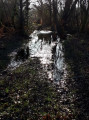
A pleasant and easy hike with no elevation gain, accessible to all (may be a little long for children). Wide, clear paths throughout the route. Point 5 was completely flooded following storms Nils and Pedro in recent weeks. We had to modify our itinerary slightly and turn back.
A few unnecessary circular loops, in my opinion, which lengthen the route for little gain.
The short historical section in Brion was enjoyable.

Machine-translated

DESMARIE
DESMARIE

Overall rating : 4.7 / 5

Date of your route : Apr 07, 2025
Reliability of the description : ★★★★★ Very good
Ease of following the route : ★★★★☆ Good
Route interest : ★★★★★ Very good
Very busy route : No

On a lovely sunny day in April, a great walk across varied terrain, with a well-detailed route that was easy to follow. A slight disappointment at the Brion site. Some really lovely stretches along wide forest paths.
I highly recommend it.

Machine-translated

DESMARIE
DESMARIE

Not yet carried out. Scheduled for the coming weeks.

Machine-translated

Other walks in the area

For more walks, use our search engine .

The GPS track and description are the property of this route's author. Please do not copy them without permission.