Orsinie Circular Loop

A shaded walk in the footsteps of Jacquou.
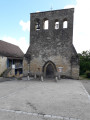
The walk begins in the charming village of Fanlac, home of Jacquou le Croquant (the setting for Eugène Leroy’s novel), where you’ll pass three of the places he lived, immortalised in Stélio Lorenzi’s 1968 TV series. You’ll leave this little gem of Périgord architecture behind to walk almost the entire way through lush greenery, which offers magnificent views of the village and its surrounding hamlets. You’ll pass through the Thonac valley, which separates the two sides of the commune, following the GR®36 trail that links the village to Montignac-Lascaux.

Details

n°39275664
Creation:
Last update:
Last review:
  • Walking
    Activity: Walking
  • ↔
    Distance: 3.10 mi
  • ◔
    Average duration: 2h 00 
  • ▲
    Difficulty: Easy

  • ⚐
    Back to start: Yes
  • ↗
    Ascent: + 627 ft
  • ↘
    Descent: - 653 ft

  • ▲
    Highest point: 748 ft
  • ▼
    Lowest point: 374 ft

Description of the walk

A89 motorway, Montignac exit, follow signs for Montignac then Fanlac. Park in the Fanlac car park.

(S/E) From the Fanlac town hall car park, head towards the centre of the village, then turn left towards the church.

(1) Opposite the church, take the path on the left, situated between the houses where there is a yew tree on the left and a lime tree on the right. Continue to the road.

(2) Turn right onto the road and cross the Fanlac bridge over the stream known as ‘le Thonac’ to reach a junction.

(3) Leave the road and take the path opposite, which crosses the Bois d’Amour and leads to Le Chazal and a house on the Route des Quatre Chemins.

(4) Continue to the right until you reach the Y-junction.

(5) Continue to the right, towards L’Orsinie. Take the limestone track which descends into the valley until it ends at the road.

(6) Walk alongside the tarmac road on the right for 20 metres, then turn left onto the “Chemin de la Fontaine”, also known as the “Chemin de Jacquou”, which crosses the stream and winds its way up towards Fanlac through the woods.

(7) Turn right onto the Chemin de la Croix du Couderc and head towards the village centre. Continue until you reach the Croix de Benoît, at the far end of the village. Take the Rue de la Mairie to return to the village car park (S/E).

Waypoints

  1. S/E : mi 0 - alt. 725 ft - Town hall car park
  2. 1 : mi 0.06 - alt. 728 ft - Church
  3. 2 : mi 0.43 - alt. 404 ft - Route du Mémorial - Thonac (cours d'eau) - Affluent de la Vézère
  4. 3 : mi 0.52 - alt. 394 ft - Path opposite - Thonac (cours d'eau) - Affluent de la Vézère
  5. 4 : mi 1.28 - alt. 741 ft - Route des Quatre Chemins
  6. 5 : mi 1.46 - alt. 748 ft - Y-junction
  7. 6 : mi 2.49 - alt. 381 ft - Route du Ruisseau - Thonac (cours d'eau) - Affluent de la Vézère
  8. 7 : mi 3 - alt. 712 ft - Fanlac, Chemin de la Croix du Couderc - Chateau d'Auberoche
  9. S/E : mi 3.1 - alt. 725 ft - Town hall car park

Worth a visit

(1) On the descent, on your left, you can admire a dry-stone hut.
(5) Here you’ll be treated to a magnificent view of the village of Fanlac.

Always be cautious and plan ahead when you're outdoors. Visorando and the author of this route cannot be held responsible for any accidents occurring on this route.

The GR® and PR® markings are the intellectual property of the Fédération Française de Randonnée Pédestre.

Reviews and comments

5 / 5
Based on 1 review

Reliability of the description
5 / 5
Ease of following the route
5 / 5
Route interest
5 / 5
PatocheJLD
PatocheJLD

Overall rating : 5 / 5

Date of your route : Oct 11, 2024
Reliability of the description : ★★★★★ Very good
Ease of following the route : ★★★★★ Very good
Route interest : ★★★★★ Very good
Very busy route : No

The route of this walk is particularly well-marked, with a course featuring very steep gradients that can be classified as ‘moderate’. A very shaded route passing through chestnut groves, which are particularly enjoyable at this time of year. A truly pleasant walk.

Machine-translated

Other walks in the area

For more walks, use our search engine .

The GPS track and description are the property of this route's author. Please do not copy them without permission.