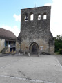
Circular route from the village centre to Fanlac

This walk is circular and takes you around the village of Fanlac. A short, pleasant walk suitable for families.

Details

39271374
Creation:
Last update:
Last review:
  • Walking
    Activity: Walking
  • ↔
    Distance: 1.61 mi
  • ◔
    Average duration: 1h 00 
  • ▲
    Difficulty: Easy

  • ⚐
    Back to start: Yes
  • ↗
    Ascent: + 279 ft
  • ↘
    Descent: - 279 ft

  • ▲
    Highest point: 728 ft
  • ▼
    Lowest point: 446 ft

Description of the walk

From Thonac, take the road that follows the stream of the same name, heading towards Fanlac. After five kilometres, turn left towards the village. Park in the car park by the town hall.

(S/E) From the signpost in the town hall car park, head up towards the centre of the village until you reach the junction with Chemin du Couderc.

(1) At the junction, head straight ahead, past the well and the wayside cross, until you reach the edge of a downhill slope.

(2) Take the path straight ahead, veering slightly to the right, until you reach the road.

(3) Turn right. Ignore a path on the left and continue to the next junction with the Chemin du Passadour.

(4) Turn right and continue to the end of the road at the Route des Plateaux.

(5) Turn right, then carry on straight ahead along Rue des Écoles to the village centre, where you should turn left onto Rue de la Mairie to return to the starting point. (S/E)

Waypoints

  1. S/E : mi 0 - alt. 725 ft - Fanlac Town Hall car park
  2. 1 : mi 0.03 - alt. 728 ft - Chemin du Couderc
  3. 2 : mi 0.28 - alt. 728 ft - Downhill stretch – path opposite
  4. 3 : mi 0.58 - alt. 472 ft - Chemin du Château d’Auberoche - Chateau d'Auberoche
  5. 4 : mi 1.05 - alt. 495 ft - Chemin du Passadour - Passadour (cours d'eau) - Affluent du Ruisseau d'Auberoche
  6. 5 : mi 1.42 - alt. 722 ft - Route des Plateaux
  7. S/E : mi 1.61 - alt. 725 ft - Fanlac Town Hall car park

Worth a visit

Reviews and comments

4 / 5
Based on 2 reviews

Reliability of the description
4 / 5
Ease of following the route
4.5 / 5
Route interest
3.5 / 5
Kouro
Kouro

Overall rating : 4 / 5

Date of your route : Apr 06, 2026
Reliability of the description : ★★★★☆ Good
Ease of following the route : ★★★★☆ Good
Route interest : ★★★★☆ Good
Very busy route : No

A very pleasant route

Machine-translated

Manu,-
Manu,-

Overall rating : 4 / 5

Date of your route : Nov 04, 2024
Reliability of the description : ★★★★☆ Good
Ease of following the route : ★★★★★ Very good
Route interest : ★★★☆☆ Average
Very busy route : No

Very little to eat and not much of a view.

Machine-translated

Other walks in the area

For more walks, use our search engine .

The GPS track and description are the property of this route's author. Please do not copy them without permission.