Fongran Ponds Circular Route

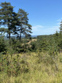
A walk along the ponds and the Ruisseau le Thonac. You’ll enjoy a stroll that follows the ponds and a stream before climbing a hillside and following the ridge, which offers a lovely view.

Details

n°39981393
Creation:
Last update:
Last review:
  • Walking
    Activity: Walking
  • ↔
    Distance: 6.88 mi
  • ◔
    Average duration: 3h 55 
  • ▲
    Difficulty: Moderate

  • ⚐
    Back to start: Yes
  • ↗
    Ascent: + 823 ft
  • ↘
    Descent: - 794 ft

  • ▲
    Highest point: 722 ft
  • ▼
    Lowest point: 236 ft

Description of the walk

Thonac lies on the Les Eyzies–Montignac D706 road. The route starts from the signpost in the car park opposite the Thonac village hall.

(S/E) Turn left towards “Le Colombier”. Continue along this road for about 1 km until you reach a five-way junction, where you’ll find the Route du Moulin and a cross.

(1) Turn left. On leaving the hamlet of Saint-Chabran, at the junction, turn right onto the Route de la Rosière for 50 metres.

(2) Turn left again onto theGR®36until you reach a junction with a tarmac road, near the leaning tower of La Vermondie.

(3) Cross the road to enter the woodland opposite and follow the path until you reach the junction with another road. Turn right onto the forest track for 50 m, then left onto the Route des Crêtes until the next junction with the path leading to the hamlet of Engout.

(4) Turn right towards the hamlet, then take the path on the right. Continue along this path, passing the hamlet of La Fouillouse. Join the tarmac road and follow it on the left for about 150 metres until you reach the first junction.

(5) Turn right, join the Route de Fongran and walk alongside the eponymous ponds. Continue along the road at the end of the ponds until you reach a bend.

(6) Take the small path on the left running parallel to the stream Le Thonac. Follow this path to the hamlet of Pré du Pont at the second junction. Join the road and turn right onto it. Cross the Thonac and continue to the crossroad.

(7) Turn left and follow the Route de Jacquou before turning right onto the Route de la Côte de la Tustedie. Continue along this road until you reach the first junction.

(8) Turn right towards the hamlet of Grigne and carry on straight along the path until you reach the Impasse de la Borie, then the Route de Jacquou at its end.

(9) Turn left onto this road and return to the original junction.

(1) Carry on straight ahead until you rejoin the starting route (S/E) via the Allée des Platanes.

Waypoints

  1. S/E : mi 0 - alt. 236 ft - Signpost opposite the village hall - Vézère (rivière)
  2. 1 : mi 0.6 - alt. 266 ft - Crossroads of the circular loop - Thonac (cours d'eau) - Affluent de la Vézère
  3. 2 : mi 0.81 - alt. 289 ft - Junction. GR 36
  4. 3 : mi 1.57 - alt. 676 ft - D45. Côte de la Vermondie
  5. 4 : mi 1.84 - alt. 709 ft - Impasse d’Engout
  6. 5 : mi 2.39 - alt. 489 ft - Junction - Fongran (ruisseau) - Affluent du Thonac
  7. 6 : mi 3.09 - alt. 292 ft - Bend. Fork in the road - Fongran (ruisseau) - Affluent du Thonac
  8. 7 : mi 4.08 - alt. 328 ft - Route de Jacquou - Thonac (cours d'eau) - Affluent de la Vézère
  9. 8 : mi 4.92 - alt. 640 ft - Crossroads
  10. 9 : mi 6.23 - alt. 266 ft - Route de Jacquou - Thonac (cours d'eau) - Affluent de la Vézère
  11. S/E : mi 6.88 - alt. 236 ft - Signpost opposite the village hall - Vézère (rivière)

Worth a visit

(3) Legend of the Tower of Vermondie: the lord’s daughter, who was deeply smitten with a young troubadour, was locked away in the tower by her father. The troubadour came every evening and the two of them sighed… The tower was moved and leaned over so that the lovers could finally kiss…

Always be cautious and plan ahead when you're outdoors. Visorando and the author of this route cannot be held responsible for any accidents occurring on this route.

The GR® and PR® markings are the intellectual property of the Fédération Française de Randonnée Pédestre.

Reviews and comments

4.2 / 5
Based on 2 reviews

Reliability of the description
5 / 5
Ease of following the route
4.5 / 5
Route interest
3 / 5
User 29771438

Overall rating : 4.3 / 5

Date of your route : Jun 25, 2026
Reliability of the description : ★★★★★ Very good
Ease of following the route : ★★★★★ Very good
Route interest : ★★★☆☆ Average
Very busy route : No

A lovely walk in the morning because of the heatwave
in the hamlet of Grigran
Of course, you have to carry on straight ahead and head down through the forest
I can confirm that the dog is friendlier than the owner....

Machine-translated

aultoffy68
aultoffy68

Overall rating : 4 / 5

Date of your route : May 28, 2026
Reliability of the description : ★★★★★ Very good
Ease of following the route : ★★★★☆ Good
Route interest : ★★★☆☆ Average
Very busy route : No

Route mainly through woodland with not much to see, other than the pleasure of the walk itself. Note that after checkpoint 8, at a place called Grignan, a local resident clearly doesn’t want us to walk past their property. The direction of the arrow on the post has been changed (from straight ahead to the right) and therefore directs you towards the tarmac road… which is less pleasant. We went past anyway.

Machine-translated

Other walks in the area

For more walks, use our search engine .

The GPS track and description are the property of this route's author. Please do not copy them without permission.