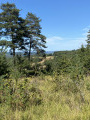
Maillol circular in Thonac

A walk around the “Thot Espace Cro-Magnon”. You’ll leave the village of Thonac and quickly climb 70 metres over a distance of 500 metres. The rest of the route is much less challenging.
You’ll make your way through the countryside, passing two viewpoints and two hamlets. You’ll pass close to the “Thot Espace Cro-Magnon”.

Details

40010781
Creation:
Last update:
Last review:
  • Walking
    Activity: Walking
  • ↔
    Distance: 5.83 mi
  • ◔
    Average duration: 3h 10 
  • ▲
    Difficulty: Easy

  • ⚐
    Back to start: Yes
  • ↗
    Ascent: + 522 ft
  • ↘
    Descent: - 492 ft

  • ▲
    Highest point: 728 ft
  • ▼
    Lowest point: 236 ft

Description of the walk

Thonac is situated on the Les Eyzies–Montignac D706 road.
From the village of Thonac, the signpost is in the car park of the village hall.

(S/E) Head towards Fanlac via the Allée des Platanes. Continue to the five-way junction with the Route de Salvetou.

(1) Take the track on the right towards Maillol and Les Chabannes. After 600 m, turn right, carry on and turn right again to reach a tarmac road in the hamlet of Les Chabannes.

(2) Follow the tarmac road to the left, pass through the hamlet of Maillol to reach a T-junction near the Thot Cro-Magnon.

(3) Turn left and follow the road straight on, ignoring one junction. Carry on to the next one on the Chemin du Thot.

(4) Carry on to the right. You’ll reach the crossroads known as the Quatre Chemins.

(5) Turn onto the path on the left, which branches off at a 90° angle. Take thefirst path on the left, then thesecond path on the left. You’ll reach a crossroads.

(6) Take the path on the left and carry on straight ahead, passing through the hamlet of Grigne until you reach the Impasse de la Borie. Follow this until you reach the Route de Jacquou.

(7) Turn left onto it and carry on straight ahead until you reach the starting point. (S/E).

Waypoints

  1. S/E : mi 0 - alt. 236 ft - Sign for the village hall car park - Vézère (rivière)
  2. 1 : mi 0.6 - alt. 266 ft - Route de Salvetout
  3. 2 : mi 1.33 - alt. 502 ft - Les Chabannes hamlet - Thonac (cours d'eau) - Affluent de la Vézère
  4. 3 : mi 1.89 - alt. 610 ft - T-junction – turn left
  5. 4 : mi 2.75 - alt. 689 ft - Chemin du Thot
  6. 5 : mi 3.09 - alt. 722 ft - Quatre Chemins crossroads
  7. 6 : mi 3.88 - alt. 646 ft - Crossroads, turn left - Auberoche (ruisseau) - Affluent du Thonac
  8. 7 : mi 5.18 - alt. 266 ft - Route de Jacquou - Thonac (cours d'eau) - Affluent de la Vézère
  9. S/E : mi 5.83 - alt. 236 ft - Sign for the village hall car park

Worth a visit

Reviews and comments

4.7 / 5
Based on 2 reviews

Reliability of the description
5 / 5
Ease of following the route
5 / 5
Route interest
4 / 5
User 6102070

Overall rating : 4.7 / 5

Date of your route : Jul 09, 2025
Reliability of the description : ★★★★★ Very good
Ease of following the route : ★★★★★ Very good
Route interest : ★★★★☆ Good
Very busy route : No

A pleasant hike that met our expectations. No particular problems.

Machine-translated

Brunolebelge
Brunolebelge

Overall rating : 4.7 / 5

Date of your route : Jul 06, 2024
Reliability of the description : ★★★★★ Very good
Ease of following the route : ★★★★★ Very good
Route interest : ★★★★☆ Good
Very busy route : No

Very easy to get to, a lovely walk, and it passes right by Thot Park

Machine-translated

Other walks in the area

For more walks, use our search engine .

The GPS track and description are the property of this route's author. Please do not copy them without permission.