Circular route north-east of Guillestre

A long circular day’s walk, which is a development of the hike I described in 2020 under the title ‘Around and North of Guillestre’.
For those who enjoy narrow paths and prefer to keep tarmac to a minimum.

Details

n°9002709
Creation:
Last update:
Last review:
  • Walking
    Activity: Walking
  • ↔
    Distance: 11.42 mi
  • ◔
    Average duration: 8h 15 
  • ▲
    Difficulty: Difficult

  • ⚐
    Back to start: Yes
  • ↗
    Ascent: + 3,448 ft
  • ↘
    Descent: - 3,455 ft

  • ▲
    Highest point: 4,770 ft
  • ▼
    Lowest point: 2,940 ft

Description of the walk

Park at the top of Guillestre, near the sports hall and the care home.

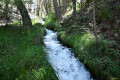
(S/E) Cross the avenue and take the path opposite which follows the Canal de la Chalp.

(1) Turn left up the street that crosses the Route du Queyras to join the Route de la Viste (closed to vehicles), which you should follow for 500 m.

(2) Turn right onto the path that leads to the Canal de Salvat (which has its source in the Ceillac valley).

(3) Follow it to the left to join a path at Les Terrasses and continue upstream.

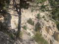
(4) Turn right onto a path that climbs and winds round a ravine before descending again and crossing the canal. The path is narrow and runs alongside a steep ravine, but it’s easy going if the path is dry and not slippery.
You can continue along the bank of the canal.

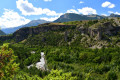
(5) Descend into a valley and then follow a small path at Gratteloup to reach the D 902 at the Maison du Roy, where you should turn right. Cross the road bridge over the Guil.

(6) Turn left onto the path towards theGR® and Gros.

(7) Turn left onto theGR®541, which leads to the hamlet of Gros and the Saint-Barthélémy Chapel.

(8) Head down a small, refurbished and secured path towards the Font d’Eygliers.

(9) Take the wide track for 300 m, then turn right onto a path that climbs up to a plateau and rejoins the wide track; follow this track to the left. Then turn right onto another wide track, crossing the Torrent de la Combe Loubatière.

(10) Follow the tarmac road opposite (Chemin de la Font) as far as the entrance to Eygliers. Walk round the Chapel of Saint John the Baptist.

(11) Turn right onto the right-hand branch of the path which joins the track running alongside the Guil; follow the path to the footbridge.

(12) Cross the footbridge and take the path straight ahead which climbs steeply towards Guillestre. Reach the Plateau de la Chalp. Walk alongside the canal of the same name and leave it after about 300 metres to reach a fountain.

(13) Turn right onto the small road (Chemin des Barnières) which leads back to the village. On the descent, look out for the Canal de la Chalp and its path on the left.

(14) Take the footpath which leads back to the sports hall car park (S/E).

Waypoints

  1. S/E : mi 0 - alt. 3,468 ft - Gym. Car park
  2. 1 : mi 0.21 - alt. 3,474 ft - Route de la Viste
  3. 2 : mi 0.84 - alt. 3,773 ft - Path on the right
  4. 3 : mi 0.97 - alt. 3,957 ft - Salvat Canal
  5. 4 : mi 2.26 - alt. 4,216 ft - Path upstream
  6. 5 : mi 2.75 - alt. 4,255 ft - Crossing the canal. Combe downstream
  7. 6 : mi 3.55 - alt. 3,445 ft - Path on the left. Near the - Guil (rivière)
  8. 7 : mi 4.73 - alt. 4,757 ft - GR on the left
  9. 8 : mi 5.44 - alt. 4,495 ft - The hamlet of Gros. Saint-Barthélémy Chapel
  10. 9 : mi 6.52 - alt. 3,356 ft - On the right
  11. 10 : mi 7.48 - alt. 3,570 ft - Route: Chemin de la Font
  12. 11 : mi 8.12 - alt. 3,353 ft - St John the Baptist Chapel
  13. 12 : mi 9.13 - alt. 3,012 ft - Footbridge over the - Guil (rivière)
  14. 13 : mi 10.53 - alt. 3,435 ft - Turn right onto the Chemin des Barnières
  15. 14 : mi 10.95 - alt. 3,435 ft - Chalp Canal
  16. S/E : mi 11.42 - alt. 3,465 ft - Gym. Car park

Notes

Water sources at Gros, Eygliers and the Guillestre plateau.
Sturdy footwear and walking poles recommended.
A map or GPS is essential.

Worth a visit

The pretty Saint-Barthélémy Chapel in the hamlet of Gros.
The Guil Gorges (kayaking).
The Vauban Fort at Mont Dauphin and the Main de Titan (rock formation).

Always be cautious and plan ahead when you're outdoors. Visorando and the author of this route cannot be held responsible for any accidents occurring on this route.

The GR® and PR® markings are the intellectual property of the Fédération Française de Randonnée Pédestre.

Reviews and comments

4.7 / 5
Based on 1 review

Reliability of the description
5 / 5
Ease of following the route
4 / 5
Route interest
5 / 5
Le Solognot
Le Solognot

Overall rating : 4.7 / 5

Date of your route : Aug 11, 2022
Reliability of the description : ★★★★★ Very good
Ease of following the route : ★★★★☆ Good
Route interest : ★★★★★ Very good
Very busy route : No

A lovely walk, with quite a bit of elevation gain, beautiful paths with stunning views, and very few people to be seen.
I’d recommend it if you’re in the area.

Machine-translated

Other walks in the area

For more walks, use our search engine .

The GPS track and description are the property of this route's author. Please do not copy them without permission.