Col Garnier from the hamlet of Gros

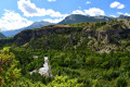
A lovely circular walk that will take you through varied landscapes overlooking the Guil Valley. From the Col Garnier, you’ll enjoy a bird’s-eye view of the Furfande chalets.
Moderator update as at 20/08/2020: Please note! Route change; see the notice from slax57 dated 20/08/2020

Details

2304457
Creation:
Last update:
Last review:
  • Walking
    Activity: Walking
  • ↔
    Distance: 10.08 mi
  • ◔
    Average duration: 8h 00 
  • ▲
    Difficulty: Difficult

  • ⚐
    Back to start: Yes
  • ↗
    Ascent: + 3,868 ft
  • ↘
    Descent: - 3,848 ft

  • ▲
    Highest point: 7,467 ft
  • ▼
    Lowest point: 4,544 ft

Description of the walk

Park above the hamlet of Gros.

(S/E) Follow the forest track north-east; it is marked in red and white, the colours ofthe GR®541. At a place called La Deuxième Batterie, you’ll come to a junction of paths in a bend near the Torrent de la Reynaude.

(1) Ignore the path on the left and continue along the track to Les Chalanches, where the track ends.

(2) Directly beneath the power line, take the path on the left, which is still marked in red and white. Reach and then cross the Torrent de la Valette further down (a tricky crossing). You’ll come to a spring gushing like a fountain.

(3) Continue eastwards. You will reach Les Girards.

(4) Cross them and arrive at a clearing near the Cabane du Touroudet.
.
(5) Continue through the mountain pastures to reach a plateau called Pré Fonza. A sign indicates 2,160 m.

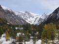
(6) Carry on straight ahead due north to reach Col Garnier, the highest point of the walk. Enjoy a lovely view of the Furfande chalets from here.

(7) Return along the same path to the previous junction.

(6) Turn onto the path on the right, cross several dry streams and reach a junction; take the path on the left which leads to the Cabane de la Valette (a former sheepfold).

(8) Continue down the path alongside the Valette torrent.
The path is sometimes covered with scree carried down by the stream. Keep heading south, then south-west. You will reach the crossing point over the stream.

(9) Cross it carefully via a sloping crossing. Continue the descent southwards along the right bank of the stream. You’ll reach another junction of paths.

(10) Turn right towards Grand Coulet; there is a yellow sign on the rock. You’ll reach another fork in the path.

(11) Take the steep shortcut on the left which leads back to the junction by the Reynaude stream taken on the way out.

(1) Turn right back onto the route you took on the way there to return via the forest track to the starting car park at Le Gros (S/E).

Waypoints

  1. S/E : mi 0 - alt. 4,544 ft - Car park above the hamlet of Gros
  2. 1 : mi 0.59 - alt. 4,747 ft - Crossroads on the circular loop
  3. 2 : mi 1.43 - alt. 5,194 ft - End of the track
  4. 3 : mi 2.27 - alt. 5,095 ft - Source
  5. 4 : mi 2.77 - alt. 5,459 ft - The Girards
  6. 5 : mi 3.74 - alt. 6,617 ft - Clearing
  7. 6 : mi 4.44 - alt. 7,103 ft - Pré Fonza
  8. 7 : mi 4.9 - alt. 7,467 ft - Col Garnier.
  9. 8 : mi 6.33 - alt. 6,804 ft - Cabane de la Valette
  10. 9 : mi 6.63 - alt. 6,545 ft - Crossing the Valette torrent
  11. 10 : mi 7.48 - alt. 5,758 ft - Towards Grand Coulet
  12. 11 : mi 8.74 - alt. 6,043 ft - Shortcut - Col du Grand Coulet (1865m)
  13. S/E : mi 10.08 - alt. 4,547 ft - Car park above the hamlet of Gros

Notes

You can reach Gros from Eygliers via a narrow but tarmac-surfaced road (the D37L, alsothe GR®541) which overlooks the Guil Gorges
Car park in the hamlet of Gros (1,385 m), at the start of the forest road.
At the start or finish, you can fill your water bottles at the fountain with its mushroom-shaped spout, situated in the centre of the hamlet.
Although there is a spring on the first part of the route (see description), it is advisable to bring enough water to last the entire walk.

Worth a visit

For history buffs, the hamlet of Le Gros has been in use since 1692: troops from Marshal de Catinat’s French army set up camp there to monitor and combat the army of the Duke of Savoy. From this high vantage point on the border with Italy, defensive batteries were installed there during the Second World War.
Today, let’s take the time to visit the Saint-Barthélémy Chapel and admire the sundials as we stroll through the streets of this picturesque site, which has been tastefully restored.

Always be cautious and plan ahead when you're outdoors. Visorando and the author of this route cannot be held responsible for any accidents occurring on this route.

The GR® and PR® markings are the intellectual property of the Fédération Française de Randonnée Pédestre.

Reviews and comments

4.3 / 5
Based on 2 reviews

Reliability of the description
4 / 5
Ease of following the route
4.5 / 5
Route interest
4.5 / 5
hotmelette
hotmelette
• Edited:

Overall rating : 4.3 / 5

Date of your route : Jul 18, 2026
Reliability of the description : ★★★★☆ Good
Ease of following the route : ★★★★★ Very good
Route interest : ★★★★☆ Good
Very busy route : No

Only 4 stars due to the difficulties around point 10. Even if you (absolutely must) avoid the section marked with a Yellow Cross, there are still two or three very difficult sections on a slope; I’d even say they’re quite dangerous (very narrow sections with slippery ground, even in dry weather).
It’s a shame, as the rest of the walk (97 per cent) is extremely pleasant, with no difficulties (no steep sections, no very steep climbs), and offers magnificent scenery.

For the less adventurous, and to avoid point 10, it is possible to return via the same route as the outward journey.

Alternative route 1: after Col Garnier, you can carry on to Col Saint Antoine. No difficulty, but it adds 45 minutes to the ascent.

Alternative route 2: it is possible to start this walk at the Maison du Roy rather than at Gros.

Machine-translated

grandin
grandin ★

Thank you for the information; I've added it to the description

Machine-translated

slax57
slax57

Overall rating : 4.3 / 5

Date of your route : Aug 10, 2020
Reliability of the description : ★★★★☆ Good
Ease of following the route : ★★★★☆ Good
Route interest : ★★★★★ Very good
Very busy route : No

IMPORTANT INFORMATION: Near point 10 on the route, you’ll come to a dangerous section on a slope. Apparently a diversion has been put in place; the sloping path is now marked with a yellow cross, and you must follow the “Grand Coulet” to take the diversion. Apart from the painted yellow cross, the original path still appears to be accessible, but it has become dangerous. We strongly recommend taking the diversion (which, unfortunately, isn’t signposted as such – it just looks like you’ve reached a junction; furthermore, the GPX track isn’t up to date and still follows the original path).

Apart from that, the walk is very pleasant and straightforward. It’s quite a climb, but you’re rewarded with magnificent views of the surrounding mountains once you reach the meadow at the summit. Much of the walk is shaded, allowing you to take breaks out of the sun.

Machine-translated

Other walks in the area

For more walks, use our search engine .

The GPS track and description are the property of this route's author. Please do not copy them without permission.