Country:

 City:
City:


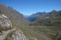
Head to the end of the Val di Rhêmes valley to the village of Thumel, where there is a large car park.
(S/E) Take the path towards the Benevolo refuge, following route 13 which climbs gently.
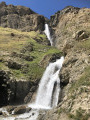
(1) After passing beneath a beautiful, large waterfall, turn right onto a path marked 13D (the start is not very visible but the path is very well signposted thereafter). Climb more steeply up the right-hand side of the mountain.
(2) At a fork in the road, keep to the right and continue the ascent (ignore the path that branches off to the left and descends towards the Benevolo refuge).
(3) At the next fork, carry straight on along route 13C (ignore the path branching off to the right towards Lac de Goletta). The climb levels out.
(4) Cross a stream, which may be dry. Continue straight on (south) through a very rocky area, with cairns and signposts clearly marking the path.
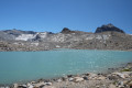
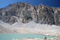
(5) At the Fork in the road, take the path on the right which leads to Lake Tsanteleina, at the foot of the impressive Granta Parei.
(6) Retrace your steps to the previous junction.
(5) Turn right and continue on route 13C towards the Benevolo Mountain Hut. Go round the Truc de Tsanteleina on the right and head towards the Fond and Lavassey glaciers. After a descent that is rocky at first and then through mountain pastures, you’ll reach the Benevolo Mountain Hut, still following route 13C.
(7) Continue the descent below the refuge along a track.
(8) Leave the track and head down a path that crosses it.
(1) At the junction you passed at the start of the walk, turn right. Follow the same route as on the way up, but in the opposite direction, to return to the car park (S/E).
 Visorando Member
 Association / Club / Walk leader
 Difficult
  Easy
Easy