


 Country:

 City:


To reach the start car park, from Saint-Claude head towards Ranchette, a small rural village situated between Chevry and Larrivoire. At the fountain on the main road, coming from Saint-Claude, turn left onto the Chemin des Trois Fontaines. Continue along this narrow, steeply ascending path and leave the village. At the junction, keep left onto the hairpin bend, which climbs steeply. The car park, marked out by large boulders, is situated on a right-hand bend.
(S/E) Set off along the forest track heading east. At the 90° bend, leave the forest track and continue along the path in the same direction for approximately 1.4 km. Walk past the Grange Quairon building, then continue across the meadow, following the clearly marked track on the ground (created by vehicle traffic) and skirting the edge of the woods. Once you reach the fir forest, walk for 200 m until you come to a small path branching off to the right.
(1) The marked path (Red Rectangle on two fir trees) leads you right into the undergrowth heading east. Please note: there are no signposts, but the path is clearly marked on the ground and easy to follow. Continue up a steep climb heading east for approximately 700 m, until you reach the Combe Mathieu forest road. Head left (north-west) along the forest road until you reach the mast.
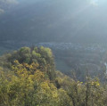
(2) At the Belvédère du Surmontant, return to the forest road and continue left along the path that runs alongside it. Follow the yellow markings and the signs pointing towards the Grotte du Maquis (or Grotte du Mont).
(3) At the Grotte du Maquis, by the flagpole standing on the path, you are below the cave. Climb up to it; it is situated about ten metres from the path. Then resume your walk, continuing to follow the yellow markings. Pass in front of the Granges du Mont and continue in this direction for about 400 metres.
(4) Leave the main path and turn left onto the small track heading north-west. Please note that from this point onwards, there are no markings. Use your GPS and map to guide you.
(6) Walk past a mud-pool used by wild boars, then past some stacks of firewood covered with tarpaulins.
(6) Continue to the right (west) along this forest track, which is clearly marked on the ground but not shown on the IGN map, until you reach its highest point, then head down the small path that leads south-west. Be careful: it’s a fairly steep, stony descent.
(7) At the bottom of the descent, you should see a fenced pasture and, at the far end of the pasture towards the north-west, the farm at a place called Aux Tappes. Cross the pasture and head towards the farm, skirting the edge of the woodland to spot the stream and the forest track it crosses.
(8) Leave the pasture to join the forest track, cross the stream and continue to the left, heading south-south-west.
(1) Cross the fir forest and continue south-west, following the ascent route in the opposite direction back to the car park (S/E).

 Visorando Member
 Moderate

 Easy


