Country:

 City:


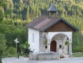
To reach the start, head towards the centre of Avignon-lès-Saint-Claude (39200). Once you reach Place du Avril, follow signs for Saint-Laurent, cross the bridge over the Bienne, then turn right at the roundabout. 150 metres after the level crossing, turn left towards Avignon-lès-Saint-Claude. Drive up to the village via the D303 (winding road). Turn right at the village entrance to reach the chapel and the car park at the start.
(S/E) From the small chapel, the route climbs (yellow markings) to the right of the chapel, along a road that joins an old track following the slope, lined first with ash trees, then boxwood and juniper. Ignore the road branching off to the right and continue in the same direction.
(1) At the hairpin bend on Rue de la Buissières, continue along the path heading west. At the junction with Chemin du Crozet, turn left and follow this path until thesecond left-hand bend.
(2) Take the forest track that climbs to the right, heading north. Carry on along this track, which is alternately muddy and stony, until you reach a flat stretch where the track veers to the right, heading north. At the T-junction with the Route Forestière Mayet, continue to the left, heading north-west, to reach the Grande Combe clearing, 700 metres further on.
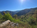
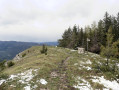
(3) Turn left onto a narrower path heading south-west; after a few short descents, this will take you to the Ponthoux viewpoint.
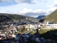
(4) Continue south on a narrow path, then along a pleasant stony track to reach La Bataille. At the T-junction, turn left and follow this track for 100 m, then turn right onto a narrower path, mostly carved out of the rock. Descend along this mountain-side path for 2 km. There are numerous vantage points offering views of the Bienne valley, the Plan d’Aier industrial estate and the Étables dam.
(5) At the Puits des Niais (reservoir), head slightly uphill to the left until you reach ‘Sur les Boutonnières’, the path leading to the pylon. Turn right to return to the village and the car park where you started, located at the end of the second street on the left (S/E).

 Visorando Member
 Difficult