


Refine your search for walks in Banyeres de Mariola
Banyeres de Mariola walks


 The Pic de la Blasca in Baneyres de Mariola, in the province of Alicante
 Visorando Member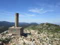
 7.39 mi
 +2,513 ft
 -2,500 ft
 4h 30
4h 30
 Moderate
 Departure from Banyeres de Mariola (Alacant / Alicante)
A hike to the highest peak in the Baneyres de Mariola area, a village in the Province of Alicante. Most of the route follows wide paths surrounded by meadows or trees. However, the majority of the elevation gain occurs over a short distance.
The route suggested here is known locally as the PR®-CV 313 (short for Pequeno Recorrido de la Comunidad Valenciana) and is signposted in white and yellow. It is easy to follow if you pay a little attention, as there are numerous signposts in addition to the coloured markings.
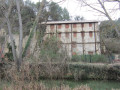
The Banyeres de Mariola Windmill Route
 2.97 mi
+164 ft
-167 ft
1h 30
2.97 mi
+164 ft
-167 ft
1h 30
 Easy
Departure from Banyeres de Mariola (Alacant / Alicante)
Easy
Departure from Banyeres de Mariola (Alacant / Alicante)
The Mill Trail offers an insight into part of the industrial history of the town of Banyeres de Mariola. This walk allows you to discover three flour and paper mills. There used to be many more. It follows the River Vinalopo through very pretty countryside. It is an easy walk suitable for the whole family.
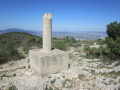
The peaks of the Sierra del Flare and Alt Redo towards Biar
 6.88 mi
+3,337 ft
-3,278 ft
6h 05
6.88 mi
+3,337 ft
-3,278 ft
6h 05
 Difficult
Departure from Biar (Alacant / Alicante)
Difficult
Departure from Biar (Alacant / Alicante)
A superb hike to explore several peaks over 1,000 metres high near the village of Biar in the province of Alicante. The spectacle of the surrounding mountains is fantastic, with their vertical cliffs. What’s more, the route follows part of a botanical trail, allowing you to learn more about the plants.
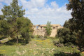
Mas de Tetuan from Font Roja near Alcoi
 3.50 mi
+932 ft
-902 ft
2h 25
Easy
Departure from Alcoi / Alcoy (Alacant / Alicante)
3.50 mi
+932 ft
-902 ft
2h 25
Easy
Departure from Alcoi / Alcoy (Alacant / Alicante)
In the Font Roja Natural Park, there is an easy hike to stretch your legs or enjoy with the family (but wear hiking boots), following wide trails through the forest.
Summit of La Replana and Font del LLop near Castalla
 6.26 mi
+1,660 ft
-1,647 ft
4h 20
Moderate
Departure from Castalla (Alacant / Alicante)
6.26 mi
+1,660 ft
-1,647 ft
4h 20
Moderate
Departure from Castalla (Alacant / Alicante)
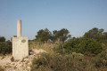
This is an easy hike, mostly on wide paths, to climb a peak at an altitude of 1,229 metres. The ascent is fairly gradual. You will pass by a superb snow well. Optionally, you can also visit a fountain.
The Carrasca snow well near Castalla
 3.50 mi
+784 ft
-787 ft
2h 20
Easy
Departure from Castalla (Alacant / Alicante)
3.50 mi
+784 ft
-787 ft
2h 20
Easy
Departure from Castalla (Alacant / Alicante)
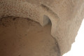
In the Alicante region, snow wells are called "pou" or "pou de neu" in the Valencian dialect. They are round wells dug into the ground with stone walls and a dome. There are usually two doors, one for putting snow in and the other for taking ice out. They are, of course, located at high altitude. The snow industry, which can be traced back to 1630, was very prosperous until the advent of refrigerators in the 1960s. Here we suggest a short, easy hike to discover one of the most beautiful snow wells in the region.
Pou del Canonge in Ibi
 7.21 mi
+1,289 ft
-1,283 ft
4h 25
Difficult
Departure from Ibi (Alacant / Alicante)
7.21 mi
+1,289 ft
-1,283 ft
4h 25
Difficult
Departure from Ibi (Alacant / Alicante)
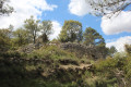
The word "pou" is Valencian and means snow well. This was a very important trade involving the manufacture of ice from snow, which was more abundant at that time. This activity, which began in the 16th or 17th century, came to an end in the mid-20th century with the advent of the refrigerator.This trail offers a chance to see the remains of the snow well known as del Canonge, but most of the route is off-trail and requires some mountain experience and good navigation skills. This hike is therefore only suitable for experienced hikers.
Please note: Due to the difficulty of navigating this route, it is strongly recommended that you use the app (or a hiking GPS)
Alt del Bubo and Alt de la Casa Castalla starting from Castalla
 8.02 mi
+1,273 ft
-1,273 ft
4h 50
Moderate
Departure from Castalla (Alacant / Alicante)
8.02 mi
+1,273 ft
-1,273 ft
4h 50
Moderate
Departure from Castalla (Alacant / Alicante)
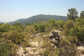
This hike takes you up two little-known peaks over 1,000 metres high near Castalla. Most of the time, you will be walking on wide paths lined mainly with almond trees in deserted areas.Prohibited during hunting season
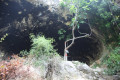
The caves of Agua, Olm and the summit of El Xocolate in Petrer
 5.24 mi
+1,663 ft
-1,657 ft
3h 50
Difficult
Departure from Petrer (Alacant / Alicante)
5.24 mi
+1,663 ft
-1,657 ft
3h 50
Difficult
Departure from Petrer (Alacant / Alicante)
This hike takes you up to one of the peaks in the province of Alicante, which is over 1,000 metres high. While the climb to the summit is not particularly difficult, the start of the hike involves exploring some well-hidden caves. This means passing through areas where there is virtually no path and having a good sense of direction. This hike is therefore not suitable for everyone.
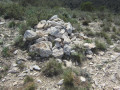
The Cabeço Redondo and Cabec Redo peaks as seen from Tibi
 4.57 mi
+2,415 ft
-2,425 ft
4h 10
Moderate
Departure from Tibi (Alacant / Alicante)
4.57 mi
+2,415 ft
-2,425 ft
4h 10
Moderate
Departure from Tibi (Alacant / Alicante)
This walk takes you to two peaks over 1,000 metres in altitude amidst fantastic scenery near Penya Mitjorn. It is a fairly short walk but has an elevation gain of almost 600 metres, which means the climb is quite steep right from the start and continues steadily.
The Mill Trail in Tibi
 3.29 mi
+607 ft
-449 ft
2h 05
Easy
Departure from Tibi (Alacant / Alicante)
3.29 mi
+607 ft
-449 ft
2h 05
Easy
Departure from Tibi (Alacant / Alicante)
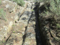
Here, we suggest exploring the old mills of Tibi, which once produced flour or paper. There were once as many as 11 mills in the area. You can see the main gate of the Groc mill at the crossroads at the entrance to Tibi. For your information, the rating established by the French Hiking Federation (FFR) gives an IBP of 22, which classifies this walk as ‘easy’.
It is an easy walk that generally follows the river known as the ‘Riu de Montnègre’ or ‘Rio Verde’.
The Mos del Bou and Moleta peaks near Tibi
 4.16 mi
+1,181 ft
-1,175 ft
2h 55
Difficult
Departure from Tibi (Alacant / Alicante)
4.16 mi
+1,181 ft
-1,175 ft
2h 55
Difficult
Departure from Tibi (Alacant / Alicante)
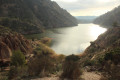
A superb hike with exceptional views of Lake Tibi and impressive peaks to climb. However, it is a difficult hike with some very steep climbs and a path that is quite difficult to follow.
A GPS track is essential to avoid getting lost.
Around Maigmó from El Aljibe near Agost
 7.11 mi
+2,904 ft
-2,730 ft
5h 50
Moderate
Departure from Tibi (Alacant / Alicante)
7.11 mi
+2,904 ft
-2,730 ft
5h 50
Moderate
Departure from Tibi (Alacant / Alicante)
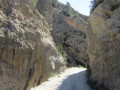
The Maigmó, at an altitude of 1,295 metres, is one of the region’s best-known peaks. However, this walk does not take you to the summit itself, but instead offers an extraordinary circuit around it. After a steep climb to the Balcon d’Alicante, where the view is fantastic, the walk takes you via the famous Col de la Xau, offering magnificent views of the peaks. You follow a barranco (a stream bed), passing through the superb spot known as ‘El Estret’. In short, everything is beautiful and practically in perfect solitude.
Climb up to the Ermita de Santa Barbara in Jijona
 1.54 mi
+259 ft
-259 ft
0h 55
Easy
Departure from Xixona / Jijona (Alacant / Alicante)
1.54 mi
+259 ft
-259 ft
0h 55
Easy
Departure from Xixona / Jijona (Alacant / Alicante)
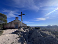
A little way from the historic centre and tourist routes, this short walk will show you the town of Jijona from a different angle through the eyes of the Ermita de Santa Barbara, a small 15th-century chapel, forgotten by all, perched on a hill of the same name. From its summit, you will not only have an unusual view of Jijona and its castle, but also of Alicante and the entire surrounding valley. Although there is a slight incline, this walk is relatively easy and accessible to all.
The summit of Escobella near Agost
 6.78 mi
+1,371 ft
-1,352 ft
4h 20
Moderate
Departure from Tibi (Alacant / Alicante)
6.78 mi
+1,371 ft
-1,352 ft
4h 20
Moderate
Departure from Tibi (Alacant / Alicante)
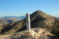
A hike in an almost desert environment to climb two peaks: La Mosca and L'Escobella. Don't forget to bring plenty of water, as the entire route is on paths exposed to the sun.
The Sierra de la Grana circular walk starting from Torre de les Maçanes
 6.60 mi
+1,217 ft
-1,217 ft
4h 05
Moderate
Departure from la Torre de les Maçanes / Torremanzanas (Alacant / Alicante)
6.60 mi
+1,217 ft
-1,217 ft
4h 05
Moderate
Departure from la Torre de les Maçanes / Torremanzanas (Alacant / Alicante)
The Sierra de la Grana is surrounded by much higher mountain ranges; as a result, it is somewhat overlooked and far less visited. But this makes it an excellent vantage point for all the region’s iconic peaks, such as Cabeço d’Or, Peña Migjorn, Menajador, Els Plans, Aitana, Puig Campana, etc. What’s more, the route is very pleasant and combines forest tracks, footpaths and lightly marked sections with no technical difficulties.
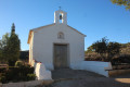
Ermita de las Cañadas in Elda
 5.17 mi
+367 ft
-374 ft
2h 40
Easy
Departure from Elda (Alacant / Alicante)
5.17 mi
+367 ft
-374 ft
2h 40
Easy
Departure from Elda (Alacant / Alicante)
The Ermita de Nuestra Señora de Los Dolores is situated in an area near Elda, at the crossroads between Monovar and Elda, in an area known as Partida de las Cañadas. Consequently, the Ermita is commonly referred to as the Ermita de las Cañadas. It is located in a former agricultural area, irrigated by rainwater.
Even today, it remains an almost desert-like area, and the path leading there, which is not particularly difficult, passes through desert-like terrain, offering a complete change of scenery.
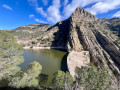
Tibi Dam from Sabinar
 9.04 mi
+1,788 ft
-1,781 ft
5h 45
Moderate
Departure from Sant Vicent del Raspeig / San Vicente del Raspeig (Alacant / Alicante)
9.04 mi
+1,788 ft
-1,781 ft
5h 45
Moderate
Departure from Sant Vicent del Raspeig / San Vicente del Raspeig (Alacant / Alicante)
This is a hilly hike that takes you to the Tibi Dam, one of the oldest dams in Europe (1580) still in operation, via a circular route through the surrounding hills. The route offers beautiful views of the coast at the start and finish, but overall, it is more typical of the "Sierra Alicantina" landscape. The route goes up and down quite a bit, but the slopes are not very steep or very long. It is therefore a relatively accessible hike for people with a minimum level of fitness.
The summit of Don Pedro in Salinas
 6.24 mi
+1,647 ft
-1,493 ft
4h 20
Moderate
Departure from Salinas (Alacant / Alicante)
6.24 mi
+1,647 ft
-1,493 ft
4h 20
Moderate
Departure from Salinas (Alacant / Alicante)
The summit of Don Pedro (Alto de Don Pedro) is a modest peak at an altitude of 817 metres, but it offers beautiful views of the neighbouring peaks such as the Sierra de Salinas and the Maigmo. You can walk along lovely, relatively easy paths and discover traces of an Iberian tribe. In short, it’s a spot well worth exploring.