Country:
 City:
City:


Park in the car park at Les Fonts de Mariola campsite; for directions, see the ‘Practical Information’ section.
(S/E) Walk back about a hundred metres along the road you’ve just come along. You’ll immediately see a sign by the roadside indicating “Cueva de Bolumini 2.1 kmPR®-CV370”. So, head in that direction – in other words, turn left. You’ll then come to a signpost indicating the direction of Cueva de Bolumini.
(1) As the walk described here doesn’t go there directly, we ignore this sign and instead turn right onto a wide path. At the junction with another very wide path, we turn left towards El Refugio. Then, at the next junction, we turn right and follow this wide dirt track through the pine trees, ignoring the various crossroads.
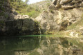
(2) In just under half an hour, you’ll reach the Font del Cerrer, also known as the Font del Cirer or the Font del Mas dels Arbres. You’ll notice that this spring feeds not only the large pool where you are standing but also a smaller pool that you may have spotted about a hundred metres earlier. You then continue along theGR®7.
(3) You leave the wide path by taking a narrower track on the left. This track becomes increasingly narrow and steeper, eventually leading to the Cava de Don Miguel, a monumental snow well dating from the 19th century, with a diameter of 14.5 m and a depth of 11 m.
(4) Walk carefully around it, as the well is in a state of disrepair, then follow thePR®-CV370 path marked with white and yellow markings. You’ll immediately reach a summit, the ‘Alt de la Cava’, at 1,077 metres.
Please note: from this point onwards, you’ll need a very good sense of direction, as the trail often becomes unclear, particularly amongst the rocks, and you’ll need to constantly look out for the next mark or small cairn. In my opinion, it’s absolutely essential to have the route map for this hike with you to avoid getting lost.
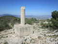
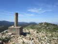
After a short climb over the rocks, where you’ll need to use your hands for support, you reach the summit of El Portin (around 1,090 m). This summit is easily recognisable as it features a triangulation point (a large cylinder on a cube) with a very large cairn beside it.
(5) You descend a little to rejoin the path and then, a short while later, make a very short detour to see the Cava de Portin (another snow pit). Be careful not to get too close to the large hole as there is no safety barrier.
(6) Here you need to leave the path you’re on and head towards the path visible a little further up, as there’s no real junction between these two paths. You then continue on your way and will find yourself walking along the ridge.
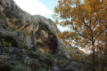
(7) You’ll pass close to a very large mushroom-shaped rock known as the Roca dels Taulellets (take the time to have a closer look). A little further on, you begin the descent and follow a circular route (you’ll come across a sign pointing to Cueva de Bolumini, 15 mins via thePR®-CV370) to visit the immense Bolumini Cave.
(8) The cave is 15 m high and 30 m deep. It was inhabited during the Neolithic period and the remains of an Iberian settlement have been found all around it.
After the visit, we complete the circular route by following the sign for “Senda des Ibers”. We then pass the sign mentioned a little earlier and begin the descent.
After a short while, you’ll leave the wide track to take the path on the right; then, further on, when you see the campsite, take the path on the left, which will bring you back very quickly to your starting point (S/E).


 Visorando Member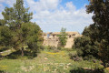
 Easy
Easy 
 Difficult