Country:
 City:
City:


The starting point for this walk is on Calle Pablo Sorozabal in Ibi, near Parc de les Hortes. To get to this starting point by car, see the ‘Practical Information’ section below.
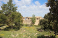
(S/E) From the park, walk up Calle Pablo Sorozabal, cross the road and continue along the street opposite. Then take the dirt track on the right. Pass a junction and take the path which, via some steps, leads to a small hilltop where the Ermita de Sant Miquel is situated.
(1) Retrace your steps and take the path opposite which, after passing two benches, leads into the woodland. Walk along the ridge and, at the bottom of the descent, turn right.
(2) Follow the dirt track alongside the fields, which turns into a lovely dirt track.
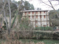
(3) You’ll come to a large building: this is Casa Fernova l’Alta, a former large farm and livestock holding. Pass to its left and continue along the path behind it.
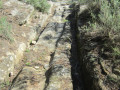
(4) At the junction, take the path on the left and carry on. After a while, cross the Valencia–Alicante gas pipeline: carry on straight ahead along a very narrow path. At first, the path is fairly easy to follow, but towards the end it becomes somewhat obscured by low vegetation and numerous fallen trees, forcing you to zigzag your way through. Try to follow a few signposts and blue markings on the ground: the GPS track helps you stay on course.
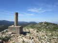
(5) You’ll reach the summit of Fernoveta (995 metres). It has a geodetic marker in the form of a cylinder resting on a cube, but because of the trees, you need to get quite close to see it. From the summit, follow the ridge towards a standing stone (like a small menhir). The path is clearly visible at first, then it becomes a bit overgrown, but there are cairns, small boundary markers and standing stones to help you keep your bearings. Towards the end, when you can see a road below, head to the left to find a spot where you can descend more easily onto this road (be very careful during these final metres). Follow it to the right for a short while.
(6) Please note: from this point onwards there is no longer a path, and the route ahead is only suitable for those with good hill-walking experience.
This point is situated opposite the entrance to a house. Go through the safety barrier and descend through dense vegetation over terraced ground; there is therefore a very steep drop between each terrace. You can continue to zigzag your way down. The GPS track is essential for finding a route.
(7) Reach the starting point for the ascent to the summit. This climb is steep and goes straight up over rocks. Reach the foot of the cliffs.
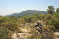
(8) Look for an easy route to reach the summit of El Castellet, popularly known as El Castell Vell, at an altitude of 907 metres, where the aerial masts are located. Then, following the track, tackle a steep descent with caution. This descent leads onto a wide path, signalling the end of the difficult sections of this route. Follow it to the right. You will then find coloured markings to follow. Pass by and admire a mill: the Molí de la Llapissera, and continue along the path. You’ll come out onto the CV-801 road; cross it and immediately leave it via a path on the left.
(9) Walk past a very beautiful wash house, then, as you head downhill, pass the Llavador dels Malats, dating from 1860. Then turn immediately right, following the water channel. Continue straight on along a tarmac path, then keep going straight on along a very pretty little path.
(10) Turn left onto a tarmac track, then a short distance further on, turn off onto the track on the right.
(11) Leave this track and head down to the left onto a path surrounded by fields.
(12) You’ll then join a road; follow it to the left. You’ll emerge at the bottom of the steps leading to the Ermita de Sant Miquel. Head left to return to where your car is parked (S/E).
 Visorando Member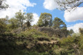

 Easy
Easy 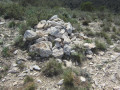
 Moderate