Country:
 City:
City:


The starting point for this walk is on Avenida Villena in Salinas.
To get to this starting point by car, see the “Practical Information” section below.
Note: the path is generally well-marked, but it does occasionally lose its way. Whilst there are sometimes cairns or markings at these points, if you want to avoid getting lost, I believe it’s essential to have a map with you – ideally the Visorando app – so you can check from time to time that you’re on the right track.
(S/E) Look out for the park gate (which serves no purpose as there are no walls nearby) and take the path just behind it, then take the first path on the right. Follow this path straight on as it runs alongside fields. You’ll come to a tarmac road.
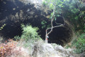
(1) Follow it to the left until it ends. Then head straight on towards a pump (with large pipes) and a small cave.
(2) Take the path on the left and follow it through the rocks; it disappears from view from time to time. This section is a bit tricky as you sometimes have to work out where the path goes by spotting as many cairns as possible, and you’ll also need to use your hands on the rocks. You should also use the map to help you find your way. The path becomes magnificent as you walk between two mountains forming natural walls.
(3) At the junction, take the path on the left. At the next fork, take the path on the left which goes uphill.
(4) Further on, take the path on the left, then, at the cairn, turn left again. The path climbs.
(5) At the pass, change direction and turn right. Follow the path, which climbs gradually, using the various cairns as guideposts. On the ridges (known as Lomas de Salinas), you must stay on the ridge line (here too, the path becomes a little unclear).
(6) In this area, several paths cross; here, take the path on the right. About a hundred metres further on, head slightly to the right. You will finally reach the summit.
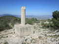
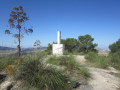
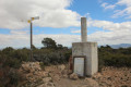
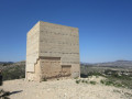
(7) El Caire, at an altitude of 1,049 metres. It is easily recognisable by its triangulation point, which consists of a cylinder on top of a cube.
But there are also signposts. One of these points towards Salinas (at 4,761 m, with an estimated walking time of 1 hour 15 minutes): this is thePR®-CV 159 path, marked with white and yellow markings.
Take this path for the descent. At the start, it is clearly marked with white and yellow markings; further on, by cairns. Initially, the slope is relatively gentle.
(8) Here, the slope becomes much steeper, even very steep, over small pebbles that tend to roll: take extra care.
(9) At this cairn, turn left. Further on, take the small path on the left and, very quickly, you’ll reach the Ermita San Isidro (at an altitude of 619 m), which is unfortunately currently in a state of serious disrepair, with a collapsed roof and completely covered in graffiti; you can barely make out its name.
(10) This is also where the Camino de la Ermita begins, though it is now a tarmac road that you should follow.
(11) Walk past the ‘area recreativa’ (a former farmstead built during the rural repopulation programme of the 1950s).
(12) Walk past La Cabana (a landmark of the town).
(13) You’ll come to a ‘Stop’ sign marking the entrance to the town. You’ll need to zigzag a little through the streets of Salinas to return to the starting point: carry on straight ahead, then turn left into Calle Maestro Serrano. At the end, turn right into Calle Nueva and finally, at the end of that, you’ll rejoin Avenida Villena, where you can park (S/E).

 Visorando Member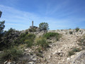

 Easy
Easy 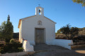
 Difficult