Walk from Gué du Rez d’Abran to Les Grandes Versennes

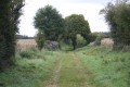
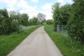
A pleasant walk across the Mellois plateau, exploring the cultural and natural heritage. This route takes you past the Gué du Rez d’Abran, which irrigates and drains the plain just a stone’s throw from the Bignon wetland, the Grandes Versennes water reservoir, the Fontaine spring, as well as the church of Sainte-Soline and traditional buildings. This walk takes place in a particularly peaceful and relaxing rural setting.

Details

n°1003432
Creation:
Last update:
–
Last review:
  • Walking
    Activity: Walking
  • ↔
    Distance: 7.59 mi
  • ◔
    Average duration: 3h 35 
  • ▲
    Difficulty: Moderate

  • ⚐
    Back to start: Yes
  • ↗
    Ascent: + 62 ft
  • ↘
    Descent: - 62 ft

  • ▲
    Highest point: 476 ft
  • ▼
    Lowest point: 404 ft
  • ⚐ Country: France
  • ⚐ City: Sainte-Soline (79120)
  • ⚑
    Start/End: N 46.246143° / E 0.035859°
  • ❏
    IGN map(s): Ref. 1728SB, 1729SB
  • Hour-by-hour weather

Photos

Description of the walk

Start at the Place de l’Église in Sainte-Soline.

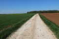
(S/E) With your back to the church, head to the right (west). Turn left into Rue de l’Église. Shortly afterwards, first turn left then right to follow the Chemin des Près Brain. At the last buildings, the road turns into a track. Follow the course of the Bignon at a slight distance, along the edge of a small wood and plots of land nestled in clearings.

(1) Turn onto the first path on the right. Cross the River Bignon, then turn left at a right angle. At the end, follow a small road to the left. You will reach the Gué du Rez d’Abran, which regulates irrigation of the plain.

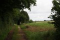
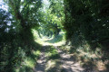
(2) Continue straight on along the road with caution and take the first path on the right. The path is lined with trees, on both sides at the start and then only on the right-hand side. At the next junction (elevation 124), turn right (south-south-west) and continue to follow the course of the Bignon at some distance.

(3) At the junction, turn left onto a track that starts by running alongside a small triangular copse on the right-hand side. Heading slightly uphill, cross an area of open fields known as Les Chagnasses. At the end, carefully follow the D15 road on the right.

(4) At the crossroads, turn right onto the path, which climbs slightly. At the end, follow a small road to the left for about twenty metres.

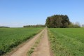
(5) Turn right onto a path lined with trees on the right-hand side. At the next junction (elevation 132), turn left. Walk alongside a small copse on your right and the Grandes Versennes on your left, an area of large fields bordered by hedgerows.

(6) Follow the D15 to the left towards Chez Duchêne and, after about twenty metres, turn right onto the path that cuts through a small wood. When you reach Pers, turn right onto Rue de l’Église.

(7) After about fifty metres, turn left onto a dirt track. Ignore Rue de la Chaume on your left and carry straight on along the dirt track until you reach the hamlet of La Fontaine.

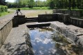
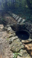
(8) Then turn left onto a small road and, at the Fork in the road that appears immediately, take the road on the right (there’s a magnificent, perfectly preserved washhouse and a very beautiful well that’s still in use). Ignore a road coming from the right and continue north. Then ignore a small road on the left, followed by another on the right.

(9) At the edge of the Bois de Magaud, turn left and follow the edge of the woodland on your right. The road soon becomes a track. At the T-junction, turn right.

(10) About two hundred metres further on, before the Bois du Fief Georges, take the track on the left. At the T-junction, turn left onto a small road and you’ll come to a crossroads (with a wayside cross).

(11) Turn right onto the D15 or Rue d’Aunis. Follow it carefully until you reach the junction with Rue de la Dive. Then turn left then right to return to Place de l’Église (S/E).

Waypoints

  1. S/E : mi 0 - alt. 413 ft - Place de l’Église, near the - Dive du Sud (rivière)
  2. 1 : mi 0.37 - alt. 407 ft - Junction, path on the right
  3. 2 : mi 0.91 - alt. 407 ft - Rez d’Abran ford
  4. 3 : mi 1.78 - alt. 417 ft - Crossroads
  5. 4 : mi 2.49 - alt. 440 ft - Crossroads, take the path on the right
  6. 5 : mi 2.95 - alt. 453 ft - Road–path junction
  7. 6 : mi 3.86 - alt. 466 ft - Junction of the path and the D15 road
  8. 7 : mi 4.18 - alt. 476 ft - Junction of Rue de l’Église and the footpath
  9. 8 : mi 4.36 - alt. 449 ft - La Fontaine
  10. 9 : mi 5.46 - alt. 430 ft - T-junction at Bois Migaud
  11. 10 : mi 6.1 - alt. 427 ft - T-junction
  12. 11 : mi 7.15 - alt. 420 ft - Road junction, D15 on the right
  13. S/E : mi 7.59 - alt. 413 ft - Place de l’Église

Notes

The car park is located at Place de l’Église

This walk across varied terrain requires suitable footwear. The second part of the route takes you through open fields. In strong sunshine, it is recommended that you bring water, a cap and sun cream.

This route is unmarked but does not present any real difficulties. Consequently, it is advisable to follow the directions in the description and on the map, whilst also paying attention to the landscape.

Hike completed by the author on 20 April 2018.

Worth a visit

Sainte-Soline
Sainte-Soline was a virgin and martyr from Poitou. Canonised by the Catholic Church, her feast day is 17 October.
There is no precise or reliable information about the life of Saint Soline. Some sources often date her to the late 3rd century, around 290. Others suggest that her martyrdom took place in the year 80.
She gave her name to the village of Sainte-Soline in Poitou and to the parish church there. She is said to have come to Chartres to make a pilgrimage to the Virgin Mary and to have died a martyr in that city. A stained-glass window in the Church of Saint-Pierre in Chartres depicts her.
Claire Sainte-Soline was the pen name of the École Normale supérieure graduate and writer Nelly Fouillet (1891–1967).

The commune of Sainte-Soline
This commune, situated in the south of the Deux-Sèvres department, lies at the heart of the Huguenot region that characterises the Bas Poitou. Numerous family cemeteries are scattered throughout this region.

Places and monuments
The church, listed as a historic monument since 5 November 1907.
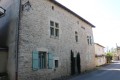
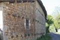
The Church of Sainte-Soline is one of the major churches of the Pays Mellois. Having lost its chancel, it dominates the square with its bell tower and porch. It stands in the heart of an ancient setting, very close to the Gallo-Roman road that linked Poitiers to Saintes.
Now a parish church, in the 12th century it was a priory dependent on the Abbey of Saint-Maixent. Later, records refer to the church as belonging to the Augustinian Abbey of Saint-Séverin-sur-Boutonne.
The Church of Sainte-Soline is the only parish church dedicated to this saint in the diocese of Poitiers. The life of Saint Soline began on the banks of the River Dive in the 1st century; she is said to have been martyred in Chartres. Her remains are said to have been buried there in the Church of Saint-Père.
The church was listed as a Historic Monument in 1907 for its Romanesque features.
The church has lost its sanctuary, which was probably originally an apse with a straight bay, destroyed during the Hundred Years’ War (14th and 15th centuries). The church, along with the village, was the victim of arson in 1348, carried out by a man named Moreau Audouin, a mercenary in the pay of the English garrisoned at Lusignan Castle. Was it at this time that the church lost its transept and chancel? Traces of this loss can be seen in the current flat chevet. The vaults, covered with slate slabs, withstood the fire. The town hall, formerly the presbytery, was rebuilt in 1861 on the site of the chancel, of which no remains are left.
The west façade, rebuilt in the 18th century, was originally a tripartite façade; the former blind arcades can still be discerned in the stonework. The bell-tower porch was rebuilt in the 13th century, a type of bell tower also found at the church in Clussais-la-Pommeraie.
Inside the building, there is a tripartite nave, comprising a central nave and two side aisles. What is striking here is the narrowness of these two side aisles, which undoubtedly served more as structural supports than as passageways.
The sculpture at Sainte-Soline does not follow the tradition of the Melle workshops, but constitutes a project in its own right. This is evident from the entrance, with this capital adorned with two busts (a man and a woman), unique in the sculpture of the Mellois region. Also worth noting is the care taken with the bases of the columns, one of the church’s distinctive features. Also worth noting is the curious holy water font near the high altar. It depicts a three-headed figure, with three faces sharing four eyes, which is unique in the region.

The Chapel of Our Lady, listed in the register of historic monuments.
The chapel was built between 1868 and 1869 and consecrated on 13 June 1869 to the Virgin Mary; capitals and corbels from the Notre-Dame de Bonneuil convent were reused on the façade; the church is currently owned by an association

The Montioux tumulus, a group of three tumuli with dolmen chambers, listed in the register of historic monuments.
Excavations were carried out between 1975 and 1981, during which bones, flint and pottery were discovered; all are on display at the Musée du Bougon. This site was occupied from 4600 BC (Middle Neolithic) until 1100 BC, i.e. the Iron Age, as objects from this period were also discovered there.
Further information:

Notable figures associated with the commune
In 1934, the writer Nelly Fouillet (Melleran 1891 – Paris 1967) adopted the pen name Claire Sainte-Soline.
Claire Sainte-Soline, born Nelly Fouillet on 18 September 1891 in Melleran and died on 14 October 1967 in Paris, was a French writer.
Between 1934 and 1967, she published around twenty novels, short stories, narratives and essays. Her first work earned the admiration of André Gide.
She sat on the judging panels for the Prix du Roman populiste and the Prix Femina. She served as vice-president of the PEN Club de France.
Legacy
In December 1996, an avenue in the Milaterie district of Niort was named after Claire Sainte-Soline.
The Niort Central Urban Library holds an archive collection dedicated to Claire Sainte-Soline.
On 14 October 2017, to mark the fiftieth anniversary of the writer’s death, the municipality of Melleran named its nursery and primary school after Claire Sainte-Soline. The commemorative plaques unveiled on this occasion quote the writer: ‘Every child possesses more knowledge than we realise, but it is knowledge that they struggle to draw from the depths and are still unable to express, for lack of words.’

The actress Anémone has a house there.

The Gué du Rez d’Abran watercourse
The wetland area of the Bignon stream, with its meadows and native tree species, provides a contrast to the plain irrigated and drained by the Étier du Gué du Rez d’Abran and an anachronistic copse of conifers

Pers
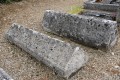
Pers, a small village with a small Romanesque church and a magnificent lantern of the dead in the cemetery adjoining the Church of Notre Dame (13th century), as well as some interesting medieval tombs of the former lords of Pers (5) adorned with geometric motifs, including one with diamond-shaped points
11th-century and 12th-century cemetery, tombs, lantern of the dead.

Reviews and comments

3.8 / 5
Based on 2 reviews

Reliability of the description
4.5 / 5
Ease of following the route
4 / 5
Route interest
3 / 5
Jean-Jacques Mongeaud

Overall rating : 3.3 / 5

Date of your route : Jan 26, 2026
Reliability of the description : ★★★★☆ Good
Ease of following the route : ★★★☆☆ Average
Route interest : ★★★☆☆ Average
Very busy route : No

Hello, It's an easy hike, with no elevation gain, but also no interest. There are three tricky passages to navigate given the current high water levels. Between points 1 and 2, you can still reach the REZ ford (it's more of a bridge) by continuing straight after point 1. Then between points 6 and 7, the trail is flooded twice. Sainte Soline is also a charming little village worth exploring. We followed the route using my GPS and did not see any signposts corresponding to the hike.

Machine-translated

philouis
philouis

Overall rating : 4.3 / 5

Date of your route : Jul 25, 2018
Reliability of the description : ★★★★★ Very good
Ease of following the route : ★★★★★ Very good
Route interest : ★★★☆☆ Average

A morning walk. Disappointed by the ford, which isn’t really a ford at all. It would have been nice and interesting to visit the villages of Pers and also Sainte-Soline. We crossed a lot of flat countryside, which lacked a bit of charm.

Machine-translated

Other walks in the area

For more walks, use our search engine .

The GPS track and description are the property of this route's author. Please do not copy them without permission.