Country:
 City:
City:


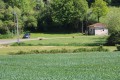
(S/E) Leave the car park and take the path that runs alongside the lake. A wind turbine is used to maintain the water level in the fish farming area.
The path continues along the River Dive, offering a view of the wash house at the foot of the bridge over which the D15 road passes. Join Rue de la Dive (D15). Turn right and follow the road with care.
Cross Rue de la Dive carefully and turn left into Rue de l’Église. Walk past Sainte-Soline Church (see the ‘During the walk’ section).
You’ll see a dovecote at Place de l’Église. Whilst walking through Sainte-Soline, you’ll also see a Hosanière Cross (1884) at the junction at the end of Rue de l’Église, a well and a few medieval houses.
Carry on straight ahead, and at the end of Rue de l’Église, turn left into Rue des Gasses. Pass Impasse des Gasses on your left and continue to the right.
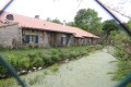
When you reach the square farmstead of Les Îles – a remarkable complex of buildings forming three sides of a generously proportioned layout – turn right.
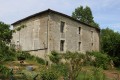
(1) At the next junction, turn right again into Rue du Logis. Before reaching Rue des Granges (the D55 road), you’ll see an old house. Turn right into Rue des Granges and drive along it with care.
Walk through the village, admiring some of the houses with their vaulted entrance porches and finely carved corner stones.
When you reach the D15 road (Rue d’Aunis), walk about a hundred metres to the left and back to explore the ruins of the old castle.
On your return, continue to the left along Rue de la Dive until you reach the junction with ‘Chemin des Près Brain’, almost directly opposite Rue de l’Église.
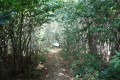
(2) Turn left onto the track known as Chemin des Prés Brain. This track becomes a farm track once you pass the last houses.
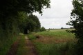
The track runs to the right, some distance away, alongside a branch of the River Dive and then the Bignon, an intermittent stream. It is lined with hedges and trees. Continue straight on along this track until you reach a small road.
Turn right onto this road and follow it carefully for less than a hundred metres.
Note: the Gué du Rez d’Abran is situated on this small road less than two hundred metres further on. The Gué du Rez d’Abran sluice is situated on the Bignon and helps to regulate the water in the irrigated and drained plain.
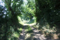
Turn left onto a farm track. The track runs alongside the intermittent stream known as the Bignon on the right-hand side for a short distance. The track is lined with hedges and trees.
(3) At the next crossroads, turn right onto a track. Continue straight on until you reach a small road.
(4) Turn right onto a farm track. As you cross the small bridge over the Bignon, the feudal motte of La Douve Ronde lies hidden 200 metres to the right, in the Petites Aubuges meadow.
The track passes close to the ruins of the Grandes Aubuges Convent on the right-hand side before climbing slightly. Continue straight on until you reach the Moulin à Vent promontory.
(5) Turn right and take a ridge path offering lovely views. This path heads north and joins a small road. Turn left onto it.
Cross the River Dive (a wetland area with several leats) to reach the hamlet known as Le Moulin de Germain, a building on your right.
(6) After crossing the Dive, turn right onto a farm track that runs alongside an intermittent stream.
Carry on until the farm track joins a small road. Turn left and follow the small road carefully for just over a hundred metres.
(7) Turn right onto a farm track. Shortly afterwards, turn right again onto a tarmac farm track which heads straight towards the hamlet of Champrimbault after rounding a copse.
At the end of the farm track, turn left onto a small road that serves the hamlet.
(8) Immediately after the buildings at Champrimbault, turn right onto a grassy track which goes round the hamlet before rejoining the small road. Carry on straight ahead towards the south-east.
Shortly afterwards, the road reaches a crossroads where four roads meet. Cross the road carefully and continue straight ahead to the hamlet of Moulin Petit.
(9) Turn left onto a small road leading to the neighbouring hamlet of “Les Maisons”.
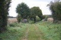
Before reaching Les Maisons, carry on straight ahead along a farm track with grass in the middle, which runs alongside the River Dive towards Sainte-Soline.
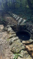
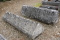
The track eventually runs alongside the Sainte-Soline cemetery before joining a small road which immediately leads onto the D15. At the entrance to the cemetery, Merovingian and Carolingian tombs stand alongside the graves of members of the Compagnons du Devoir; the tools of the butcher and the bricklayer are well represented.
Turn right onto the D15 and, about twenty metres further on, turn right again towards the lake.
Head for the car park, which marks the end of this walk (S/E).

 Visorando Member
 Easy
Easy