In the vicinity of the Benedictine Abbey of Les Alleuds

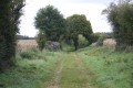
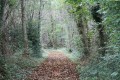
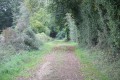
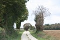
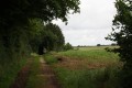
This walk takes you along the path used by the people of Melleran to reach Les Alleuds via ‘le Chemin de l’Abbaye’. The route takes you through the Bois du Juge, past the villages and their limestone buildings characteristic of the Pays Mellois, whilst also allowing you to discover a rich heritage of trees: lime, chestnut, oak and walnut, amongst others.
For your information, the word ‘alleu’ dates back to the 10th century and refers to land without a lord.

Details

782662
Creation:
Last update:
Last review:
  • Walking
    Activity: Walking
  • ↔
    Distance: 7.25 mi
  • ◔
    Average duration: 3h 20 
  • ▲
    Difficulty: Moderate

  • ⚐
    Back to start: Yes
  • ↗
    Ascent: + 26 ft
  • ↘
    Descent: - 26 ft

  • ▲
    Highest point: 561 ft
  • ▼
    Lowest point: 512 ft

Photos

Description of the walk

The car park is located in front of the Alleuds cemetery.

(S/E) Leave the car park in front of the cemetery via the road, Impasse de l’Abbaye, which leads towards Les Alleuds. Cross the D110 road with care and continue straight on to Les Alleuds via Rue de la Tonnelle (D111). At a right-hand bend, take the second path on the left, which heads south after passing several properties and houses.

Further on, it joins another track, which you take by turning right. Continue straight on to Rue du Verger, arriving at La Gaillochonnière. The village square is adorned with lime trees; the prettiest one, though ‘slenderer’ than the other lime trees on the route, still boasts a respectable circumference of 3.5 metres!

At the junction with Rue du Tilleul, turn left, then right onto Route de Chef-Boutonne (D110), which you follow for just over a hundred metres.

(1) Cross the Route de Chef-Boutonne and take the road on the left, then the farm track on the right. Carry on straight ahead: shortly afterwards, the track runs alongside the Bois des Folles (on your right). At the junction with a farm track, admire a magnificent lime tree, several centuries old, with a circumference of over 4 metres. Continue to the right along the track at the edge of the Bois des Folles.

(2) Cross a farm track and continue almost directly opposite along the path. The farm track you have crossed leads to the hamlet of Les Ouchettes, whose residents – farmers – are helping to restore a network of hedgerows as part of a project launched in the Sauzé-Vaussais district in 1990. Further on, the path runs alongside the Bois Robert on your right.

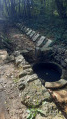
(3) At the crossroads, turn left. The path runs along the edge of the Bois de Prenan (private), which occupies a small hollow whose base lies about 15 metres below the surrounding land. This is one of the many small hollows or sinkholes characteristic of a karst landscape. Runoff water, rich in carbonic acid, has dissolved the calcium carbonate that makes up the limestone, causing underground subsidence.

At the end of the Bois de Prenan, take the path on the left (leaving a road on your right) and, at the next junction, turn right onto a farm track. When this farm track joins a road, continue along the farm track, which bends sharply to the left.

(4) At the next junction, turn right onto the Chemin des Grandes Rivières towards Mandegault.
When you reach the first houses, turn left onto Rue des Nougerats, with its beautiful renovated houses. The road gives way to a track shortly after the last house.

Carry on straight ahead until you reach the Route des Alleuds (north of Melleran). As you approach, take care as the building on the right before the junction is a sawmill with its storage area on the left-hand side of the track. Cross this area with great caution as trolleys carrying heavy logs are in use.

(5) At the junction, turn left and immediately take the right-hand road at the ‘Y’-junction.
Before a large building, turn right onto a track that joins Rue de l’Abbaye at a place called La Ballerie. On reaching it, turn left and take a forest track heading north. This is where the old track known as the “Chemin de l’Abbaye” began, which the inhabitants of Melleran used to reach the Abbaye des Alleuds in its heyday. Further on, the track runs along the edge of the Bois des Prises before joining a road leading to La Chevrelle, where you turn left.

(6) Turn onto the track to the right of the road. The track soon crosses the Bois de Chevrelle, then the Bois du Juge (see the section ‘During the walk or nearby’). Continue along the main track until you reach a farm track (passing three tracks on the right and one on the left).

(7) At this four-way junction, take the left-hand path, which soon leads to a road. Cross the road and continue straight on until you reach the D110. Turn right and, at the next junction, turn right again into Impasse de l’Abbaye. Turning right takes you back to the car park marking the end of this walk (S/E) .


Waypoints

  1. S/E : mi 0 - alt. 535 ft - Opposite the Alleuds cemetery
  2. 1 : mi 0.87 - alt. 554 ft - T-junction
  3. 2 : mi 1.98 - alt. 548 ft - Crossroads
  4. 3 : mi 2.45 - alt. 541 ft - Turn left towards Bois Prenan
  5. 4 : mi 3.44 - alt. 528 ft - T-junction
  6. 5 : mi 4.44 - alt. 515 ft - Path–road junction
  7. 6 : mi 5.57 - alt. 531 ft - Road–path junction
  8. 7 : mi 6.49 - alt. 548 ft - Crossroads where four paths meet in an X-shape
  9. S/E : mi 7.25 - alt. 535 ft - Opposite the Alleuds cemetery

Notes

This walk across varied terrain requires you to wear very suitable footwear.

This walk is largely signposted with yellow markers, but not necessarily near Melleran, where other walking routes may intersect.

Worth a visit

The Benedictine Abbey of Les Alleuds
Of the former Abbey Church of Notre-Dame, once vaulted and now greatly reduced in size, only the nave and the portal remain. Inside, of note are the recumbent effigy of Abbot Guillaume, who died in 1318, the baptismal font and
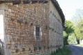
the 13th-century stone altarpiece. During excavations, a 16th-century semi-circular vaulted cellar was uncovered, a few metres from the church. Numerous remains of the original building can be found in neighbouring houses, notably in the farmhouse near the site, where you will notice the small door surmounted by a carved and dated coat of arms.

Its history
According to the cartulary of the Abbey of Notre-Dame des Chatelliers, it was founded by Giraud de Salles in 1120, a monk whose numerous foundations were mostly affiliated with the Cistercian Order after his death.
It became a priory-parish in 1715, whilst retaining the title of abbey.
During the French Revolution, it was sold as national property and was subsequently partially destroyed (in particular, it lost its entire Romanesque chancel). All that remains today is a small single-nave church ending in a flat wall.
The abbey’s distinctive décor suggests that its construction was linked to that of the Church of Saint-Hilaire in Melle.
A drawing by Arthur Bouneault of the Abbey of Les Alleuds depicts a small pediment carved in relief from a semi-cylindrical stone measuring 1.25 metres in circumference, 0.85 metres in height and 0.10 metres in radius. It is surmounted by a shield bearing… three squirrels of… arranged 2 and 1, the shield surmounted by an abbatial crozier and set within a Renaissance-style cartouche. At the base of the pediment is engraved the inscription:
‘COR MONDUM CREA IN ME DEUS 1573’: ‘God created (or an abbreviation of creavit) the world within me, 1573’.
‘Cor’ here does not mean ‘heart’. It is a reference to the Second Epistle to the Corinthians. ‘Mondum’ is, of course, a mistake for ‘mundum’. The full quotation is as follows:
‘For God was in Christ, reconciling the world to himself, not counting their trespasses against them, and he has committed to us the message of reconciliation.’
The stone is currently on display in the cemetery at Chef-Boutonne on the grave of a private individual

The Judge’s Wood
It is said that a tragicomic incident took place in this wood in 1560, which gave it its name. It is recounted in the book *Sauzé and its surroundings – from prehistory to 1789* by Jean-Luc Audé.
A lawyer for the king, Michel Le Riche, recounts in his diary an attack on royal officers: “La Ronde, an occupier and self-styled Lord of Mesleran, accompanied by five men, all armed with breastplates, pistols, maces, swords and daggers, emerged from the Bois des Alleux and engaged in combat on both sides”. This resulted in the death of a man (the aforementioned La Ronde) and horses, and several injuries to those attacked. Today, one can walk through the Bois du Juge in complete peace!

Sauzé-Vaussais
Vignaud Dovecote:
Owned by the Coulleau du Vigneau family in 1463, this dovecote formed part of the buildings of the Royal Post Office at Sauzé.
Featuring an original architectural design, the Royal Post Office’s dovecote consists of a square base, pierced by four semicircular arches. The keystone is finely carved with the coat of arms of the Coulleau du Vigneau family.
The upper storey, containing 260 nesting boxes, is octagonal in shape and features an entrance door framed by four coats of arms that are indecipherable, having been hammered away during the Revolution. The pigeons entered via the two roof hatches, which were originally open to the south-west and north-west.
The ruins of the dovecote were donated to the local council in 1993. Clearing and dismantling work began in early November 1993 and was completed in late December 1996. It was transported and reassembled in 1999 on the RD948 bypass. Part of its vault was deliberately left gaping open to reveal the terracotta nesting boxes and the chestnut timber framework.
The local council acquired and cleared a small adjoining woodland, and the site of the dovecote has been converted into a rest area.

Clock Tower:
The Clock Tower was built in 1840. It was the focal point of the Market Halls, which housed the town hall and magistrates’ court on the first floor.
It was around 1824 that the residents of Sauzé and the merchants called for the installation of a clock.
In 1839, the town council decided to build a square tower to house the famous municipal clock. However, the council eventually abandoned this plan in favour of constructing a town hall and magistrates’ court within the market halls, along with a bell tower (the current tower).
Later, at the start of the 20th century, the halls were demolished and only the tower was preserved

The Market Halls:
The old market halls, a timber-framed building with a tiled roof, were situated on the market square; these were demolished in the early 20th century.
In 1870, on the site of the current socio-cultural centre, the foundation stone was laid for the Halle aux blés, or grain market. Having suffered initial damage in February 1935 following a storm, it was completely destroyed in June 1944, during the war.
The new market halls, built in the early 1950s, were funded by the state following the war damage.
Several rooms were later fitted out on the upper floor, and the market halls were renamed the Socio-Cultural Centre.

Reviews and comments

4.8 / 5
Based on 2 reviews

Reliability of the description
5 / 5
Ease of following the route
5 / 5
Route interest
4.5 / 5
ppsb
ppsb

Overall rating : 5 / 5

Date of your route : Apr 21, 2021
Reliability of the description : ★★★★★ Very good
Ease of following the route : ★★★★★ Very good
Route interest : ★★★★★ Very good
Very busy route : No

A lovely walk, with no oncoming traffic, plenty of trees and very pleasant scenery; no difficulties apart from the fact that it might be a bit long. 😊👍

Machine-translated

pgetrochon
pgetrochon

Hello,

This walk is classified as moderate in difficulty because it is over 10 km long; otherwise, it is actually quite easy throughout. This is a convention that a moderator pointed out to me when I first started suggesting walks on Visorando.

Kind regards

Machine-translated

Azimut71
Azimut71

Overall rating : 4.7 / 5

Date of your route : Jun 26, 2018
Reliability of the description : ★★★★★ Very good
Ease of following the route : ★★★★★ Very good
Route interest : ★★★★☆ Good

At Les Alleuds cemetery, you can park … one vehicle; however, it is possible to park along the access road.
The route is clearly marked in yellow. Whatever some people may say, signposting, if done properly, provides extra guidance.
There are still plenty of trees, both within and outside the hedgerows, providing pleasant patches of shade along the route.
However… from point (6) to the middle of the Bois du Juge, forestry machinery has severely damaged the path, which is nevertheless passable on foot in dry weather (but not by bike).
In my view, the difficulty level is easy.

Machine-translated

Other walks in the area

For more walks, use our search engine .

The GPS track and description are the property of this route's author. Please do not copy them without permission.