Country:
 City:
City:


Start from the car park at Sepvret cemetery.
(S/E) Leave the car park by carefully taking the D108 road westwards, towards Sepvret.
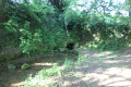
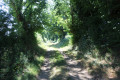
Walk to a tree-lined clearing, take the Chemin du Marronnier on the right and, shortly afterwards, turn right onto a narrow track which almost immediately becomes a small footpath. Follow the footpath downhill, straight on, to the Fontaine du Bireau.
(1) Start walking back up the path and turn onto the first track on the left, which joins a small road.
When you reach it, turn left and follow this quiet road, which ends at a place called Le Grand Moulin.
Carry on straight ahead along the farm track that follows on from the small road until it begins to climb to the right at a right-angled bend.
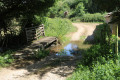
(2) Turn left into an open grassy area on the banks of the Sèvre Niortaise and cross the bridge.
Carry on along the narrow path, which soon begins to climb and leads towards a second fountain on the right, the Brunetière. This section can be wet in very rainy weather as the path also acts as a drainage channel for heavy rainfall.
After the fountain, continue up the path to a crossroads at the edge of the woods.
Turn left onto the farm track heading west, which leads in a straight line to the hamlet of Circé.
(3) At the corner of the first property on the right – after you have passed it – turn right and follow the farm track which runs alongside the property wall and then passes between farm buildings (permission to walk through granted by the farmer – see practical information –).
The farm track turns at the corner of the first building on the left. Then turn onto the farm track that branches off to the right, heading north. This runs alongside a building on your left.
Carry on straight ahead until you reach an area where the farmer stores silage. Go round it on the right and head uphill to a junction with a farm track.
Cross the farm track and continue straight on along the grassy farm track heading north-east.
Follow it straight on until you reach the hamlet of La Granerie.
On arrival, the track turns into a small road. At the first junction, turn left and carry on straight ahead until you leave La Granerie and quite soon reach a T-junction with a small road.
Turn right and continue for about fifty metres, until the road takes a right-angle bend to the left.
(4) Take a grassy farm track on the right which descends towards the Ruisseau de Fonblanche.
When you reach it, turn right and follow the stream for a few metres until you come to a pretty little bridge, then cross the stream.
After crossing it, take the path that climbs steeply up through the Bois du Côteau. At the top of the climb, it comes out at a junction of farm tracks.
(5) Turn right onto the farm track that runs alongside the Bois du Côteau (this is theGR® 655 or the Way of St James).
Follow it straight on to the hamlet of Chassandré (hard to spot as there is only one building) before beginning a steep descent towards the hamlet of Foucault. On arrival, the forest track gives way to a small road serving the hamlet.
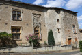
Here, you can admire various remarkable old houses, in particular a 16th-century dwelling featuring, amongst other things, a very beautiful window.
After passing the house on your left, turn right onto the small road leading downhill and, immediately afterwards, turn right again to cross the Ruisseau de Foucault shortly afterwards.
The small road climbs up to a T-junction with another road.
Turn right and follow this very quiet road with care; it runs alongside the woodland on your right and leads to the hamlet of La Maisonnière, where you can see fine examples of traditional Poitou architecture.
Cross through the hamlet and continue along the farm track which follows on from the small road.
Carry on to a junction of farm tracks.
(6) Turn left and take the farm track leading towards the junction with a small road known as la Croix du Chemin Vert. Continue straight on towards Brégion.
Carry on to the junction with the road leading to Brégion: you’ll reach it after passing a farm and a house on your left.
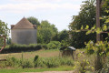
At the crossroads, look out for the fully restored Brégion Dovecote on your right (a place of interest to visit off the route).
The route leaves theGR® 655 here.
(7) Turn left onto the road, walk past an old farm building and, about a hundred metres further on, turn right onto a downhill farm track.
It passes over a spring and the remains of an old swimming pool (?) before crossing the Sèvre Niortaise at a place called La Serpe.
The track then climbs again. Follow it to a small road and a crossroads immediately beside it.
(8) Turn right and follow this small road carefully to pass through the hamlet of La Ripaudière and continue towards Faugerit.
Please note that the farm track on the left, whilst clearly marked at the start, is subsequently impassable as the farmer has incorporated it into his field and is ploughing it! Consequently, it is best to follow the road.
Once past the first houses in Faugerit, the road reaches a crossroads; turn right and, about fifty metres further on, turn left onto a farm track.
This leads onto a small road in the centre of Faugerit. Continue straight on along the road known as the Chemin de Saint-Jacques.
At the junction with the Chemin de l’Engachet, carry on straight ahead until you reach the junction with the D108.
(9) Cross the D108 road with care and take the farm track opposite, which heads towards a telecoms pylon.
In front of the pylon, the farm track turns sharply right, then crosses the plateau.
Continue to the T-junction. Turn right onto a shaded farm track. Follow it to the first junction with a farm track on the right.
(10) Turn right and follow this track, which runs alongside some recent livestock farm buildings, just before joining the D108 road.
Turn right and follow the D108 road with care to reach the nearby car park, which marks the end of this walk (S/E).

 Visorando Member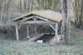

 Easy
Easy