Discovering the heritage of Poitou between Chenay and Breuil

Two towns, Chenay and Brieuil, enjoyed their heyday in the Middle Ages: they retain a rich heritage from that period. This walk offers a glimpse of these two towns as well as the plateau through which the Sèvre Niortaise has carved its course.

Details

938414
Creation:
Last update:
Last review:
  • Walking
    Activity: Walking
  • ↔
    Distance: 5.84 mi
  • ◔
    Average duration: 2h 45 
  • ▲
    Difficulty: Easy

  • ⚐
    Back to start: Yes
  • ↗
    Ascent: + 98 ft
  • ↘
    Descent: - 102 ft

  • ▲
    Highest point: 430 ft
  • ▼
    Lowest point: 328 ft

Photos

Description of the walk

The start is at the car park in front of Chenay Church (on the D950).

(S/E) Cross the D950 with care (at the pedestrian crossing) and head northwards. Turn right onto Rue des Pélerins (GR®655). Continue along this street, turning left to rejoin the D950.

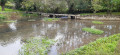
(1) Walk back about thirty metres along the D950, then cross it carefully to take the small road opposite leading towards the hamlet of Le Petits Puits. On arrival, walk along the left-hand side of the Petit Puits pond, the only remaining water source from days gone by. Then turn right onto the D307.

(2) Take the first path on the right. Ignore a path branching off to the left and carry on straight ahead, slightly uphill. At the T-junction, turn left. Do the same at the next junction, and head downhill.

(3) At the junction, carry on straight ahead. Further on, cross the D307 and continue straight ahead along the path, which slopes gently downwards. You’ll reach the hamlet of Les Champs Bons near the Sèvre Niortaise.

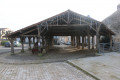
(4) Continue straight on along the path, which climbs slightly, keeping the Sèvre Niortaise river some distance to your left. The path then descends gently towards the village of Brieuil (Logis de Brieuil, private property). Take Rue du Lavoir as far as the Route de la Sèvre Niortaise (Brieuil’s very distinctive wash house; see the ‘During the walk’ section).

(5) Turn left onto the Route de la Sèvre Niortaise and walk uphill through a residential area. Take the first left, Rue du Logis. At the junction, turn right onto Rue du Marronnier.

(6) At the next junction, follow Rue des Parsonneaux to the left and leave Brieuil. The route then follows theGR®655(as far as Chenay). When the road bends to the left, take the path branching off to the right.

At the first junction with a farm track on the right, where the small road bends, turn right onto this track. Cross the Ruisseau de Foucault and you’ll immediately come to a junction.

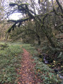
(7) Then turn left. Next, take the first path on the right, passing between two wooden gates that block it. The well-shaded path joins a small road.

(8) Turn left, cross the Sèvre Niortaise and, at the Fork in the road a few metres further on, continue along the left-hand track. Join a small road and follow it to the right towards the first houses in Chenay. Let theGR® head off to the right; continue straight on along the road, then turn right onto Rue de la Mare. Turn right before the D950 to return to the car park (S/E).

Waypoints

  1. S/E : mi 0 - alt. 427 ft - Car park near the church along the D950 - Chenay
  2. 1 : mi 0.22 - alt. 404 ft - D950 junction – minor road
  3. 2 : mi 0.59 - alt. 394 ft - Start of the path
  4. 3 : mi 2.01 - alt. 371 ft - Crossroads
  5. 4 : mi 2.89 - alt. 344 ft - Les Bons Champs
  6. 5 : mi 3.45 - alt. 328 ft - Rue du Lavoir – Route de la Sèvre Niortaise - Fontaine de Brieuil (Exoudun)
  7. 6 : mi 3.69 - alt. 351 ft - Crossroads
  8. 7 : mi 4.5 - alt. 358 ft - Ryisseau de Foucault
  9. 8 : mi 5.01 - alt. 361 ft - Crossroads near the - Sèvre Niortaise (fleuve)
  10. S/E : mi 5.84 - alt. 427 ft - Car park near the church along the D950 - Chenay

Notes

This walk across varied terrain requires suitable footwear.

The route is largely signposted in yellow and/or blue, as it is based on a route published by the Deux-Sèvres Department, the Pays Mellois, etc., under the title ‘Chenay – discovering our heritage’. The published route corresponds to the short alternative route (8 km).
Nevertheless, it is advisable to follow the instructions in the route description and on the map, whilst also observing the landscape along the way.

Alternative route
At (2), turn left onto the farm track and continue straight on towards (3), heading west. The route is then approximately 8 km long.

Hike completed by the author on 1 May 2018

Worth a visit

Chenay:
The 12th-century Church of Notre-Dame de Chenay has a richly decorated entrance porch. Three pointed archivolts are covered in carvings. The small columns feature, amongst other things, animals. To visit, ask for the key at the hotel.
The canton of Chenay, established in 1790, had its administrative centre transferred to Lezay by a royal decree of 1831.

The Logis de Brieuil:
The seigneury of Brieuil is first mentioned in the 12th century. In 1461, it was described as a fortified house. Defensive features of the north wing of the outbuildings, part of the main house and the dovecote – which has lost its upper storey – may date from this period. In the early 17th century, the Garnier family had the present-day main house built, featuring a return gallery to link the main building to a circular tower, which was demolished in 1831. The family’s coat of arms is carved on the doors of the main residence and the dovecote. In the 18th and 19th centuries, the outbuildings and annexes were refurbished. The dates 1708 and 1836 are inscribed on a door and a roof structure respectively. The main building, outbuildings and annexes feature long-pitched roofs with covered gables, covered with hollow tiles. The gallery and tower have long-pitched hipped roofs covered in slate. The three superimposed rooms of the dovecote are topped with flattened domes.

The Brieuil washhouse:
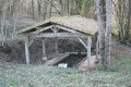
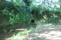
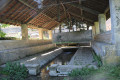
The Brieuil washhouse, situated in the commune of Exoudun, is located in an unusual spot, at the bottom of a pit approximately 6 metres deep. The term ‘gouffre’ (chasm) or ‘trou’ (hole) of Brieuil is also often used to refer to this washhouse, situated below the level of the Sèvre Niortaise.
Unusually, this hole, dug to a depth of 6 metres, revealed the presence of a spring. Subsequently, the local council decided to convert the bottom of the excavation into a washhouse. A well was also dug at the surface’s edge of the gouffre, in order to reach the resurgence directly and gain direct access to the water flowing from the spring.
During periods of heavy rainfall, and when the water table and underground passages are no longer sufficient to absorb the entire inflow of water, the chasm fills completely to the surface (6 metres high) and discharges its excess water directly into the Sèvre Niortaise.
The reverse is also true: during heavy rainfall, floodwaters from the Sèvre frequently flow into the washhouse.

25 July 1858: The parishes of Exoudun and Chenay (both owners of the pit) commissioned two local stonemasons to build a retaining wall for the existing well and to construct a two-row washhouse at the bottom of the pit after the rubble had been cleared away. The opening, measuring approximately 1 metre by 1 metre, cut into the base of the washhouse and providing access directly to the well, also dates from this period
Source: La Laverie de Breuil

In 1968, the Brieuil chasm was apparently partially filled in, though it is not known why.
26 July 1969: Marking of the Brieuil chasm (Exoudun) by B. Coirier; reappearance at the bubbling spring (Exoudun) the following day.
Source: Sous les Deux-Sèvres (CDS 79).

In 2006, the wash house was restored by volunteers from the ‘Avenir et Patrimoine de Brieuil’ association with the help of the municipality of Exoudun. This restoration work revealed the wash house’s original threshold and the resurgence of the spring.
Source: Le Chenayou.

Always be cautious and plan ahead when you're outdoors. Visorando and the author of this route cannot be held responsible for any accidents occurring on this route.

The GR® and PR® markings are the intellectual property of the Fédération Française de Randonnée Pédestre.

Reviews and comments

4.4 / 5
Based on 3 reviews

Reliability of the description
4.3 / 5
Ease of following the route
5 / 5
Route interest
4 / 5
Gicorne
Gicorne

Overall rating : 5 / 5

Date of your route : May 12, 2025
Reliability of the description : ★★★★★ Very good
Ease of following the route : ★★★★★ Very good
Route interest : ★★★★★ Very good
Very busy route : No

We did this walk as a group; it was shortened by 1 km. It was a lovely walk through a charming village, and very easy to follow using the app! I’d recommend it.

Machine-translated

AYRAULT DANIELLE
AYRAULT DANIELLE
• Edited:

Overall rating : 4 / 5

Date of your route : Sep 01, 2024
Reliability of the description : ★★★★☆ Good
Ease of following the route : ★★★★★ Very good
Route interest : ★★★☆☆ Average
Very busy route : No

This is the second time I’ve done this route. The paths are very well-maintained. As for the keys to the church, the Hôtel des 3 Pigeons is up for sale, so no visit – what a shame!!! Perhaps someone else will volunteer to take over. BRIEUIL used to be full of flowers, which isn’t the case anymore!!! Environmental regulations, I suppose (laughs)

Machine-translated

pgetrochon
pgetrochon

Hello,

Thank you for your review.
Personally, when I go hiking, I also admire the variety of landscapes along the route, the historic architecture, and so on.
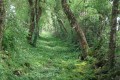
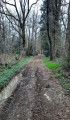
What’s more, at the end of the route there’s an interesting tree-lined path which offers welcome shade during hot spells and is a rather unusual feature.

Enjoy your walk

Machine-translated

AYRAULT DANIELLE
AYRAULT DANIELLE

Overall rating : 4.3 / 5

Date of your route : Aug 31, 2018
Reliability of the description : ★★★★☆ Good
Ease of following the route : ★★★★★ Very good
Route interest : ★★★★☆ Good

Apart from the wash house, which is rather unusual, there’s nothing special to see!!!

Machine-translated

Other walks in the area

For more walks, use our search engine .

The GPS track and description are the property of this route's author. Please do not copy them without permission.