Country:
 City:
City:


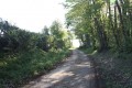
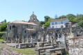
Start from the car park in front of the Saint-Coutant cemetery.
(S/E) Leave the car park and head for Rue de l’Église, turning right onto it.
Take the first road on the right, which is the Allée de Barauderie. Follow it to the end, then take the path leading to the Allée du Charroi.
This leads onto Rue de L’Église. Turn right onto it.
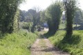
(1) At the junction, turn right onto the farm track, which shortly afterwards becomes a simple path on the edge of a small wood.
At the next junction, take the path on the left and turn left again a few metres further on.
The path winds its way and reaches Puy Richard.
(2) Where it joins Rue de Puy Richard, carry straight on, leaving a path on your right.
Further on, pass Rue des Gillères on your left and immediately afterwards turn right into Rue des Jardins. This leads to Rue de la Bransle. Turn right. The road curves to the left.
At the next junction, carry on straight ahead, passing a path on your right and Rue du Bois de l’Épine on your left.
A little further on, turn left onto a road which leads to a farm opposite. At the T-junction, take the path on the left.
(3) The track leads to a crossroads between the hamlets of Branle and Le Souil. Carry straight on towards the hamlet of Le Souil.
When you reach the place known as Le Souil, continue keeping to the right (leaving the farm on your left).
At the next junction, turn left onto the farm track. Immediately afterwards, pass a path straight ahead and continue along the farm track, which bends to the left.
Further on, ignore the track branching off to the left towards Le Souil.
(4) At the next junction of farm tracks, take the track furthest to the left towards Les Chaumes.
As you approach the hamlet of Les Chaumes, continue to the right along Rue des Chaumes towards Les Bons.
(5) At Les Bons, pass a dead-end on the left and immediately afterwards take the track on the right. At the next junction, turn right onto the farm track which leads back to the junction you passed on the way out.
(4) When you reach the crossroads, turn left to continue along the path you left earlier. Further on, pass a path on your right.
(6) The track joins the Route de Saint-Vincent-la-Chêtre, Saint-Coutant; continue straight on along the track.
At a bend in the farm track, carry straight on along the path, leaving the farm track leading to the hamlet of La Toison on your right.
(7) At the crossroads, turn left onto the farm track.
This leads further on to Rue de la Girardière. Turn right and, immediately afterwards, turn left into Rue du Plan de la Roue.
Follow this street as far as Crolour. As you enter the hamlet of Crolour, pass two streets on your right.
(8) At the crossroads in Crolour, between Rue du Plan de la Roue and Rue du Méridien, you’ll see the small Méridien square with information about the Greenwich Meridian. Turn left onto Rue du Méridien.
Pass a dead-end road on your right (near the crossroads), then a path on your right.
At the three-way junction, turn right, leaving Rue du Liezeau on your left.
Shortly afterwards, pass a track on your left that leads back to Rue du Liezeau and continue along the road, which soon turns into a farm track.
Follow this farm track to Saint-Coutant.
On arrival in Saint-Coutant, the track leads out near the cemetery and ends at the car park, which marks the end of the walk (S/E).

 Visorando Member
 Moderate