Circular route from La Lambertière and La Braudière

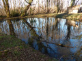
A lovely walk starting from Saint-Vincent-la-Châtre, alternating between footpaths and a few sections along minor roads. Ideal for an easy walk after a very wet spell: the route is a variation on another circular route, avoiding the wettest sections.
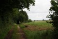
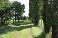
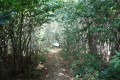
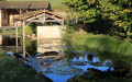
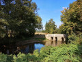
Beautiful and varied scenery throughout the route.
A circular loop that can be done in all weathers.

Details

n°280526
Creation:
Last update:
Last review:
  • Walking
    Activity: Walking
  • ↔
    Distance: 6.18 mi
  • ◔
    Average duration: 2h 55 
  • ▲
    Difficulty: Easy

  • ⚐
    Back to start: Yes
  • ↗
    Ascent: + 66 ft
  • ↘
    Descent: - 66 ft

  • ▲
    Highest point: 574 ft
  • ▼
    Lowest point: 522 ft

Photos

Description of the walk

(S) Start from the car park in front of the War Memorial in Saint-Vincent-la-Châtre (next to the post office in the village centre).
Take the main road eastwards towards the roundabout 50 metres away
At the crossroads, turn left and follow the Route de Lezay for approximately 150 metres.

(1) Turn left onto the street leading towards L’Artigault.

(2) After just over a kilometre, turn right onto the first track.

(3) At the first houses in the hamlet of La Martinière, turn left, and immediately afterwards take the track directly opposite in the left-hand corner of the square. This track leads out of the hamlet. Follow it to the junction with a farm track. Turn left and continue to the road, about 300 metres away.
Turn left onto the road towards L’Artigault.

(4) At the crossroads, turn right; the road runs past several houses on the right. Take the first farm track on the left. Four hundred metres further on, the farm track bends sharply to the right; continue straight on along the single track opposite.

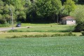
Pass two tracks on your right, continuing straight on to join a farm track. Follow this to the village of La Lambertière. Just before the first house, turn left (there’s a lovely view of a well-restored traditional property on your right).
Walk through the whole of the village of La Lambertière, staying on the main road.

(5) At the crossroads, just before joining the D305, turn right onto a farm track which runs alongside a property on the right before continuing towards the fields and, further on, the forest.
Stay on this farm track, passing the first track on your right.
Three to four hundred metres further on, at the junction with a track, carry straight on.

Then leave the farm track on your right, about a kilometre further on, and continue straight ahead.

(6) Turn left onto the track leading to La Braudière.
The track leads onto a road; turn left onto it. You’ll soon reach the junction with the D305.

(7) Cross it and carry on straight ahead towards La Braudière. Immediately take the road on the right at the T-junction just before the entrance to the hamlet.
Drive through the hamlet, staying on this main road, which curves to the left and leads onto another road (the second road at the T-junction mentioned above).
Turn right. The road passes close to the hamlet known as La Maison Neuve.

(8) Leave the road and turn left onto a farm track. Follow it until you reach a junction with a road.

(9) Turn left onto the road. At La Balatrie, continue along the road which goes round the hamlet on the right.

(10) When you reach the crossroads at the entrance to La Guillonnière, turn right, then take the second road on the left (the first is a dead end leading to a few houses in the hamlet).
This road leads back to the D305 (Route de Melle) at the entrance to Saint-Vincent-la-Châtre. Turn right. The route passes the village school, situated on the left-hand side of the road.
A few hundred metres further on, the road joins the square in front of the War Memorial and the church, which was the starting point of the route (S/E).

Waypoints

  1. S/E : mi 0 - alt. 554 ft - Car park in the village centre
  2. 1 : mi 0.14 - alt. 554 ft - Carrefour
  3. 2 : mi 0.48 - alt. 535 ft - Path on the right
  4. 3 : mi 0.84 - alt. 531 ft - La Martinière
  5. 4 : mi 1.27 - alt. 528 ft - The Artigault
  6. 5 : mi 2.43 - alt. 554 ft - The Lambertière
  7. 6 : mi 3.23 - alt. 554 ft - Crossroads
  8. 7 : mi 3.75 - alt. 541 ft - Crossing the D305
  9. 8 : mi 4.03 - alt. 541 ft - Junction of road and footpath
  10. 9 : mi 4.72 - alt. 574 ft - Carrefour
  11. 10 : mi 5.48 - alt. 548 ft - La Guillonnière
  12. S/E : mi 6.18 - alt. 554 ft - Car park in the village centre

Notes

A circular route that can be made in any weather.

Worth a visit

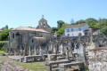
Saint-Vincent Church is already mentioned in the list of churches donated to the Abbey of Saint-Jean-d’Angély in the early 12th century by Guillaume I, Bishop of Poitiers. In the 14th century, Saint-Vincent-la-Châtre (from *castrum* = fortified place) was under the jurisdiction of the Abbey of Saint-Séverin-sur-Boutonne, which at that time formed part of the Diocese of Poitiers. The parish priest-prior, under the Rule of Saint Augustine, retained this title until the Revolution, when the church, being very poor, was not sold.
The church has undergone extensive alterations since the 12th century. However, it is unified by a large roof of curved tiles, surmounted by a small bell tower built in 1653. It houses a bell named Marie-Louise, cast in 1866 by Bollée in Le Mans. The portal, beneath three pointed arches, is particularly remarkable for its capitals: on the left, a bird and a quadruped devouring one another and metamorphosing in a symbolism that eludes us; and on the right, the martyrdom of Saint Vincent, naked and lying amongst the flames.
Inside, the nave, having lost its vault—most likely during the Wars of Religion—has a squat appearance. Two Romanesque columns with their historiated capitals occupy the space: to the north, a dog hunting a stag; and to the south, a dog pursued by a mythical creature resembling the one on the portal. The chancel consists of a single large bay with a Gothic vault. The chapel opening onto the north side, nestled between two buttresses, is a 15th- or 16th-century addition. Set against its wall is the flat tomb of Canon Aubert Gazeau, adorned with his effigy; he died in 1508, and the tomb has been listed as a Historic Monument since 1903. Lovely details give this little church its charm; it is well worth a visit.

L’Artigaut:
Producer of some of the finest ‘tourteaux fromagers’ (BOBEAU company)
The ‘tourteau fromager’, a surprising round cake with a black surface, is one of the jewels of Poitou-Charentes cuisine. Its crust, which looks as though it has been charred, does not taste burnt; the inside is soft, light, barely sweet and refreshing on the palate! A real treat. This cake is usually made with fresh goat’s cheese.
This sort of soufflé used to be a staple at all celebrations. Every family had their own decorated moulds. The women would get together at weddings to make them, then take them to the village baker to be baked, so they could be served at the reception.
Although easy to make, it does, however, require considerable skill to bake properly.

Reviews and comments

4.2 / 5
Based on 2 reviews

Reliability of the description
4 / 5
Ease of following the route
4.5 / 5
Route interest
4 / 5
MARTDomi
MARTDomi

Overall rating : 4 / 5

Date of your route : Jul 08, 2024
Reliability of the description : ★★★★☆ Good
Ease of following the route : ★★★★☆ Good
Route interest : ★★★★☆ Good
Very busy route : No

A lovely circular path, with plenty of shade along the way – which certainly doesn’t spoil it.

Machine-translated

Sneg
Sneg

Overall rating : 4.5 / 5

Date of your route : Feb 12, 2023
Reliability of the description : Not used / Not applicable
Ease of following the route : ★★★★★ Very good
Route interest : ★★★★☆ Good
Very busy route : No

A lovely walk along beautiful paths, especially the straight stretches. You really must take the time to admire the trees, which can sometimes be quite surprising.

Machine-translated

Other walks in the area

For more walks, use our search engine .

The GPS track and description are the property of this route's author. Please do not copy them without permission.