


Refine your search for walks in Lienne (rivière) - Belgique) - Affluent de l'Amblève
Lienne (rivière) - Belgique) - Affluent de l'Amblève walks


 Ardennes walk around Odrimont
 Visorando Member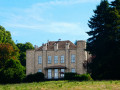
 9.90 mi
 +1,037 ft
 -1,040 ft
 5h 25
5h 25
 Moderate
 Departure from Lierneux (Province de Liège)
Offering stunning panoramic views in a rolling landscape alternating between open countryside and woodland, mostly on hilltops, this walk takes you to explore the Prés de la Lienne Nature Reserve, Belgium’s first forest wind farm, the village of Arbrefontaine, its chapel and 18th-century wayside cross, as well as the site of the former Odrimont mill.
Walks near Lienne (rivière) - Belgique) - Affluent de l'Amblève
Vielsalm - Gouvy
 10.65 mi
+1,572 ft
-1,237 ft
6h 15
Moderate
Departure from Vielsalm (Province de Luxembourg)
10.65 mi
+1,572 ft
-1,237 ft
6h 15
Moderate
Departure from Vielsalm (Province de Luxembourg)
La Salm Valley, known as Le Glain
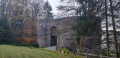
This stage ofthe GRP®571starts in Vielsalm in the Pays des Macralles, crosses the river at Salmchâteau and enters the Deux Ourthes Nature Park, heading towards the Ardennes plateau and Gouvy.
From Vielsalm station to Trois-Ponts station
11.33 mi
+1,440 ft
-1,765 ft
6h 30
 Difficult
Departure from Vielsalm (Province de Luxembourg)
Difficult
Departure from Vielsalm (Province de Luxembourg)
This Ardennes walk stretches across the heights of the left bank of the Salm. Set mainly in woodland, it offers magnificent views of the region. Relatively far from road traffic, it is a walk that rejuvenates body and mind through its tranquillity and the fresh air that is ever-present. The charming village of Goronne, the tranquillity of the Domaine de Farnières and the hamlet of Bergeval are much-loved stops along the way.
Sterpigny – Rodt Sankt-Vith
 14.25 mi
+840 ft
-587 ft
7h 15
Difficult
Departure from Gouvy (Province de Luxembourg)
14.25 mi
+840 ft
-587 ft
7h 15
Difficult
Departure from Gouvy (Province de Luxembourg)
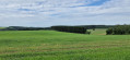
Here we are in the Eastern Cantons. This region isn’t part of Wallonia, but I’ve included it in my ‘Parkin’son tour of Wallonia’ all the same. Through a succession of climbs, some of which are quite steep, as are the descents, we gradually make our way towards the highest altitudes in Belgium. Mainly via paths, tracks and back roads, we link up the various villages and small towns situated between Sterpigny and Rodt, namely Gouvy, Aldringen, Maldingen and Crombach.
From Gouvy station to Vielsalm station
12.32 mi
+1,112 ft
-1,457 ft
6h 40
Moderate
Departure from Gouvy (Province de Luxembourg)
From Gouvy to Vielsalm, skirting Courtil and Provèdroux, the route is quintessentially Ardennes and serene. It alternates between peaceful forest stretches and open countryside, with gently rolling hills. The terrain becomes more undulating as you approach Vielsalm. The walk through the hamlet of La Comté, followed by the climb over the next ridge with its magnificent views, is a real treat. This is followed by the typical descent towards Vielsalm, where you’ll find it all: schist, the Bonalfa forest, blueberry bushes… and the ‘macralles’ (witches)!
Trois-Ponts - Vielsalm
 12.67 mi
+1,788 ft
-1,444 ft
7h 25
Difficult
Departure from Trois-Ponts (Province de Liège)
12.67 mi
+1,788 ft
-1,444 ft
7h 25
Difficult
Departure from Trois-Ponts (Province de Liège)
La Salm Valley, whose real name is Le Glain
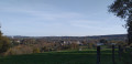
This stage ofthe GRP®571leaves the Amblève Valley and heads up the slopes of the La Salm Valley, known as Le Glain. The route changes banks several times until it reaches Vielsalm in the Pays des Macralles.
Stoumont - Trois-Ponts
 12.22 mi
+2,034 ft
-2,290 ft
7h 25
Difficult
Departure from Stoumont (Province de Liège)
12.22 mi
+2,034 ft
-2,290 ft
7h 25
Difficult
Departure from Stoumont (Province de Liège)
Amblève Valley
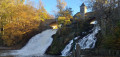
This stage ofthe GRP® 571 starts in Stoumont, passes in front of Froidcourt Castle and crosses the Amblève in Cheneux. The route then descends towards the Coo waterfall, crosses the river again and reaches Trois-Ponts via the Belvédère de Ster.
Rodt Sank Vith – Losheimergraben
 16.19 mi
+994 ft
-459 ft
8h 20
16.19 mi
+994 ft
-459 ft
8h 20
 Very difficult
Departure from Sankt Vith (Province de Liège)
Very difficult
Departure from Sankt Vith (Province de Liège)
On this twenty-third stage, we’ll head to the German border – the easternmost point of my tour of Wallonia – as the village of Losheimergraben lies on the border. In reality, it isn’t really a village but rather a hamlet that’s ideal as a starting point for hikes or cross-country skiing trips. So you’ll have no trouble finding somewhere to stay there. The lowest point on the route is at an altitude of 500 m, and the highest at 682 m. We are therefore in the highest region of Belgium, to some extent. The first third of the day is spent in the countryside, and the rest in the woods.
The Luxembourg Ardennes between Troisvierges and Drauffelt
 11.92 mi
+1,460 ft
-1,804 ft
6h 45
Moderate
Departure from Troisvierges (Luxembourg (Country))
11.92 mi
+1,460 ft
-1,804 ft
6h 45
Moderate
Departure from Troisvierges (Luxembourg (Country))
Set off to explore the north of the Grand Duchy of Luxembourg and, in particular, Clervaux Abbey.
Please note: this hike is not circular and is based on the concept of walks from station to station. We chose to leave our vehicle at the free P+R car park at Drauffelt station, from where the train takes hikers to Troisvierges free of charge (1 train per hour on track 1).