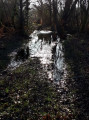
St-Germain d’Esteuil / Artiguillon southern circular loop

Starting from Artiguillon in the commune of St-Germain-d’Esteuil, this walk takes you on a journey of discovery through the forests of the Médoc along beautiful paths. Suitable for all year round.

Details

n°43051809
Creation:
Last update:
Last review:
  • Walking
    Activity: Walking
  • ↔
    Distance: 4.79 mi
  • ◔
    Average duration: 2h 15 
  • ▲
    Difficulty: Easy

  • ⚐
    Back to start: Yes
  • ↗
    Ascent: + 30 ft
  • ↘
    Descent: - 30 ft

  • ▲
    Highest point: 82 ft
  • ▼
    Lowest point: 52 ft

Photos

Description of the walk

Park in Artiguillon, in the car park on the D4, near Rue de la Place.

(S/E) From the car park, turn left onto Rue du Marquis des Vignes Oudides. Walk along the wide grassy verge and turn left onto Rue du Moulin Rompu, until you reach the left-hand bend in the road.

(1) Continue along the path opposite, following the fence, until you reach the next crossroads.

(2) Turn onto the path on the right, until you reach the junction of the path and the track.

(3) Ignore the return path straight ahead; turn left and carry on straight ahead, heading south along the track. Join another track coming from the left.

(4) Carry on straight ahead, ignoring a path on the left, until you reach the next junction.

(5) Turn left onto the grassy path and, further on, follow the Chenal de la Calupeyre on your left until you reach the path that continues from Rue de la Source in the hamlet of Cazeau.

(6) Turn right, heading due west, onto a wide track curving north-westwards; pass the next junction and carry on straight ahead until you reach a track on the right.

(7) Turn right, heading due east, onto this path which enters the fairly dense woodland. At the next path you come to, turn left onto it and continue due north through the Bois du Plantier until you reach the next junction. Turn right to rejoin the track at the junction you passed earlier.

(3) Turn left onto the white track, then join another track and a path. Continue right along the path until you reach the bend in Rue du Moulin Rompu.

(1) Turn left onto this street and carry on until you reach Rue du Marquis des Vignes de Oudides and the car park (S/E).

Waypoints

  1. S/E : mi 0 - alt. 82 ft - Car park
  2. 1 : mi 0.22 - alt. 79 ft - Carrefour on the circular village loop
  3. 2 : mi 0.45 - alt. 66 ft - Crossroads
  4. 3 : mi 0.64 - alt. 69 ft - Crossroads at the ‘Circular Route’
  5. 4 : mi 1.26 - alt. 66 ft
  6. 5 : mi 1.51 - alt. 59 ft - Crossroads
  7. 6 : mi 1.97 - alt. 62 ft - The hamlet of Cazeau. The Calupeyre canal
  8. 7 : mi 2.97 - alt. 79 ft - Path leading into the woods
  9. 8 : mi 4.39 - alt. 75 ft - Y-junction
  10. S/E : mi 4.79 - alt. 82 ft - Car park

Notes

- Car park with around fifteen spaces.
- Bakery and takeaway pizza near the level crossing.
- Book box in the car park.

Worth a visit

Lesparre: shops, supermarkets, swimming pool and the medieval tower.
St-Germain-d'Esteuil with its vineyards and châteaux.

Reviews and comments

4.7 / 5
Based on 1 review

Reliability of the description
5 / 5
Ease of following the route
5 / 5
Route interest
4 / 5
Marquilly
Marquilly

Overall rating : 4.7 / 5

Date of your route : Sep 13, 2024
Reliability of the description : ★★★★★ Very good
Ease of following the route : ★★★★★ Very good
Route interest : ★★★★☆ Good
Very busy route : No

A lovely walk in the woods 🌳!

Machine-translated

Other walks in the area

For more walks, use our search engine .

The GPS track and description are the property of this route's author. Please do not copy them without permission.