


Refine your search for walks in Aulne (fleuve)
Aulne (fleuve) walks


 From the summit of Ménez Hom to the banks of the Aulne via Trégarvan
 Visorando Member
 11.49 mi
 +1,375 ft
 -1,365 ft
 6h 30
6h 30
 Moderate
 Departure from Dinéault (Finistère)
Start at the summit of Ménez-hom (330 m) and descend on the west side with views of Douarnenez Bay.Stroll through pine forests to the banks of the River Aulne in Trégarvan, then return to the summit via the eastern side.
Saint-Sébastien route
 6.21 mi
+295 ft
-285 ft
3h 05
6.21 mi
+295 ft
-285 ft
3h 05
 Easy
Departure from Port-Launay (Finistère)
Easy
Departure from Port-Launay (Finistère)
A route through the countryside and along the banks of the Aulne, the final section of the Nantes–Brest Canal which runs through a channel.Discover Saint-Sébastien Chapel.
Circular between the Aulne and the Faou river
 10.11 mi
+1,335 ft
-1,342 ft
5h 50
Moderate
Departure from Rosnoën (Finistère)
10.11 mi
+1,335 ft
-1,342 ft
5h 50
Moderate
Departure from Rosnoën (Finistère)
A circular loop between the Aulne in its final meanders before its estuary in the Brest harbour and its last tributary, the Faou river.
Several viewpoints on the left bank of the Aulne with Ménez-Hom, the new Térénez bridge, Landévennec and its abbey.
Shellfish farming on the Faou river is currently limited to the cultivation of Pacific oysters.
The Moustoir Route
 6.19 mi
+594 ft
-594 ft
3h 20
Moderate
Departure from Châteauneuf-du-Faou (Finistère)
6.19 mi
+594 ft
-594 ft
3h 20
Moderate
Departure from Châteauneuf-du-Faou (Finistère)
Starting from Châteauneuf-du-Faou, the route follows the Nantes-Brest Canal and sunken lanes.
Rosconnec marsh route via the Sant-Dispar Chapel
 5.92 mi
+830 ft
-830 ft
3h 25
Moderate
Departure from Dinéault (Finistère)
5.92 mi
+830 ft
-830 ft
3h 25
Moderate
Departure from Dinéault (Finistère)
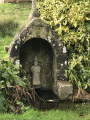
From the beautiful green setting where the Sant-Dispar Chapel nestles, flanked by its calvary and fountain, make your way through the woodland to the protected Rosconnec marshes at the confluence of the Aulne and its tributary, the Douffine.These meadows, which flood at spring tides, are protected areas for the aquatic reed warbler, a small passerine measuring 12 to 13 cm in length and weighing 10 to 14 g. This species is one of the birds protected by the European Commission.
Seillou beach - Kergadalen - Térénez bridge - Aulne river
 7.05 mi
+889 ft
-860 ft
4h 00
Moderate
Departure from Rosnoën (Finistère)
7.05 mi
+889 ft
-860 ft
4h 00
Moderate
Departure from Rosnoën (Finistère)
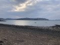
Walk along the banks of the Aulne with views of the Térénez bridge, Térénez Island, the Landévennec boat graveyard, Saint-Guénolé Abbey and Landévennec.
Route of the canalised Aulne river starting from Pont-Coblant
 6.56 mi
+502 ft
-486 ft
3h 25
Moderate
Departure from Gouézec (Finistère)
6.56 mi
+502 ft
-486 ft
3h 25
Moderate
Departure from Gouézec (Finistère)
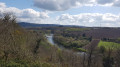
After a gentle walk along the Nantes–Brest Canal, you’ll climb slightly into the countryside, where you’ll have a bird’s-eye view of the Aulne, the Montagnes Noires and the Monts d’Arrée.You’ll return to your starting point after walking along small country roads and sunken lanes.
Pont-Coblant is located about 5 km from Pleyben via the D785 towards Briec.
From the Huelgoat State Forest to the banks of the Aulne
 9.05 mi
+1,007 ft
-994 ft
5h 00
Moderate
Departure from Locmaria-Berrien (Finistère)
9.05 mi
+1,007 ft
-994 ft
5h 00
Moderate
Departure from Locmaria-Berrien (Finistère)
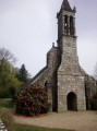
A hike in the heart of the Huelgoat forest, rich in legends but away from the tourist trails. A typical Central Brittany landscape awaits you with forests, hills, valleys, rivers, houses, calvaries and Breton churches.
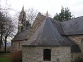
Aulne towpath and Notre-Dame de Kerluan Chapel
 7.05 mi
+243 ft
-243 ft
3h 25
Moderate
Departure from Châteaulin (Finistère)
7.05 mi
+243 ft
-243 ft
3h 25
Moderate
Departure from Châteaulin (Finistère)
Let's take a leisurely stroll along the canalised Aulne for about 6 km, passing three locks. Then let's head back up small roads towards the Notre-Dame de Kerluan Chapel. Let's climb a little further to finally descend back down to the banks of the Aulne.
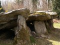
Gouézec route starting from Pont-Coblant
 7.22 mi
+344 ft
-331 ft
3h 35
Moderate
Departure from Gouézec (Finistère)
7.22 mi
+344 ft
-331 ft
3h 35
Moderate
Departure from Gouézec (Finistère)
The towpath of the canalised Aulne and its two locks, small roads leading to the rural village of Gouézec offering views of the Monts d’Arrée, and a return to Pont-Coblant via paths through the countryside.Along the route, discover a beautiful covered walkway.
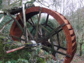
From the Chapel of Guénily along the banks of the Aulne and through the countryside
 6.71 mi
+499 ft
-472 ft
3h 30
Moderate
Departure from Pleyben (Finistère)
6.71 mi
+499 ft
-472 ft
3h 30
Moderate
Departure from Pleyben (Finistère)
Starting from the little chapel at Guénily, a peaceful route between the banks of the channelled Aulne (Nantes-Brest Canal) and the countryside.Sweeping views over the Montagnes Noires.
The two banks of the Aulne as it winds through the hills
 8.78 mi
+505 ft
-492 ft
4h 30
Moderate
Departure from Locmaria-Berrien (Finistère)
8.78 mi
+505 ft
-492 ft
4h 30
Moderate
Departure from Locmaria-Berrien (Finistère)
This walk will first take you along a quiet road through the surrounding hills with beautiful views, then along forest paths on the banks of the Aulne, in the shade of the trees and with lovely opportunities to dip your feet in the water.
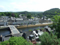
Along the Aulne in Châteaulin
 6.72 mi
+318 ft
-299 ft
3h 20
Moderate
Departure from Châteaulin (Finistère)
6.72 mi
+318 ft
-299 ft
3h 20
Moderate
Departure from Châteaulin (Finistère)
With the River Aulne, in its final stretch before the sea, as our guide, let’s set off to explore Port-Launay, a former river port. Let’s follow the towpath and then climb up to the Notre-Dame Chapel, which offers a view of Châteaulin, before returning to the river.
Route de l'Aulne via Pont Pol
 6.81 mi
+443 ft
-446 ft
3h 30
Moderate
Departure from Lennon (Finistère)
6.81 mi
+443 ft
-446 ft
3h 30
Moderate
Departure from Lennon (Finistère)
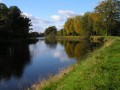
Route through the countryside and along the River Aulne (towpath of part of the Nantes–Brest Canal).
Paul Sérusier and Aulne River Circuit in Châteauneuf-du-Faou
 2.24 mi
+207 ft
-203 ft
1h 15
Easy
Departure from Châteauneuf-du-Faou (Finistère)
2.24 mi
+207 ft
-203 ft
1h 15
Easy
Departure from Châteauneuf-du-Faou (Finistère)
The municipality of Châteauneuf-du-Faou wanted to pay tribute to the painter Paul Sérusier, who stayed there and then lived there from 1906 until his death in 1927: creation of a museum, which opened in June 2025, and installation of a trail punctuated by eight information panels passing through places that were sources of inspiration for him.A walk along the banks of the River Aulne and through the woods completes the trail.
The River Aulne and the Térenez Bridge as seen from Argol
 12.84 mi
+1,083 ft
-1,112 ft
6h 50
12.84 mi
+1,083 ft
-1,112 ft
6h 50
 Difficult
Departure from Argol (Finistère)
Difficult
Departure from Argol (Finistère)
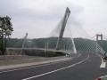
Starting from Argol, at the gateway to the Crozon Peninsula, this route leads to the coastal stretch of the River Aulne.
Highlight of the route: the new Térénez Bridge, opened in 2011 to replace the old one, which was converted into two viewing points following its demolition. This magnificent curved structure holds the world record for the longest span of its kind, at 515 metres in length, with its bold and highly aesthetic design. Also along the route are an old tide mill and the Folgoat Chapel.
Following the canalised River Aulne
 6.79 mi
+154 ft
-154 ft
3h 15
Easy
Departure from Châteaulin (Finistère)
6.79 mi
+154 ft
-154 ft
3h 15
Easy
Departure from Châteaulin (Finistère)
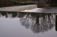
The route is largely a return walk, following a section of the channelled River Aulne. Peace and quiet, with the murmur of the water as you approach the two locks. You’ll regularly spot pairs of mallards and, occasionally, herons and great cormorants.
Along the route, you’ll pass a memorial stone commemorating a terrible shipwreck on this river in 1693 (in which 77 people, including many children, drowned).
Walk in Landévennec
 2.87 mi
+115 ft
-108 ft
1h 25
Easy
Departure from Landévennec (Finistère)
2.87 mi
+115 ft
-108 ft
1h 25
Easy
Departure from Landévennec (Finistère)
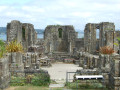
Landévennec is well known for its new Saint-Guénolé Abbey, inaugurated in 1958, which attracts many worshippers, as well as for the ruins of the 10th-century Romanesque abbey church and its museum. The village is located at the confluence of the Aulne and Rivière du Faou rivers and offers a beautiful walk, best enjoyed at high tide.
Via the towpath and the highest point at Lothey
 5.34 mi
+495 ft
-518 ft
2h 55
Moderate
Departure from Lothey (Finistère)
5.34 mi
+495 ft
-518 ft
2h 55
Moderate
Departure from Lothey (Finistère)
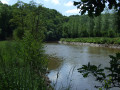
This little-used route descends towards the towpath of the channelled Aulne and follows the river, lined with beautiful ash trees.After the somewhat noisy stretch under the N165 bridge, the route continues along quiet country lanes and several grassy paths to reach the highest point in the commune of Lothey (166 m), offering a sweeping panorama of the Châteaulin basin which separates the Monts d’Arrée from the Montagnes Noires.Finish with a return trip to the wash house and the Saint-Fiacre fountain.