The River Aulne and the Térenez Bridge as seen from Argol

Starting from Argol, at the gateway to the Crozon Peninsula, this route leads to the coastal stretch of the River Aulne.

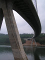
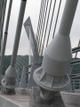
Highlight of the route: the new Térénez Bridge, opened in 2011 to replace the old one, which was converted into two viewing points following its demolition. This magnificent curved structure holds the world record for the longest span of its kind, at 515 metres in length, with its bold and highly aesthetic design. Also along the route are an old tide mill and the Folgoat Chapel.

Details

3143333
Creation:
Last update:
Last review:
  • Walking
    Activity: Walking
  • ↔
    Distance: 12.84 mi
  • ◔
    Average duration: 6h 50 
  • ▲
    Difficulty: Difficult

  • ⚐
    Back to start: Yes
  • ↗
    Ascent: + 1,083 ft
  • ↘
    Descent: - 1,112 ft

  • ▲
    Highest point: 364 ft
  • ▼
    Lowest point: -10 ft

Photos

Description of the walk

Starts from the car park by Argol Church.

PR® trail marked in yellow.

(S/E) From the car park, head for Rue de l’Église (D60), follow it to the left to leave the village of Argol and pass the school on your left. At the three-way junction, keep right on the same road and pass the hamlet of Pont Lorbic.

(1) Turn right onto a farm track which makes a slight left-then-right bend and joins a road at Goarem an Abat. Turn left, follow this road, then turn right off it onto a path leading to the Sainte-Agnès Spring, which is currently tapped for water.

(2) Turn left and continue along this north-east-facing track, which veers left to join the D60 at the hamlet of Lescoat (Leskoat). Cross the road, leaving the signposted route behind to reach the hamlet, then turn right to rejoin the D60 and the yellowPR® markings. Continue for a few dozen metres along this road.

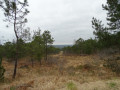
(3) Turn right onto a stony track that climbs towards a shooting range. After the shooting range, turn right along a field, then follow the path to the left through the communal pine woodland to reach an ancient Roman road.

(4) Turn right to descend onto the D60. Follow it to the right for about a hundred metres.

GR®37(red and white markings).

(5) Turn left onto thisGR® path, which is closed to vehicles over 3.5 tonnes, pass to the left of the village of Coat Carrec and head down this small road. Cross a road linking two hamlets and continue downhill to the bottom of the valley. Cross a small stream which flows into a bend in the River Aulne and head back up to the next crossroads (there’s a transformer just before it).

(6) Turn right, head towards the hamlet of Kerfanc, then continue along the path overlooking the Stêr ar C’haro cove, which leads to Pen Butun Point and the Aulne estuary. Continue towards the Térénez Bridge, passing under power lines.

No signposting.

(7) Head up to the left, then take a short round trip to the viewing point at the end of the old, demolished bridge, before retracing your steps. Turn right and follow the path leading to the walkway on the left-hand side of the bridge (Landévennec side, downstream). Cross this fine structure, which was opened in 2011, and at the very end turn right, crossing the road with care to reach the second viewpoint.

(8) Retrace your steps and now cross over to the Rosnoën side (upstream) to return to the junction just before the passage under the bridge.

GR ®37(red and white markings).

(7) Go under the bridge (spectacular view of the piers and the curve of the bridge), follow the path along the banks of the Aulne and arrive at a small cove.

(9) Turn right to go round a small hillock and reach a small road leading to a jetty (kayak launch point). Follow this road, which runs alongside the Anse de Moulin Mer, to reach the old tide mill. Walk alongside this reservoir.

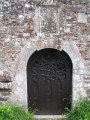
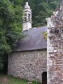
(10) At the Folgoat Forest House, turn right towards the Chapel of Notre-Dame du Folgoat, rebuilt in the 17th century and restored in the 1960s.

(11) With your back to the chapel and the car park on your left, walk a few steps along the road then turn left onto a path, cross a footbridge over a small stream and rejoin the path in the Landévennec State Forest.

PR® marked in yellow.

Turn right, continue through the forest and pass through a gate to reach the entrance to Moulin Neuf, then a crossroads.

(12) Take the road on the left which climbs steadily towards Ty ar C’hoat and turn left onto a track that joins the D791.

(13) Taking a right-left turn, cross this departmental road with care and, opposite, take the road towards Argol, passing under some power lines. You’ll come to a crossroad.

(14) Turn right, heading due west towards Kerguélen; ignore the road to the hamlet of Kerdary and look for a footpath on the left a little further on.

(15) Turn left onto the wide path leading down towards the water treatment plant (bridge over the Ruisseau l’Aber). Turn right towards the hamlet known as Le Moulin.

(16) Turn left, pass by the medical centre (a former farm converted for this purpose in 2019), then the Breton games park to reach the car park near the church (S/E).

Waypoints

  1. S/E : mi 0 - alt. 240 ft - Car park near the church
  2. 1 : mi 0.68 - alt. 240 ft - Junction onto a farm track
  3. 2 : mi 1.65 - alt. 335 ft - Turn left at the fork
  4. 3 : mi 2.68 - alt. 200 ft - Junction onto a stony path
  5. 4 : mi 3.55 - alt. 302 ft - Turn right onto the D60
  6. 5 : mi 3.87 - alt. 240 ft - Junction with the GR 37
  7. 6 : mi 5.11 - alt. 56 ft - Crossroads after the transformer
  8. 7 : mi 6.26 - alt. 39 ft - Junction at the bridge - Aulne (fleuve)
  9. 8 : mi 6.97 - alt. 98 ft - Viewpoint - Pont de Térénez
  10. 9 : mi 8.68 - alt. 46 ft - Junction at the cove
  11. 10 : mi 9.55 - alt. 20 ft - Before the Folgoat Forest House
  12. 11 : mi 9.62 - alt. 26 ft - Notre-Dame du Folgoat Chapel
  13. 12 : mi 10.5 - alt. 135 ft - Moulin Neuf crossroads
  14. 13 : mi 11.07 - alt. 341 ft - Crossing the D791
  15. 14 : mi 11.57 - alt. 341 ft - Turn right at the crossroads
  16. 15 : mi 11.84 - alt. 325 ft - Path on the left
  17. 16 : mi 12.65 - alt. 194 ft - A place known as Le Moulin
  18. S/E : mi 12.84 - alt. 240 ft - Car park near the church

Notes

This walk is classified as difficult due to the distance, but does not present any major difficulties.
There are no water points along the route.
“Saveurs et Délices” grocery shop in the centre of the village.
Les Enclos stopover lodge.

Worth a visit

Always be cautious and plan ahead when you're outdoors. Visorando and the author of this route cannot be held responsible for any accidents occurring on this route.

The GR® and PR® markings are the intellectual property of the Fédération Française de Randonnée Pédestre.

Reviews and comments

3.8 / 5
Based on 5 reviews

Reliability of the description
4 / 5
Ease of following the route
3.8 / 5
Route interest
3.6 / 5
MatthieuGD
MatthieuGD

Overall rating : 4 / 5

Date of your route : Apr 14, 2025
Reliability of the description : Not used / Not applicable
Ease of following the route : ★★★★★ Very good
Route interest : ★★★☆☆ Average
Very busy route : Yes

Completed today in under 4 hours by an experienced walker, so the estimated time is still a generous estimate.
A lovely stretch along the River Aulne!
Argol is also pleasant, and is still quite lively for a small village this spring.
I’ve rated it 3 out of 5 for interest because the path is reminiscent of Menz Hom (cleared forests, less wild), and the straight stretch from the forester’s house to the mill is more of a route for forestry machinery, with a lot of clear-cutting; this section loses some of its charm. The forest at the end of the return journey to Argol is more welcoming, for example.
Please note regarding point 11: the path that runs through it isn’t really accessible; it’s better to turn back a few steps, passing in front of the forest ranger’s house and taking the dirt track (further on you can indeed see the sign for the path/single track, but fallen trees make the path difficult to access).

Machine-translated

Briegenn
Briegenn

Overall rating : 2.3 / 5

Date of your route : Sep 16, 2024
Reliability of the description : ★★★☆☆ Average
Ease of following the route : ★★☆☆☆ Disappointing
Route interest : ★★☆☆☆ Disappointing
Very busy route : No

Hello,
We found it very difficult to follow the start and end of the walk; the GPS, which wasn’t switched on at the start of the route, proved very useful later on.
As for the walk itself, it was rather uninteresting, apart from the stretch along the Aulne Maritime, which is very pleasant, but there was nothing extraordinary about the scenery or the heritage sites.
Rated as a difficult walk: No
We were disappointed, which is rare with Visorando.

Machine-translated

Arthur 29
Arthur 29

Overall rating : 4 / 5

Date of your route : Aug 12, 2023
Reliability of the description : ★★★★☆ Good
Ease of following the route : ★★★☆☆ Average
Route interest : ★★★★★ Very good
Very busy route : No

A superb hike – a bit hilly but accessible.
The only downside is the virtually non-existent or misleading signposting. I got lost right at the start. I had to use my compass several times and, above all, the Visorando app to make sure I didn’t get lost or take too many detours.
Apart from that, there’s a variety of scenery and the highlight: the Térénez bridge – absolutely stunning. It’s well worth stopping off at the two viewing points!

Machine-translated

roques michel
roques michel

Overall rating : 4.7 / 5

Date of your route : Jun 15, 2022
Reliability of the description : ★★★★★ Very good
Ease of following the route : ★★★★★ Very good
Route interest : ★★★★☆ Good
Very busy route : No

A long, easy walk. It offers a chance to see scenery that’s different from the coastal paths. The route is very shaded and stays cool, especially during heatwaves.

Machine-translated

christian22
christian22

Overall rating : 4 / 5

Date of your route : Aug 10, 2020
Reliability of the description : ★★★★☆ Good
Ease of following the route : ★★★★☆ Good
Route interest : ★★★★☆ Good
Very busy route : Yes

a very shaded route with lovely views of the Aulne

Machine-translated

Other walks in the area

For more walks, use our search engine .

The GPS track and description are the property of this route's author. Please do not copy them without permission.