


Refine your search for walks in Alos
Alos walks


 Pic de la Quère
 Visorando Member
 7.10 mi
 +2,195 ft
 -2,178 ft
 5h 10
5h 10
 Moderate
 Departure from Alos (Ariège)
Start from the village of Alos and its castle. After a steep climb, you will discover the panorama of the Ariège Pyrenees and, at the summit of the Pic de la Quère, a small part of the Mont Valier.
Circular route via Lacourt – Lastès – Erp
5.55 mi
+1,253 ft
-1,253 ft
3h 40
 Easy
Departure from Lacourt (Ariège)
Easy
Departure from Lacourt (Ariège)
Discover Lastès with a beautiful view of the Ariège mountains – a very pleasant 3- to 4-hour hike.
Climb to the Bouriex relay antenna
 3.21 mi
+1,555 ft
-1,529 ft
2h 50
Moderate
Departure from Sentenac-d'Oust (Ariège)
3.21 mi
+1,555 ft
-1,529 ft
2h 50
Moderate
Departure from Sentenac-d'Oust (Ariège)
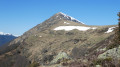
Climb up to the Bouriex relay antenna for a magnificent view of the Couserans mountains and the Toulouse plain. At the top, the Bouriex discovery trail information panels provide information on the surrounding mountains and local legends.
La Table des Quatre Seigneurs via the Crêtes trail from Ouerdes
8.92 mi
+1,982 ft
-1,972 ft
5h 50
 Difficult
Departure from Eycheil (Ariège)
Difficult
Departure from Eycheil (Ariège)
A very pleasant walk through beautiful forests along forest tracks and a few well-marked paths. A fairly difficult section that is fully roped off (to be avoided with dogs, otherwise you’ll have to carry them), with numerous short detours to see the entrances to chasms or viewpoints that are not to be missed. Beautiful beech woods and the regrowth of boxwood give this path a touch of magic. The app will be useful as numerous paths cross at various points.
On the hillsides of Soueix
 3.37 mi
+577 ft
-597 ft
2h 05
Easy
Departure from Soueix-Rogalle (Ariège)
3.37 mi
+577 ft
-597 ft
2h 05
Easy
Departure from Soueix-Rogalle (Ariège)
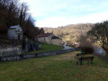
Walk through the hillsides of the village of Soueix with panoramic views of Le Vallier, the Col d'Ayens and Mirabat Castle. Architectural highlights include the churches of Saint-Sernin and Vic d'Oust, and the railway bridge.
Étang de Bethmale via the Col d'Eliet
 7.17 mi
+2,415 ft
-2,411 ft
5h 25
Moderate
Departure from Bethmale (Ariège)
7.17 mi
+2,415 ft
-2,411 ft
5h 25
Moderate
Departure from Bethmale (Ariège)
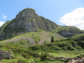
Don’t fancy just doing the Étang de Bethmale and would rather do a circular route? This route to the lake via the Col d’Eliet is perfect for you.
Bethmale and Ayes: two ponds, two atmospheres
10.12 mi
+2,844 ft
-2,844 ft
7h 10
Moderate
Departure from Bethmale (Ariège)
A circular route that allows you to discover a low-altitude pond nestled in the middle of the forest, then a mountain pond in the heart of the mountain pastures, passing by the Campuls hut, and to meet the herds in summer.
Author's note: this hike was published a long time ago: for any changes to the original route, please consult the comments at the end of the file.
Étang d'Eychelle and Cabane d'Eychelle
 5.00 mi
+2,280 ft
-2,280 ft
4h 15
Moderate
Departure from Bethmale (Ariège)
5.00 mi
+2,280 ft
-2,280 ft
4h 15
Moderate
Departure from Bethmale (Ariège)
A pretty lake nestled at the foot of the mountains and a shepherd's hut in summer surrounded by mountains with, on the way back, a beautiful view of the Bethmale Valley.
Cap de Garrié
 Local authority
 1.70 mi
+978 ft
-978 ft
1h 40
Moderate
Departure from Encourtiech (Ariège)
1.70 mi
+978 ft
-978 ft
1h 40
Moderate
Departure from Encourtiech (Ariège)
A viewpoint overlooking the neighbouring villages at your feet. Full view of the remains of the viscount's castle during the climb. At the summit, the Couserans Pyrenees stretch out before your eyes. A 300-metre climb on a well-marked, brand new footpath created in 2021 by the municipality of Encourtiech offers you a breath of fresh air in a splendid landscape.
Tour of the Garrié massif
 4.39 mi
+1,089 ft
-1,056 ft
3h 00
Moderate
Departure from Encourtiech (Ariège)
4.39 mi
+1,089 ft
-1,056 ft
3h 00
Moderate
Departure from Encourtiech (Ariège)
A route around the recently renovated and re-erected Croix de Garrié. The route begins in the shade, on a north-facing slope, and follows a gentle gradient for most of the way up this slope. Magnificent scenery on the south-facing slope with breathtaking views of the Pyrenees mountain range and Mont Valier in the foreground. And, before heading down towards the car park at the start, you cross the route to Cap de Garrié and its cross, which the more adventurous can reach in about ten minutes. The return descent is along a slightly steeper slope, but is completely safe, offering views of the Salat valley and the ruins of Encourtiech Castle.
This trail, recently renovated and signposted, was created under the supervision of the local council, which oversees and coordinates its regular maintenance.
Col d'Ayens and Col de Bès
 2.21 mi
+305 ft
-295 ft
1h 15
Easy
Departure from Soulan (Ariège)
2.21 mi
+305 ft
-295 ft
1h 15
Easy
Departure from Soulan (Ariège)
Easy walk with beautiful views of the Pyrenees.
Circular walk around the Col d’Ayens
2.89 mi
+689 ft
-705 ft
1h 55
Easy
Departure from Soulan (Ariège)
A family walk with no major difficulties.
The Couserans mountains seen from Saint-Pierre de Soulan
2.17 mi
+423 ft
-423 ft
1h 20
Easy
Departure from Soulan (Ariège)
A short family walk offering 180° views of the Couserans mountains, including Vallier, for almost the entire route. Most of the walk is along a very quiet road. It is best to do this walk in the morning to avoid the mountains being in silhouette.
The Couserans Mountains as seen from Saint-Pierre-de-Soulan
 2.64 mi
+459 ft
-463 ft
1h 35
Easy
Departure from Soulan (Ariège)
2.64 mi
+459 ft
-463 ft
1h 35
Easy
Departure from Soulan (Ariège)
A short family walk offering 180° views of the Couserans mountains, including the Vallier, for almost the entire duration of the walk. Most of the route follows a very quiet road.
 Cabane de Campuls from the Etang de Bethmale
 5.97 mi
+1,499 ft
-1,509 ft
4 hrs
Moderate
Departure from Bethmale (Ariège)
5.97 mi
+1,499 ft
-1,509 ft
4 hrs
Moderate
Departure from Bethmale (Ariège)
A short hike accessible to all, best done with snowshoes. In addition to its short distance, low altitude and easy level of difficulty, you will be treated to magnificent landscapes all the way to the final cirque of the Cabane de Campuls.
The site is very popular in summer, but much less so in winter.
Bethmale Pond from Ayet
 6.15 mi
+1,217 ft
-1,220 ft
3h 55
Moderate
Departure from Bethmale (Ariège)
6.15 mi
+1,217 ft
-1,220 ft
3h 55
Moderate
Departure from Bethmale (Ariège)
This guide has been created to reflect the new yellow signposting introduced in 2024.The route has been modified at the start and at point (7), and has been moved entirely to the left bank of the Balamet stream.
From Lac de Bethmale to Étang d'Ayes
 7.67 mi
+2,539 ft
-2,543 ft
5h 45
Moderate
Departure from Bethmale (Ariège)
7.67 mi
+2,539 ft
-2,543 ft
5h 45
Moderate
Departure from Bethmale (Ariège)
A breathtaking hike leading to Étang d'Ayès from Lac de Bethmale via Cirque de Campuls and its wonderful waterfall.
The Bethmale lake
 5.68 mi
+1,335 ft
-1,306 ft
3h 45
Moderate
Departure from Bethmale (Ariège)
5.68 mi
+1,335 ft
-1,306 ft
3h 45
Moderate
Departure from Bethmale (Ariège)
A pleasant forest walk accessible to all, leading you to the Étang de Bethmale, a must-see spot in the Couserans region of Ariège.(!) Possible problem with the trail disappearing at (5), see reviews, keep us informed.
La Tête d'Âne, between plain and mountain
 2.46 mi
+873 ft
-873 ft
1h 55
Easy
Departure from Encourtiech (Ariège)
2.46 mi
+873 ft
-873 ft
1h 55
Easy
Departure from Encourtiech (Ariège)
This hike is accessible to all, on a perfectly maintained trail which, after an hour's walk, will take you to the small summit of Tête d'Âne. There, you will enjoy a breathtaking view to the south of the highest peaks of Couserans: Valier, Maubermé and Mail de Bulard. To the north, a completely different spectacle awaits you, as in good weather you can see the plain of Saint-Girons all the way to Lescure. A striking contrast between plain and mountain.
Le Cos and the banks of the Salat
 5.39 mi
+1,693 ft
-1,683 ft
3h 55
Moderate
Departure from Seix (Ariège)
5.39 mi
+1,693 ft
-1,683 ft
3h 55
Moderate
Departure from Seix (Ariège)
A steady climb to the summit of Cos with two beautiful viewpoints, the Salat valley and the Garbet valley and the Vallier massif on the other side, and a return to the banks of the Salat River with its turbulent, turquoise-blue waters.
La Tête d’Âne at Touron
 2.34 mi
+807 ft
-807 ft
1h 45
Easy
Departure from Encourtiech (Ariège)
2.34 mi
+807 ft
-807 ft
1h 45
Easy
Departure from Encourtiech (Ariège)
A very pleasant round-trip walk offering a 360° view very close to Saint-Girons.
Etang d'Ayes, return via the Col d'Auèdole
 4.81 mi
+1,358 ft
-1,362 ft
3h 25
Moderate
Departure from Bethmale (Ariège)
4.81 mi
+1,358 ft
-1,362 ft
3h 25
Moderate
Departure from Bethmale (Ariège)
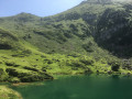
A pleasant walk with part of the outward and return journeys in the shade; a cirque, a beautiful natural pond and a lovely viewpoint at the pass.
Trémau sinkhole, starting from Saint-Girons
 6.96 mi
+1,138 ft
-1,138 ft
4h 10
Moderate
Departure from Saint-Girons (Ariège)
6.96 mi
+1,138 ft
-1,138 ft
4h 10
Moderate
Departure from Saint-Girons (Ariège)
This mostly shaded walk offers varied views of the valleys and hills at the foot of the Sourroque massif, with a wild feel in places, all close to Saint-Girons.
The Aubert Waterfall from Saint-Girons
 6.83 mi
+1,394 ft
-1,401 ft
4h 20
Moderate
Departure from Saint-Girons (Ariège)
6.83 mi
+1,394 ft
-1,401 ft
4h 20
Moderate
Departure from Saint-Girons (Ariège)
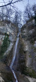
A circular from the centre to the Aubert Waterfall via Cap de la Bouiche. Beautiful view of Saint-Girons and the heights above Moulis.
Mirabat Castle
 4.40 mi
+1,713 ft
-1,699 ft
3h 30
Moderate
Departure from Oust (Ariège)
4.40 mi
+1,713 ft
-1,699 ft
3h 30
Moderate
Departure from Oust (Ariège)
Climb up to the ruined Mirabat Castle, where you can enjoy a beautiful view of the Couserans mountain range with Mont Valier and the plain in the foreground.
Mont Valier and the Ariège peaks seen from Buleix and Boussan
 4.61 mi
+1,063 ft
-1,050 ft
3h 05
Moderate
Departure from Soulan (Ariège)
4.61 mi
+1,063 ft
-1,050 ft
3h 05
Moderate
Departure from Soulan (Ariège)
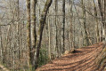
This easy hike allows you to admire all the peaks of the Ariège, including Mont Valier. From the road (first third of the route) to the end, this majestic landscape unfolds throughout the walk.
This route can also be done by mountain bike.
Circular route starting from Engomer
 3.12 mi
+1,325 ft
-1,316 ft
2h 35
Moderate
Departure from Engomer (Ariège)
3.12 mi
+1,325 ft
-1,316 ft
2h 35
Moderate
Departure from Engomer (Ariège)
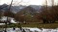
A pleasant climb towards Compussan under the beech trees accompanies the summer pastures. It continues across high-altitude meadows and leads to the rocky massif of Cap de Broc with a beautiful view of the valley floor, returning via Alas and theGR®® which follows the Lez river a little higher up.
L'Estours and L'Artigue
8.53 mi
+2,077 ft
-2,073 ft
5h 45
Moderate
Departure from Seix (Ariège)
A round-trip route centred on water, in the cool valley of the Estours and Artigue streams.
Update August 2026: a notice states that the access track to the car park is closed in July and August in 2026 and possibly in subsequent years. The walk remains possible from Moulin Lauga, which makes it considerably longer, or out of season.
Montégut-en-Couserans - Tuc de Casterot and Char de Lique via the three passes
 4.13 mi
+1,060 ft
-1,063 ft
2h 50
Moderate
Departure from Montégut-en-Couserans (Ariège)
4.13 mi
+1,060 ft
-1,063 ft
2h 50
Moderate
Departure from Montégut-en-Couserans (Ariège)
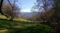
An accessible and charming hike with varied terrain and landscapes and panoramic views of over 180°.
From the Bishops’ Palace to the Marsan Chapel in Saint-Lizier
 2.91 mi
+397 ft
-420 ft
1h 40
Easy
Departure from Saint-Lizier (Ariège)
2.91 mi
+397 ft
-420 ft
1h 40
Easy
Departure from Saint-Lizier (Ariège)
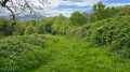
An easy walk, mostly in the shade. Mainly a dirt track, tarmac only in Saint-Lizier. You’ll enjoy superb views of the Pyrenees, the Bishops’ Palace and Saint-Lizier Cathedral.
Le belvédère du Couserans
 5.33 mi
+1,138 ft
-1,138 ft
3h 25
Moderate
Departure from Saint-Lizier (Ariège)
5.33 mi
+1,138 ft
-1,138 ft
3h 25
Moderate
Departure from Saint-Lizier (Ariège)
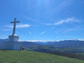
Winding through narrow streets and along footpaths, this route takes walkers from Saint-Lizier to Montcaliver, a viewpoint overlooking all the Couserans valleys and the splendid peaks dominated by the ‘Lord of the Couseran’: Mont Valier.⚠️ On 18 May 2026, a user reported:>Between the points (6) and (7), the route passes through private property.=> Route and description updated on 24 August 2026 by a moderator
From Lescure to Rimont via Clot du Pau
 8.40 mi
+1,319 ft
-1,296 ft
5h 00
Moderate
Departure from Lescure (Ariège)
8.40 mi
+1,319 ft
-1,296 ft
5h 00
Moderate
Departure from Lescure (Ariège)
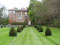
In the heart of nature, through the forest of the Ariège Pyrenees Regional Nature Park, climb the ridge from Lescure to Rimont and overlook the Little Pyrenees with a magnificent view of Mont Valier and the Montcalm massif. Turn around and admire the rolling landscapes of the Séronnais, Arize, Couserans and Volvestre valleys.
From the Maison du Valier to the Col de la Core – update to the GR®10 route
8.66 mi
+4,692 ft
-3,192 ft
8h 05
 Very difficult
Departure from Les Bordes-sur-Lez (Ariège)
Very difficult
Departure from Les Bordes-sur-Lez (Ariège)
Since the fire in July 2026, the terrain has been very unstable (frequent rockfalls) on the GR®10 towards the Ayes Lake, and this section of the path is therefore closed. Consequently, the ONF recommends an alternative route, the details of which are given below, between the Maison du Valier and the Col de la Core. The start and finish points of this stage are accessible by car.
Étangs Rond and Long loop via the Ribérot and Peyralade valleys
9.81 mi
+4,820 ft
-4,810 ft
8h 40
Difficult
Departure from Les Bordes-sur-Lez (Ariège)
A pretty loop in the Couserans valleys, leading to the Rond and Long lakes, overlooked by the iconic peaks of the massif, Mont Valier and Pic des Trois Comtes. The route often runs close to the water and is dotted with beautiful waterfalls, guaranteeing a change of scenery.
Tuc du Coucou from the Maison du Valier
6.46 mi
+3,241 ft
-3,248 ft
5h 45
Difficult
Departure from Les Bordes-sur-Lez (Ariège)
A challenging hike that takes you to a summit with breathtaking views of the Mail de Bulard.
Mont Valier from Pla de la Lau
 10.87 mi
+6,191 ft
-6,191 ft
6 hrs
Very difficult
Departure from Les Bordes-sur-Lez (Ariège)
10.87 mi
+6,191 ft
-6,191 ft
6 hrs
Very difficult
Departure from Les Bordes-sur-Lez (Ariège)
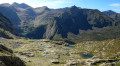
This demanding hike takes you to the "Seigneur du Couserans".
The Mont Valier circular loop via the Col de Pécouch
 11.82 mi
+7,064 ft
-7,067 ft
12 hrs
Very difficult
Departure from Les Bordes-sur-Lez (Ariège)
11.82 mi
+7,064 ft
-7,067 ft
12 hrs
Very difficult
Departure from Les Bordes-sur-Lez (Ariège)
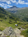
An alternative to climbing Mont Valier, passing through the adjacent valley and the Col de Pécouch, offering a change of scenery and magnificent landscapes. This variant adds 1h30 to the return journey compared to the outward route and an additional 250 m of elevation gain. This alternative is also less frequented than the main route.
The Bourdaous trail from Cazavet
 Association / Club / Walk leader
 7.71 mi
+2,474 ft
-2,457 ft
5h 40
Moderate
Departure from Cazavet (Ariège)
7.71 mi
+2,474 ft
-2,457 ft
5h 40
Moderate
Departure from Cazavet (Ariège)
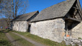
Discover the bourdaous, which are pastoral mountain hamlets, groups of barns and stables used in the past during the summer months. A bourdaou can also be an isolated barn with an adjoining hut, a very basic dwelling for shepherds. This route offers the chance to discover some of them, starting from Cazavet and climbing up to the Cours mountain pasture. The route passes by the summit of Roc de Maléchart, where a 360° view allows you to discover the Pyrenees mountain range.