Visorando Visorando
Visorando Visorando
  •  Tools 
    • Walking route planner
    • Import a GPX file
  • Walks
  • Help ↗
  • Visorando Premium
  • Sign up
  • Log in
Loading…
  1. Visorando
  2. GUYTOULG

GUYTOULG

GUYTOULG
Visorando Member
  • Gender: man

Sign up: 18 Oct 2012

Published routes 4

Published route(s)

  • List
  • Map

Boating/Canoeing/Kayaking The upper reaches of the Ria d'Étel by kayak

La partie haute de la Ria d'Etel en kayak
↔4.42 mi ↗+3 ft ↘-3 ft ◔2 hrs ▲Easy
⚑Departure from Morbihan
A 2-hour trip on the water, in a magnificent setting, on a stretch of sea that changes with the tide.
Download PDF  PDF Download GPX  GPX

Walking Loop starting from Pointe de la Vieille Chapelle
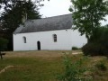
Boucle au départ de la Pointe de la Vieille Chapelle
↔6.41 mi ↗+26 ft ↘-26 ft ◔3h 00 ▲Moderate
⚑Departure from Morbihan
10 km hike between Sainte-Hélène and the Ria d'Étel.
Download PDF  PDF Download GPX  GPX

Walking Around Hennebont and the towpath

Alentours d'Hennebont et le chemin de halage
↔9.90 mi ↗+249 ft ↘-249 ft ◔4h 45 ▲Moderate
⚑Departure from Hennebont (Morbihan)
An easy loop starting from Hennebont. Pass through Saint-Antoine, Saint-Gilles, the Quelennec lock, and return to Hennebont via the towpath through Lochrist. 9/08/2023 Message from the moderator: following feedback, the hike has been modified at point 9 to avoid passing through private property.

Download PDF  PDF Download GPX  GPX

Walking Kaolins in Ploemeur circular

Boucle des kaolins à Ploemeur
↔4.80 mi ↗+105 ft ↘-98 ft ◔2h 20 ▲Easy
⚑Departure from Ploemeur (Morbihan)
A short, easy loop between countryside and seaside.
Download PDF  PDF Download GPX  GPX
Back to top
  • Privacy policy
  • Contact
  • Manage my cookies
  • Visorando community

Download the app now and go on an adventure!

App storeApp Store
Google playGoogle Play

Checking services status…© 2026 Visorando
 Loading…