A countryside route in Libramont-Chevigny

We’ll explore the Libramont countryside via country roads, farm tracks and forest paths.

Details

846702
Creation:
Last update:
Last review:
  • Walking
    Activity: Walking
  • ↔
    Distance: 11.20 mi
  • ◔
    Average duration: 5h 55 
  • ▲
    Difficulty: Moderate

  • ⚐
    Back to start: Yes
  • ↗
    Ascent: + 876 ft
  • ↘
    Descent: - 869 ft

  • ▲
    Highest point: 1,847 ft
  • ▼
    Lowest point: 1,486 ft

Photos

Description of the walk

Car park at Libramont-Chevigny station.

(S/E) Walk up towards the station, pass the station entrance and then follow the bus platforms. At the roundabout, turn left and cross the railway bridge. Turn immediately left and continue along the Grand’Rue until you reach the roundabout at the Musée des Celtes.

(1) Walk past the museum building and continue along Rue du Village.

(2) At the junction, carry straight on along Rue des Champs. Leave the built-up area of Libramont. You will then enter Saint-Pierre. Ignore the roads on your left.

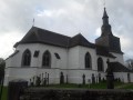
(3) At the junction, go straight on and, at the next one, turn left into Ruelle des Mais. At the end of the lane, go round the 12th-century church on the left and continue along Rue Sous le Pont until the next junction.

(4) Carry on straight ahead, passing the cemetery. A little further on, go under the railway bridge. Take the Allée des Tilleuls. Walk up the street until you reach the T-junction.

(5) Turn left and, at the Fork in the road, take the right-hand path.

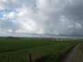
(6) At the next junction, take Voie Saint-Antoine on your right, a farm track which you should follow straight on for 2 km. Breathtaking 360° views of the Libramont countryside. Look back frequently to admire the view. When you reach the road, cross with care and continue along the path opposite. Pass under the bridge of the old railway line.

(7) Turn right and take the path running parallel to the railway line. Then walk alongside the woodland.

(8) At the corner of the plot, turn left. Continue along the edge of the woodland, keeping to your left. In the distance, you can see the Wideumont weather tower; in the foreground, the slender slate spire of the parish church of Notre-Dame de Sainte-Marie-Chevigny. You’ll come out onto the road.

(9) Cross the road and continue along the path opposite. Head downhill, ignoring the path coming up on your left. At the next road, turn left. Cross the Western Ourthe and head back up to the main crossroads at Renaumont. Carry on straight ahead. Then take the road that continues straight on between the farms. Walk alongside a patch of coniferous trees, ignore the path branching off to your left and carry on towards the forest.

(10) Turn left, ignoring the path on the right that leads into the forest at the bend, and take the next path on your right. At the road, turn left. Pass through the hamlet known as La Croisette.

(11) At the junction with the road, ignore the forest track on your right; continue along the road until you reach the next track, which you take to the right. At the fence, first turn right then left to reach the road. Turn left and follow the road for about 300m. Take care, as this road is slightly busier.

(12) Turn right at the first forest track, which quickly curves to the left. Stay on the main track until you reach the multi-way junction at the edge of a meadow.

(13) Head left, keeping the meadow on your left, until you reach the T-junction.

(14) Turn right and carry on until you reach the road. Turn right just past the bend and the forest track that heads straight on.

(15) Take the next forest track on your left. At the T-junction, turn right. At the next junction, go straight on. Stay on the main track until you reach a wider track.

(16) At the T-junction, turn left. At the multi-way junction, take the hairpin bend on your right.

(17) At the first track on your left, turn off and head down to the road. Turn right and immediately take the road on your right. Walk past a property and enter the woods. At the junction, go straight on; at the end, turn right; at the Fork in the road, turn left and then right to join another track.

(18) Carry on to the left. At the end, turn left, go through the gate and close it behind you. Back on the tarmac. Walk past the school buildings and, at the junction, turn right and head down the road. This road bends sharply. At the T-junction, turn right until you reach another road, which you should cross carefully. Continue along the footpath between the car park and the building. Cross a field to reach the road. Return to the car park (S/E).

Waypoints

  1. S/E : mi 0 - alt. 1,591 ft - Station car park
  2. 1 : mi 0.62 - alt. 1,614 ft - Celtic Museum
  3. 2 : mi 0.92 - alt. 1,578 ft - At the junction, go straight on
  4. 3 : mi 1.59 - alt. 1,519 ft - At the crossroads, go straight on
  5. 4 : mi 1.96 - alt. 1,519 ft - Cemetery junction
  6. 5 : mi 2.5 - alt. 1,555 ft - Junction
  7. 6 : mi 2.81 - alt. 1,575 ft - Saint Antoine Trail
  8. 7 : mi 4.21 - alt. 1,686 ft - Path after the bridge
  9. 8 : mi 4.52 - alt. 1,713 ft - Corner of the woodland plot
  10. 9 : mi 5.24 - alt. 1,650 ft - Straight path
  11. 10 : mi 6.52 - alt. 1,713 ft - Entry into the forest
  12. 11 : mi 7.09 - alt. 1,703 ft - Tarmac road
  13. 12 : mi 7.7 - alt. 1,755 ft - Path on the right
  14. 13 : mi 8.04 - alt. 1,768 ft - Meadow
  15. 14 : mi 8.3 - alt. 1,722 ft - Forest track
  16. 15 : mi 8.46 - alt. 1,772 ft - Trail
  17. 16 : mi 9.12 - alt. 1,804 ft - Turn left at the T-junction
  18. 17 : mi 9.69 - alt. 1,778 ft - To the left
  19. 18 : mi 10.66 - alt. 1,726 ft - To the left
  20. S/E : mi 11.2 - alt. 1,591 ft - Station car park

Notes

Most of the route is in open country.
One-third of the route is on tarmac roads: the majority from (S) to (6).
From (15) to (18), the paths are not visible on OppenStreetMap but are shown on IGN maps.
Muddy paths depending on the weather.
No drinking water along the route.

Worth a visit

Legend of Libramont
One legend attributes the name Libramont to Countess Ermesinde (1186–1267). Others attribute the same origin to a princess of Anlier from the 13th or 14th century. Whether countess or princess, this person is said to have come for a walk in the small hamlet under her suzerainty. Suddenly feeling unwell, she alighted from her carriage and sat down on the stone in question. A local woman tended to her. Thanks to her care, she soon recovered. To show her gratitude to her subjects, she declared the inhabitants of the place to be free. ‘Libres à mont’, ‘Libre mont’ – the locality being situated at the summit of a plateau – evolved into Libramont. There is some truth to this legend, as Libramont enjoyed a degree of autonomy, at least in part, during the final centuries of the Ancien Régime.

The Church of Saint-Pierre-aux-Liens
Dating from the 11th century, it is the oldest religious monument in the region and is listed by the Commission for Monuments and Sites. This former chapel was separated from the mother church of Sainte-Marie in the 13th century. The church stands at the centre of a crossroads, the arms of which lead to the various sections of the present-day parish: Presseux to the north, Flohimont to the north-east, Sberchamps to the east and Lamouline to the south. Before the site was restored, the graves were oriented towards the villages from which the buried individuals originated.

Linden Tree Avenue
This avenue has always enabled the residents of Flohimont to attend services at their parish church of Saint-Pierre. There are 101 lime trees: planted at an average interval of 5 metres, 51 on the right and 50 on the left, two of which stand close to the crucifix. Recently, these lime trees have been individually listed in the register of remarkable trees in Wallonia. They were planted at the end of the 19th century, probably after the railway line was built in 1858, as the avenue of deciduous trees never extended beyond that point. These trees were damaged shortly before the war of 1940. Deep holes are said to have been drilled into them with the intention of detonating explosives in a hurry, when the time came, to hinder the advance of the German army. The trunks still bear the scars of these drill holes today.

Voie Saint Antoine
Voie Saint-Antoine is an ancient pilgrimage route leading to Saint Anthony the Hermit, the secondary patron saint of Sainte-Marie Church. This route sets off from Saint-Pierre, crosses the railway line – which did not exist at the time – and joins the present-day Flohimont–Libramont road. It then continues towards Sainte-Marie. Here is the legend of Saint Anthony. Whilst on his way to the King of Catalonia’s palace to exorcise the queen and her children, he came across a sow. She was carrying in her mouth her piglet, which had been born without eyes or legs. Saint Anthony exorcised the piglet and the king’s descendants, and they were all healed. This saint is invoked to ward off skin diseases, the plague and hallucinations (also known as Saint Anthony’s fire).

Notre-Dame Parish Church in Sainte-Marie-Chevigny
A distinctive feature of the landscape thanks to its slender slate spire.

Reviews and comments

4.5 / 5
Based on 2 reviews

Reliability of the description
5 / 5
Ease of following the route
4.5 / 5
Route interest
4 / 5
TABURIAUX j c
TABURIAUX j c

Overall rating : 4.3 / 5

Date of your route : Mar 08, 2021
Reliability of the description : ★★★★★ Very good
Ease of following the route : ★★★★☆ Good
Route interest : ★★★★☆ Good
Very busy route : No

Machine-translated

lazzerini
lazzerini

So, actually, it’s the term ‘path’ that you feel doesn’t quite fit given its width...
Thank you, that’s clearer put that way.

And thank you for your comment – it’s always nice to hear

Kind regards

Machine-translated

Philippe Degeye
Philippe Degeye

For us, it was a path three or four metres wide. As far as I’m concerned, I’ve no problem with your answer. I’m a regular on Visorando routes and, believe me, you’re well above average.

Machine-translated

lazzerini
lazzerini
• Edited:

Hello Philippe Degeye,

thank you for your feedback.
Why don’t you want to take the hairpin bend?
I don’t understand why you’re referring back to the instructions at (16).
Could you explain further?

Thank you

Machine-translated

Philippe Degeye
Philippe Degeye

Overall rating : 4.7 / 5

Date of your route : Nov 30, 2020
Reliability of the description : ★★★★★ Very good
Ease of following the route : ★★★★★ Very good
Route interest : ★★★★☆ Good
Very busy route : Yes

A lovely, cold and sunny day. No major difficulties. Given the distance, you need to be able to walk for 4–5 hours.
The heritage sites are well showcased.
(16) At the T-junction, turn left. At the fork in the path, take the path and not the hairpin bend to your right.

Machine-translated

Other walks in the area

For more walks, use our search engine .

The GPS track and description are the property of this route's author. Please do not copy them without permission.